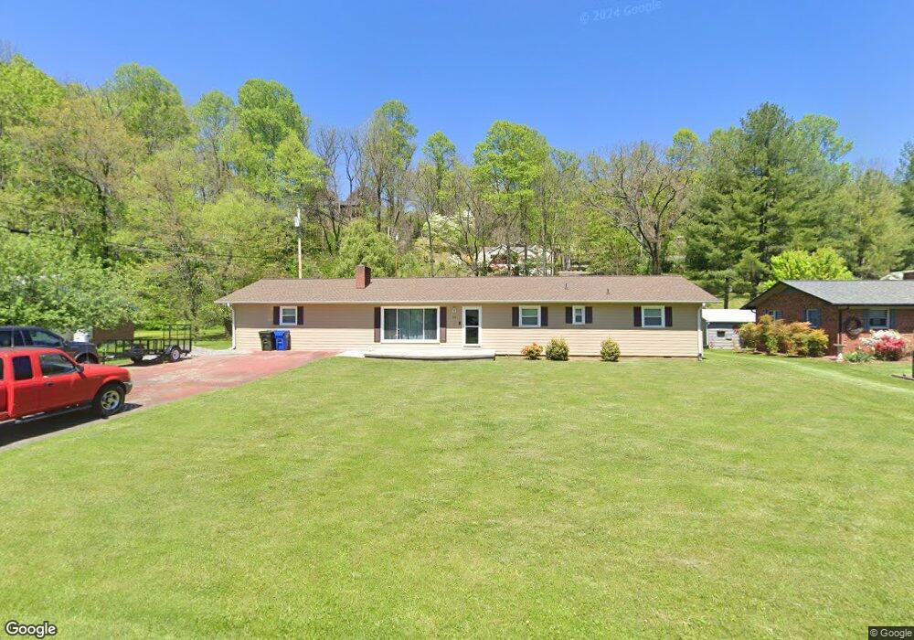
60 Timothy Ln Waynesville, NC 28786
Estimated Value: $405,000 - $449,000
4
Beds
3
Baths
2,240
Sq Ft
$190/Sq Ft
Est. Value
About This Home
This home is located at 60 Timothy Ln, Waynesville, NC 28786 and is currently estimated at $424,590, approximately $189 per square foot. 60 Timothy Ln is a home located in Haywood County with nearby schools including Hazelwood Elementary, Waynesville Middle, and Tuscola High.
Ownership History
Date
Name
Owned For
Owner Type
Purchase Details
Closed on
Oct 7, 2009
Sold by
Wijewickrama Jodi L and Wijewickrama Roy T
Bought by
Wijewickrama Jodi L and Wijewickrama Roy T
Current Estimated Value
Home Financials for this Owner
Home Financials are based on the most recent Mortgage that was taken out on this home.
Original Mortgage
$195,000
Interest Rate
5.1%
Mortgage Type
New Conventional
Create a Home Valuation Report for This Property
The Home Valuation Report is an in-depth analysis detailing your home's value as well as a comparison with similar homes in the area
Home Values in the Area
Average Home Value in this Area
Purchase History
| Date | Buyer | Sale Price | Title Company |
|---|---|---|---|
| Wijewickrama Jodi L | -- | None Available |
Source: Public Records
Mortgage History
| Date | Status | Borrower | Loan Amount |
|---|---|---|---|
| Closed | Wijewickrama Jodi L | $195,000 |
Source: Public Records
Tax History Compared to Growth
Tax History
| Year | Tax Paid | Tax Assessment Tax Assessment Total Assessment is a certain percentage of the fair market value that is determined by local assessors to be the total taxable value of land and additions on the property. | Land | Improvement |
|---|---|---|---|---|
| 2025 | -- | $235,300 | $41,300 | $194,000 |
| 2024 | $1,380 | $222,000 | $41,300 | $180,700 |
| 2023 | $1,380 | $222,000 | $41,300 | $180,700 |
| 2022 | $1,347 | $222,000 | $41,300 | $180,700 |
| 2021 | $1,347 | $222,000 | $41,300 | $180,700 |
| 2020 | $1,005 | $144,600 | $33,000 | $111,600 |
| 2019 | $1,010 | $144,600 | $33,000 | $111,600 |
| 2018 | $1,010 | $144,600 | $33,000 | $111,600 |
| 2017 | $1,010 | $144,600 | $0 | $0 |
| 2016 | $1,073 | $160,500 | $0 | $0 |
| 2015 | $1,073 | $160,500 | $0 | $0 |
| 2014 | $961 | $160,500 | $0 | $0 |
Source: Public Records
Map
Nearby Homes
- 0 Blink Bonny Dr Unit B9 & B11 CAR4292604
- 0 Blink Bonny Dr Unit B9 CAR4292577
- 0 Blink Bonny Dr Unit B11
- 290 Killian St
- 00 Great Smoky Mountains Expy
- 0 Skyline Dr
- 275 Richland St
- 39 4th St
- 269 Westwood Cir
- 106 Culpepper Dr
- 261 Westwood Cir
- 391 Knollwood Dr
- 34 Bowden Ln
- 251 Westwood Cir
- 1200 Rocky Knob Rd
- 622 S Haywood St Unit 207
- 671 S Haywood St Unit 108B
- 21 Carolinda Ln
- 780 Hazelwood Ave
- 000 Dolan Rd Unit 3
- 72 Timothy Ln
- 30 Timothy Ln
- 00 Blink Bonny Dr
- 16 Timothy Ln
- 85 Blink Bonny Dr
- 523 Blink Bonny Dr
- 57 Timothy Ln
- 79 Timothy Ln
- 29 Timothy Ln
- 101 Timothy Ln
- 31 Blink Bonny Dr
- 273 Blink Bonny Dr
- 62 Blink Bonny Dr
- 54 Blink Bonny Dr
- 128 Timothy Ln
- 117 Timothy Ln
- 297 Blink Bonny Dr
- 112 !Dnp! Add Multi Fam Test
- 106 Blink Bonny Dr
- 0 Timothy Ln