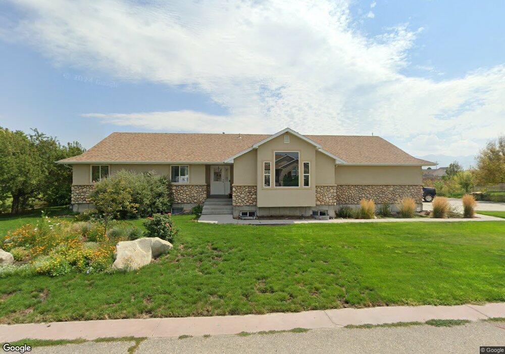
60 Trackside Cir Unit 7 Grantsville, UT 84029
Estimated Value: $645,000 - $821,000
5
Beds
3
Baths
3,666
Sq Ft
$190/Sq Ft
Est. Value
About This Home
This home is located at 60 Trackside Cir Unit 7, Grantsville, UT 84029 and is currently estimated at $697,851, approximately $190 per square foot. 60 Trackside Cir Unit 7 is a home located in Tooele County with nearby schools including Twenty Wells Elementary, Grantsville Junior High School, and Grantsville High School.
Ownership History
Date
Name
Owned For
Owner Type
Purchase Details
Closed on
Apr 15, 2019
Sold by
Bennett Wesley C and Bennett Pamela J
Bought by
Neilson Pamela Michelle and Neilson Timothy Lee
Current Estimated Value
Home Financials for this Owner
Home Financials are based on the most recent Mortgage that was taken out on this home.
Original Mortgage
$387,845
Outstanding Balance
$343,156
Interest Rate
4.62%
Mortgage Type
FHA
Estimated Equity
$354,695
Create a Home Valuation Report for This Property
The Home Valuation Report is an in-depth analysis detailing your home's value as well as a comparison with similar homes in the area
Home Values in the Area
Average Home Value in this Area
Purchase History
| Date | Buyer | Sale Price | Title Company |
|---|---|---|---|
| Neilson Pamela Michelle | -- | Metro National Title |
Source: Public Records
Mortgage History
| Date | Status | Borrower | Loan Amount |
|---|---|---|---|
| Open | Neilson Pamela Michelle | $387,845 |
Source: Public Records
Tax History Compared to Growth
Tax History
| Year | Tax Paid | Tax Assessment Tax Assessment Total Assessment is a certain percentage of the fair market value that is determined by local assessors to be the total taxable value of land and additions on the property. | Land | Improvement |
|---|---|---|---|---|
| 2025 | $4,237 | $489,836 | $111,800 | $378,036 |
| 2024 | $4,237 | $345,928 | $111,800 | $234,128 |
| 2023 | $4,237 | $317,589 | $76,300 | $241,289 |
| 2022 | $3,573 | $328,806 | $88,125 | $240,681 |
| 2021 | $2,886 | $216,612 | $53,750 | $162,862 |
| 2020 | $2,837 | $373,626 | $96,500 | $277,126 |
| 2019 | $3,097 | $398,821 | $76,200 | $322,621 |
| 2018 | $3,046 | $369,492 | $76,200 | $293,292 |
| 2017 | $2,494 | $320,610 | $76,200 | $244,410 |
| 2016 | $2,384 | $164,655 | $42,450 | $122,205 |
| 2015 | $2,384 | $164,655 | $0 | $0 |
| 2014 | -- | $111,047 | $0 | $0 |
Source: Public Records
Map
Nearby Homes
- 185 Waterhole Way
- 653 E Main St Unit 45
- 635 Wildrose Dr
- 72 S Mustang Ridge Rd Unit 109
- 187 Waterhole Way
- 697 E Main St
- 699 E Main St
- 600 Clay St
- 601 Clay St
- 573 S Eyring Place
- 359 S Archwood Way Unit 617
- 135 Willow St
- 799 E Main St
- 132 Willow St
- 113 Utah 112
- 443 E Stafford St Unit 137
- 437 E Stafford St Unit 136
- 52 East St
- 429 E Stafford St Unit 135
- 537 E Fiona Cir
- 74 Trackside Cir
- 50 Trackside Cir
- 107 Booth St Unit LOT 36
- 40 Trackside Cir
- 75 Trackside Cir
- 51 Trackside Cir
- 61 Trackside Cir
- 86 Trackside Cir
- 50 Booth St
- 606 Barbed Wire Dr Unit 1
- 606 Barbed Wire Dr
- 87 Trackside Cir
- 58 Booth St
- 58 Booth St Unit 41
- 68 Booth St
- 68 Booth St Unit 40
- 612 Barbed Wire Dr
- 633 Hunter Way
- 625 Hunter Way
- 598 E Clark St