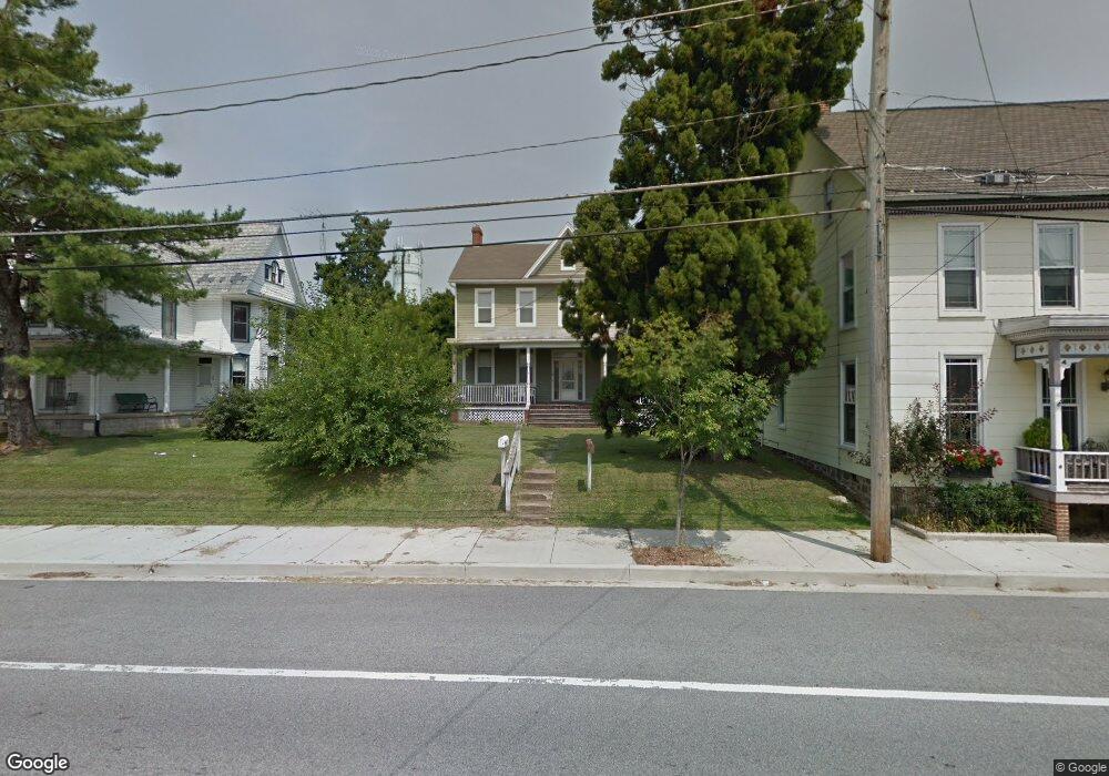
60 W Baltimore St Taneytown, MD 21787
Estimated Value: $262,000 - $299,992
4
Beds
2
Baths
2,376
Sq Ft
$119/Sq Ft
Est. Value
About This Home
This home is located at 60 W Baltimore St, Taneytown, MD 21787 and is currently estimated at $281,998, approximately $118 per square foot. 60 W Baltimore St is a home located in Carroll County with nearby schools including Taneytown Elementary School, Northwest Middle School, and Francis Scott Key High School.
Ownership History
Date
Name
Owned For
Owner Type
Purchase Details
Closed on
Oct 22, 2004
Sold by
Hodge Larry D
Bought by
Mccord Karen J and Mccord Steven D
Current Estimated Value
Purchase Details
Closed on
Aug 27, 2004
Sold by
Hodge Larry D
Bought by
Mccord Karen J and Mccord Steven D
Purchase Details
Closed on
Mar 20, 2003
Sold by
Hecht Michael R
Bought by
Hodge Larry D and Hodge Terry G
Purchase Details
Closed on
Jul 10, 2000
Sold by
Hecht Michael R
Bought by
Hecht Michael R and Hecht Helen R
Purchase Details
Closed on
Jan 13, 1997
Sold by
Hecht Michael R
Bought by
Hecht Michael R
Create a Home Valuation Report for This Property
The Home Valuation Report is an in-depth analysis detailing your home's value as well as a comparison with similar homes in the area
Home Values in the Area
Average Home Value in this Area
Purchase History
| Date | Buyer | Sale Price | Title Company |
|---|---|---|---|
| Mccord Karen J | $155,000 | -- | |
| Mccord Karen J | $155,000 | -- | |
| Hodge Larry D | $105,000 | -- | |
| Hecht Michael R | -- | -- | |
| Hecht Michael R | -- | -- |
Source: Public Records
Tax History Compared to Growth
Tax History
| Year | Tax Paid | Tax Assessment Tax Assessment Total Assessment is a certain percentage of the fair market value that is determined by local assessors to be the total taxable value of land and additions on the property. | Land | Improvement |
|---|---|---|---|---|
| 2025 | $2,602 | $181,833 | $0 | $0 |
| 2024 | $2,602 | $174,667 | $0 | $0 |
| 2023 | $2,495 | $167,500 | $67,800 | $99,700 |
| 2022 | $2,472 | $165,900 | $0 | $0 |
| 2021 | $2,448 | $164,300 | $0 | $0 |
| 2020 | $2,424 | $162,700 | $67,800 | $94,900 |
| 2019 | $2,388 | $159,233 | $0 | $0 |
| 2018 | $2,321 | $155,767 | $0 | $0 |
| 2017 | $2,269 | $152,300 | $0 | $0 |
| 2016 | -- | $152,300 | $0 | $0 |
| 2015 | -- | $152,300 | $0 | $0 |
| 2014 | -- | $152,400 | $0 | $0 |
Source: Public Records
Map
Nearby Homes
- 54 W Baltimore St
- 58 W Baltimore St
- 38 W Baltimore St
- 105 Ridge Ave
- 125 Commerce St
- 205 Ridge Ave
- 0 Harney Rd
- 223 Carroll Heights Rd
- 7 O Brien Ave
- 323 E Baltimore St
- 322 Roberts Mill Rd
- 39 O'Brien Ave
- 231 Roth Ave
- 68 Crimson Ave
- 27 Planetree Dr
- 428 E Baltimore St
- 505 Chestnut Ct
- 430 E Baltimore St
- 318 Burnside Ave
- 209 Grand Dr
- 64 W Baltimore St
- 56 W Baltimore St
- 2 Westview Dr
- 102 W Baltimore St
- 102 W Baltimore St
- 49 Westview Dr
- 6 Pumphouse Rd
- 61 W Baltimore St
- 50 W Baltimore St
- 57 W Baltimore St
- 104 W Baltimore St
- 65 W Baltimore St
- 47 Westview Dr
- 103 Baltimore 105 St Unit 2
- 103 Baltimore 105 St Unit 1
- 103 Baltimore 105 St Unit 3
- 103 W Baltimore St
- 55 W Baltimore 57 St
- 55 W Baltimore 57 St
- 45 Westview Dr