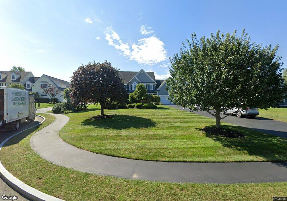
60 Weetamoo Way Wrentham, MA 02093
Estimated Value: $1,186,405 - $1,255,000
4
Beds
3
Baths
3,524
Sq Ft
$347/Sq Ft
Est. Value
About This Home
This home is located at 60 Weetamoo Way, Wrentham, MA 02093 and is currently estimated at $1,222,851, approximately $347 per square foot. 60 Weetamoo Way is a home located in Norfolk County with nearby schools including Delaney Elementary School and Charles E Roderick.
Ownership History
Date
Name
Owned For
Owner Type
Purchase Details
Closed on
Mar 31, 2005
Sold by
Diplacido Dev Corp
Bought by
Kiss Margo and Kiss Paul V
Current Estimated Value
Home Financials for this Owner
Home Financials are based on the most recent Mortgage that was taken out on this home.
Original Mortgage
$240,000
Outstanding Balance
$122,480
Interest Rate
5.61%
Mortgage Type
Purchase Money Mortgage
Estimated Equity
$1,100,371
Create a Home Valuation Report for This Property
The Home Valuation Report is an in-depth analysis detailing your home's value as well as a comparison with similar homes in the area
Home Values in the Area
Average Home Value in this Area
Purchase History
| Date | Buyer | Sale Price | Title Company |
|---|---|---|---|
| Kiss Margo | $690,000 | -- |
Source: Public Records
Mortgage History
| Date | Status | Borrower | Loan Amount |
|---|---|---|---|
| Open | Kiss Margo | $240,000 | |
| Closed | Kiss Margo | $200,000 |
Source: Public Records
Tax History Compared to Growth
Tax History
| Year | Tax Paid | Tax Assessment Tax Assessment Total Assessment is a certain percentage of the fair market value that is determined by local assessors to be the total taxable value of land and additions on the property. | Land | Improvement |
|---|---|---|---|---|
| 2025 | $12,383 | $1,068,400 | $316,800 | $751,600 |
| 2024 | $11,736 | $978,000 | $316,800 | $661,200 |
| 2023 | $11,680 | $925,500 | $288,000 | $637,500 |
| 2022 | $11,119 | $813,400 | $261,800 | $551,600 |
| 2021 | $10,838 | $770,300 | $261,800 | $508,500 |
| 2020 | $11,058 | $776,000 | $215,200 | $560,800 |
| 2019 | $10,606 | $751,100 | $215,200 | $535,900 |
| 2018 | $9,848 | $691,600 | $215,400 | $476,200 |
| 2017 | $9,201 | $645,700 | $211,300 | $434,400 |
| 2016 | $9,078 | $635,700 | $205,200 | $430,500 |
| 2015 | $9,249 | $617,400 | $197,200 | $420,200 |
| 2014 | $9,172 | $599,100 | $189,700 | $409,400 |
Source: Public Records
Map
Nearby Homes
- Lot 1 - Blueberry 2 Car Plan at King Philip Estates
- Lot 8 - Blueberry 2 Car Plan at King Philip Estates
- Lot 5 - Hughes 2 car Plan at King Philip Estates
- Lot 6 - Blueberry 3 Car Plan at King Philip Estates
- Lot 2 - Camden 2 Car Plan at King Philip Estates
- Lot 7 - Cedar Plan at King Philip Estates
- Lot 4 - Hemingway 2 Car Plan at King Philip Estates
- Lot 3 - Blueberry 2 Car Plan at King Philip Estates
- Lot 3 - 14 Earle Stewart Ln
- 11 Earle Stewart Ln
- 131 Creek St Unit 7
- 791 South St Unit 5
- 319 Taunton St
- 10 Nature View Dr
- 15 Nature View Dr
- 570 Franklin St
- 440 Chestnut St
- 50 Green St
- 1204 South St
- 1222 South St
- 50 Weetamoo Way
- 70 Weetamoo Way
- 40 Weetamoo Way
- 85 Weetamoo Way
- 75 Weetamoo Way
- 95 Weetamoo Way
- 30 Weetamoo Way
- 65 Weetamoo Way
- 110 Riverside Dr
- 20 Weetamoo Way
- 100 Riverside Dr
- 55 Weetamoo Way
- 45 Weetamoo Way
- 105 Annawon Ave
- 90 Riverside Dr
- 35 Weetamoo Way
- 115 Annawon Ave
- 10 Weetamoo Way
- 25 Weetamoo Way
- 80 Riverside Dr