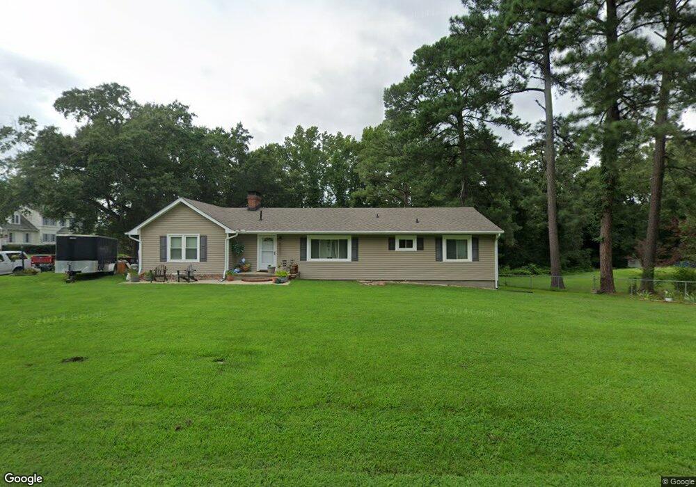
600 Atwater Rd Hopewell, VA 23860
Estimated Value: $315,000 - $364,000
4
Beds
2
Baths
2,224
Sq Ft
$154/Sq Ft
Est. Value
About This Home
This home is located at 600 Atwater Rd, Hopewell, VA 23860 and is currently estimated at $342,037, approximately $153 per square foot. 600 Atwater Rd is a home located in Hopewell City with nearby schools including Carter G. Woodson Middle School, Hopewell High School, and West End Christian School.
Ownership History
Date
Name
Owned For
Owner Type
Purchase Details
Closed on
Mar 16, 2012
Sold by
Federal National Mortgage Association
Bought by
Morris Harry W
Current Estimated Value
Home Financials for this Owner
Home Financials are based on the most recent Mortgage that was taken out on this home.
Original Mortgage
$150,767
Outstanding Balance
$103,517
Interest Rate
3.86%
Mortgage Type
FHA
Estimated Equity
$238,520
Purchase Details
Closed on
Oct 26, 2011
Sold by
Prof Foreclosure Corp Of Va
Bought by
Federal National Mortgage Association
Purchase Details
Closed on
Jan 29, 2010
Sold by
Lee Nathan C
Bought by
Taylor G Wayne and Narron Michael R
Purchase Details
Closed on
May 3, 2005
Sold by
Langley Jarold D
Bought by
Mazzei Mary E
Home Financials for this Owner
Home Financials are based on the most recent Mortgage that was taken out on this home.
Original Mortgage
$133,500
Interest Rate
5.95%
Mortgage Type
New Conventional
Create a Home Valuation Report for This Property
The Home Valuation Report is an in-depth analysis detailing your home's value as well as a comparison with similar homes in the area
Home Values in the Area
Average Home Value in this Area
Purchase History
| Date | Buyer | Sale Price | Title Company |
|---|---|---|---|
| Morris Harry W | $85,000 | -- | |
| Federal National Mortgage Association | $194,280 | -- | |
| Taylor G Wayne | $14,000 | -- | |
| Mazzei Mary E | $133,500 | -- |
Source: Public Records
Mortgage History
| Date | Status | Borrower | Loan Amount |
|---|---|---|---|
| Open | Mazzei Mary E | $150,767 | |
| Previous Owner | Mazzei Mary E | $133,500 |
Source: Public Records
Tax History Compared to Growth
Tax History
| Year | Tax Paid | Tax Assessment Tax Assessment Total Assessment is a certain percentage of the fair market value that is determined by local assessors to be the total taxable value of land and additions on the property. | Land | Improvement |
|---|---|---|---|---|
| 2025 | $3,346 | $286,000 | $37,000 | $249,000 |
| 2024 | $3,064 | $261,900 | $35,200 | $226,700 |
| 2023 | $2,959 | $261,900 | $35,200 | $226,700 |
| 2022 | $2,559 | $226,500 | $32,000 | $194,500 |
| 2021 | $2,559 | $226,500 | $32,000 | $194,500 |
| 2020 | $2,498 | $221,100 | $35,200 | $185,900 |
| 2019 | $2,498 | $221,100 | $35,200 | $185,900 |
| 2018 | $1,933 | $171,100 | $33,000 | $138,100 |
| 2017 | $1,933 | $171,100 | $33,000 | $138,100 |
| 2016 | $1,952 | $172,700 | $33,000 | $139,700 |
| 2015 | $1,952 | $172,700 | $33,000 | $139,700 |
| 2014 | $1,906 | $171,700 | $30,500 | $141,200 |
Source: Public Records
Map
Nearby Homes
- NEUVILLE Plan at Anchor Point
- PINE Plan at Anchor Point
- CABRAL Plan at Anchor Point
- DELMAR Plan at Anchor Point
- ESSEX Plan at Anchor Point
- 301 Beacon Ridge Dr Unit 109
- 4049 Eagle Dr
- 3803 Eagle Dr
- 3901 Cambridge Place
- 00 Brookneal Dr
- 01 Brookneal Dr
- 3506 W Broadway
- 3408 N Radford Dr
- 3500 N Colonial Dr
- 420 Park Ave
- 376 Libby Ave
- 3008 W Grant St
- 204 Crescent Ave
- 2111 Point of Rocks Rd
- 308 Pin Oak Dr
- 606 Atwater Rd
- 4016 Cameron Rd
- 512 Atwater Rd
- 4015 Cameron Rd
- 4017 Cameron Rd
- 607 Atwater Rd
- 607 Atwater Rd
- 4019 Cameron Rd
- 510 Atwater Rd
- 4021 Cameron Rd
- 4020 Cameron Rd
- 618 Atwater Rd
- 509 Atwater Rd
- 1620 Camerons Landing Blvd
- 1624 Camerons Landing Blvd
- 709 Atwater Rd
- 1618 Camerons Landing Blvd
- 4024 Cameron Rd
- 1616 Camerons Landing Blvd
- 1618 Camerons Landing Bld