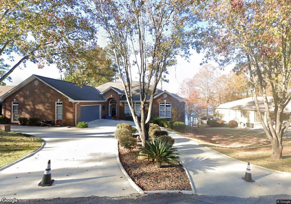
600 Burnt Log Dr Fortson, GA 31808
Estimated Value: $513,000 - $810,000
3
Beds
3
Baths
2,616
Sq Ft
$232/Sq Ft
Est. Value
About This Home
This home is located at 600 Burnt Log Dr, Fortson, GA 31808 and is currently estimated at $607,301, approximately $232 per square foot. 600 Burnt Log Dr is a home located in Harris County with nearby schools including New Mountain Hill Elementary School, Harris County Carver Middle School, and Harris County High School.
Ownership History
Date
Name
Owned For
Owner Type
Purchase Details
Closed on
May 31, 2024
Sold by
Girken Laurie A
Bought by
Girken Williams Living Trust Dated May 2 and Girken Laurie A Tr
Current Estimated Value
Purchase Details
Closed on
Apr 5, 2024
Sold by
Williams Kimberly A
Bought by
Girken Laurie A and Williams Kimberly A
Purchase Details
Closed on
Sep 22, 2015
Sold by
Tillman Susan
Bought by
Williams Kimberly
Home Financials for this Owner
Home Financials are based on the most recent Mortgage that was taken out on this home.
Original Mortgage
$300,000
Interest Rate
3%
Mortgage Type
New Conventional
Create a Home Valuation Report for This Property
The Home Valuation Report is an in-depth analysis detailing your home's value as well as a comparison with similar homes in the area
Home Values in the Area
Average Home Value in this Area
Purchase History
| Date | Buyer | Sale Price | Title Company |
|---|---|---|---|
| Girken Williams Living Trust Dated May 2 | -- | -- | |
| Girken Laurie A | -- | -- | |
| Williams Kimberly | $510,000 | -- |
Source: Public Records
Mortgage History
| Date | Status | Borrower | Loan Amount |
|---|---|---|---|
| Previous Owner | Williams Kimberly | $300,000 |
Source: Public Records
Tax History Compared to Growth
Tax History
| Year | Tax Paid | Tax Assessment Tax Assessment Total Assessment is a certain percentage of the fair market value that is determined by local assessors to be the total taxable value of land and additions on the property. | Land | Improvement |
|---|---|---|---|---|
| 2024 | $4,479 | $162,611 | $0 | $162,611 |
| 2023 | $4,154 | $150,386 | $0 | $150,386 |
| 2022 | $4,154 | $150,386 | $0 | $150,386 |
| 2021 | $3,891 | $135,389 | $0 | $135,389 |
| 2020 | $3,891 | $135,389 | $0 | $135,389 |
| 2019 | $3,649 | $135,389 | $0 | $135,389 |
| 2018 | $3,724 | $135,389 | $0 | $135,389 |
| 2017 | $3,725 | $135,389 | $0 | $135,389 |
| 2014 | $2,719 | $107,523 | $0 | $107,523 |
| 2013 | -- | $107,522 | $0 | $107,522 |
Source: Public Records
Map
Nearby Homes
- 161 Layfield Branch Rd
- 333 Eastside Dr Unit 23
- 333 Eastside Dr Unit 25
- 333 Eastside Dr Unit 60
- 333 Eastside Dr Unit 24
- 333 Eastside Dr Unit 4
- 0 Davis Rd Unit 23501828
- 0 Davis Rd Unit 10515754
- 0 Davis Rd
- 0 Davis Rd
- 302 Odom Dr
- 1236 Martin Rd
- 21 Lookout Dr
- 39 Cove Hollow Rd
- 230 Kelly Dr
- 340 Commodore Dr
- 0 Lick Skillet Rd Unit 219228
- 94 Hidden Trail
- 695 Boat Club Rd
- 625 Boat Club Rd
- 610 Burnt Log Dr
- 570 Burnt Log Dr
- 544 Burnt Log Dr
- 540 Burnt Log Dr
- 114 Wisteria Ln
- 477 Burnt Log Dr
- 514 Burnt Log Dr
- 170 Wisteria Ln
- 444 Burnt Log Dr
- 411 Burnt Log Dr
- 449 Burnt Log Dr
- 400 Burnt Log Dr
- 190 Wisteria Ln
- 986 Bartletts Ferry Rd
- 380 Burnt Log Dr
- 119 Wisteria Ln
- 980 Bartletts Ferry Rd
- 360 Burnt Log Dr
- 1414 Bartletts Ferry Rd
- 1051 Bartletts Ferry Rd