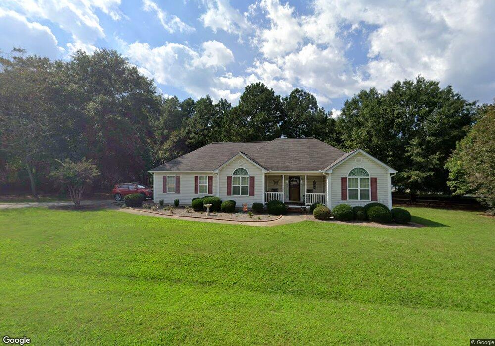
600 Cassidy Cir Athens, GA 30601
Estimated Value: $326,758 - $371,000
3
Beds
2
Baths
1,539
Sq Ft
$229/Sq Ft
Est. Value
About This Home
This home is located at 600 Cassidy Cir, Athens, GA 30601 and is currently estimated at $352,690, approximately $229 per square foot. 600 Cassidy Cir is a home located in Clarke County with nearby schools including Judia Jackson Harris Elementary School, Coile Middle School, and Cedar Shoals High School.
Ownership History
Date
Name
Owned For
Owner Type
Purchase Details
Closed on
Jan 31, 2007
Sold by
Not Provided
Bought by
Powell Carol J
Current Estimated Value
Home Financials for this Owner
Home Financials are based on the most recent Mortgage that was taken out on this home.
Original Mortgage
$126,000
Outstanding Balance
$74,368
Interest Rate
6.08%
Mortgage Type
New Conventional
Estimated Equity
$278,322
Purchase Details
Closed on
Jun 30, 2004
Sold by
J L Baker Building Inc
Bought by
Burroughs Charles A
Purchase Details
Closed on
Sep 2, 2003
Sold by
Pridgen Jimmy E
Bought by
J L Baker Building Inc
Create a Home Valuation Report for This Property
The Home Valuation Report is an in-depth analysis detailing your home's value as well as a comparison with similar homes in the area
Purchase History
| Date | Buyer | Sale Price | Title Company |
|---|---|---|---|
| Powell Carol J | $140,000 | -- | |
| Burroughs Charles A | $137,900 | -- | |
| J L Baker Building Inc | $27,600 | -- |
Source: Public Records
Mortgage History
| Date | Status | Borrower | Loan Amount |
|---|---|---|---|
| Open | Powell Carol J | $126,000 |
Source: Public Records
Tax History
| Year | Tax Paid | Tax Assessment Tax Assessment Total Assessment is a certain percentage of the fair market value that is determined by local assessors to be the total taxable value of land and additions on the property. | Land | Improvement |
|---|---|---|---|---|
| 2025 | $2,847 | $122,232 | $12,000 | $110,232 |
| 2024 | $2,847 | $117,368 | $12,000 | $105,368 |
| 2023 | $2,070 | $101,243 | $11,200 | $90,043 |
| 2022 | $2,506 | $88,552 | $11,200 | $77,352 |
| 2021 | $2,532 | $85,148 | $11,200 | $73,948 |
| 2020 | $2,103 | $72,398 | $11,200 | $61,198 |
| 2019 | $1,829 | $63,873 | $11,200 | $52,673 |
| 2018 | $1,556 | $55,839 | $11,200 | $44,639 |
| 2017 | $1,534 | $55,181 | $11,200 | $43,981 |
| 2016 | $1,491 | $53,908 | $11,200 | $42,708 |
| 2015 | $1,408 | $51,404 | $11,200 | $40,204 |
| 2014 | $1,395 | $50,943 | $11,200 | $39,743 |
Source: Public Records
Map
Nearby Homes
- 1309 Hull Rd
- 741 Harve Mathis Rd
- 540 & 542 Harve Mathis Rd
- 105 Hidden Lake Ct
- 1361 Hull Rd
- 3080 Danielsville Rd
- 789 Glenn Carrie Rd
- 105 Payne Dr
- 19 Glenn Carrie Rd
- 768 Glenn Carrie Rd
- 270 Norwood Cir
- 232 Glenn Carrie Rd Unit 1
- 240 Glenn Carrie Rd Unit 2
- 73 Woodale St
- 0 Reese Ln Unit 7703910
- 0 Reese Ln Unit CL346847
- 4000 Danielsville Rd
- 269 Norwood Ln
- 8986 Highway 29 S
- 110 Connelly Cir
- 513 Cheyenne Ave
- 602 Cassidy Cir
- 601 Cassidy Cir
- 603 Cassidy Cir
- 515 Cheyenne Ave
- 512 Cheyenne Ave
- 516 Cheyenne Ave
- 507 Cheyenne Ave
- 518 Cheyenne Ave
- 514 Cheyenne Ave
- 517 Cheyenne Ave Unit 11 A
- 517 Cheyenne Ave
- 510 Cheyenne Ave
- 520 Cheyenne Ave
- 508 Cheyenne Ave
- 522 Cheyenne Ave
- 505 Cheyenne Ave
- 524 Cheyenne Ave
- 333 Old Pittard Rd
- 329 Old Pittard Rd
Your Personal Tour Guide
Ask me questions while you tour the home.