Estimated Value: $314,577 - $343,000
3
Beds
2
Baths
2,532
Sq Ft
$128/Sq Ft
Est. Value
About This Home
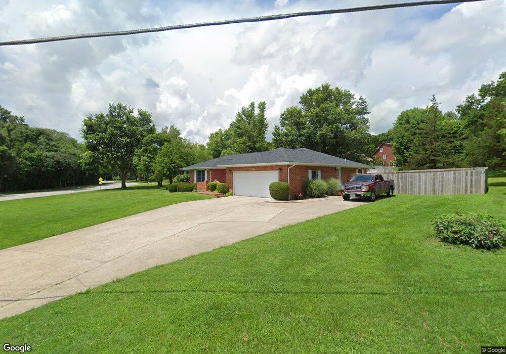
This home is located at 600 Chestnut St, Rolla, MO 65401 and is currently estimated at $325,144, approximately $128 per square foot. 600 Chestnut St is a home located in Phelps County with nearby schools including Rolla Junior High School, Rolla Senior High School, and Rolla Seventh-Day Adventist School.
Ownership History
Date
Name
Owned For
Owner Type
Purchase Details
Closed on
Jan 12, 2024
Sold by
Strain Thomas C Trust
Bought by
Potvin Bryce L
Current Estimated Value
Home Financials for this Owner
Home Financials are based on the most recent Mortgage that was taken out on this home.
Original Mortgage
$160,000
Outstanding Balance
$151,918
Interest Rate
0.66%
Mortgage Type
Construction
Estimated Equity
$173,227
Create a Home Valuation Report for This Property
The Home Valuation Report is an in-depth analysis detailing your home's value as well as a comparison with similar homes in the area
Home Values in the Area
Average Home Value in this Area
Purchase History
| Date | Buyer | Sale Price | Title Company |
|---|---|---|---|
| Potvin Bryce L | $200,000 | Wiggins Abs Co |
Source: Public Records
Mortgage History
| Date | Status | Borrower | Loan Amount |
|---|---|---|---|
| Open | Potvin Bryce L | $160,000 |
Source: Public Records
Tax History Compared to Growth
Tax History
| Year | Tax Paid | Tax Assessment Tax Assessment Total Assessment is a certain percentage of the fair market value that is determined by local assessors to be the total taxable value of land and additions on the property. | Land | Improvement |
|---|---|---|---|---|
| 2025 | $2,265 | $43,400 | $5,230 | $38,170 |
| 2024 | $2,070 | $38,500 | $3,800 | $34,700 |
| 2023 | $2,083 | $38,500 | $3,800 | $34,700 |
| 2022 | $1,769 | $38,500 | $3,800 | $34,700 |
| 2021 | $1,781 | $38,500 | $3,800 | $34,700 |
| 2020 | $1,610 | $33,970 | $3,800 | $30,170 |
| 2019 | $1,601 | $33,970 | $3,800 | $30,170 |
| 2018 | $1,587 | $33,970 | $3,800 | $30,170 |
| 2017 | $1,584 | $33,970 | $3,800 | $30,170 |
| 2016 | $1,533 | $33,970 | $3,800 | $30,170 |
| 2015 | -- | $33,970 | $3,800 | $30,170 |
| 2014 | -- | $33,970 | $3,800 | $30,170 |
| 2013 | -- | $33,970 | $0 | $0 |
Source: Public Records
Map
Nearby Homes
- 701 Brighton Ct
- 45 Mcfarland Dr
- 46 Mcfarland Dr
- 811 Sycamore Dr
- 812 Cedar Hill Ct
- 821 Cambridge Dr
- 38 Johnson Dr
- 814 Oxford Dr
- 807 Lariat Ln
- Lot 38 Scottsvale Dr
- 24 Richard Dr
- 1011 Carriage Ln
- 403 Hutchinson Dr
- 821 Highway O
- 0 Sherwood Unit MIS25076064
- 1601 E State Route 72
- 700 Lariat Ln
- 1331 Highway O
- 18119 State Route O
- 0 Redbud Ln
- 600 Chestnut St
- 1013 Winchester Dr
- 703 Brighton Ct
- 14 Mcfarland Dr
- 1103 Winchester Dr
- 13 Mcfarland Dr
- 36 Mcfarland Dr
- 15 Mcfarland Dr
- 1105 Winchester Dr
- 1104 Winchester Dr
- 704 Brighton Ct
- 1203 Devonshire Ln
- 702 Brighton Ct
- 37 Mcfarland Dr
- 12 Mcfarland Dr
- 700 Brighton Ct
- 1009 Laurel Dr
- 16 Mcfarland Dr
- 619 Brighton Ct
- 1009 Winchester Dr