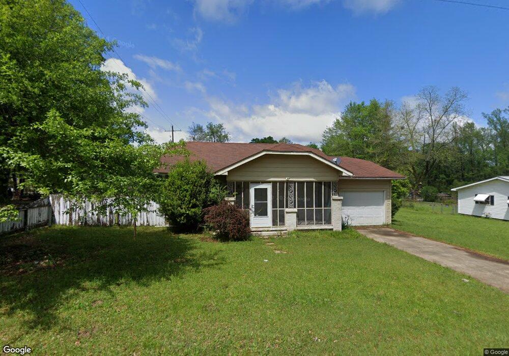
600 E 9th St SMacKover, AR 71762
Estimated Value: $74,382 - $112,000
Studio
1
Bath
1,352
Sq Ft
$69/Sq Ft
Est. Value
About This Home
This home is located at 600 E 9th St, SMacKover, AR 71762 and is currently estimated at $93,596, approximately $69 per square foot. 600 E 9th St is a home located in Union County with nearby schools including Smackover Elementary School, Norphlet Middle School, and Smackover High School.
Ownership History
Date
Name
Owned For
Owner Type
Purchase Details
Closed on
Jan 26, 2018
Sold by
Castlerock 2017 Llc
Bought by
Nelson Lt
Current Estimated Value
Purchase Details
Closed on
Mar 9, 2017
Sold by
Bank Of America
Bought by
Castlerock 2017 Llc
Purchase Details
Closed on
Apr 17, 2014
Sold by
Mackie Wolf Zientz & Mann Pc T
Bought by
Bank Of America
Purchase Details
Closed on
May 4, 2007
Sold by
Swartz Robert C and Swartz Joyce E
Bought by
Vinson Deborah R
Home Financials for this Owner
Home Financials are based on the most recent Mortgage that was taken out on this home.
Original Mortgage
$51,688
Interest Rate
6.13%
Mortgage Type
FHA
Purchase Details
Closed on
Nov 1, 2002
Bought by
Swartz Robert C
Purchase Details
Closed on
Jan 1, 1993
Bought by
Thornton Jeff
Create a Home Valuation Report for This Property
The Home Valuation Report is an in-depth analysis detailing your home's value as well as a comparison with similar homes in the area
Purchase History
| Date | Buyer | Sale Price | Title Company |
|---|---|---|---|
| Nelson Lt | $8,000 | -- | |
| Castlerock 2017 Llc | $20,890 | -- | |
| Bank Of America | $42,647 | -- | |
| Vinson Deborah R | $53,000 | None Available | |
| Swartz Robert C | $43,000 | -- | |
| Thornton Jeff | -- | -- |
Source: Public Records
Mortgage History
| Date | Status | Borrower | Loan Amount |
|---|---|---|---|
| Previous Owner | Vinson Deborah R | $51,688 |
Source: Public Records
Tax History
| Year | Tax Paid | Tax Assessment Tax Assessment Total Assessment is a certain percentage of the fair market value that is determined by local assessors to be the total taxable value of land and additions on the property. | Land | Improvement |
|---|---|---|---|---|
| 2025 | $645 | $13,000 | $2,000 | $11,000 |
| 2024 | $595 | $13,000 | $2,000 | $11,000 |
| 2023 | $545 | $13,000 | $2,000 | $11,000 |
| 2022 | $496 | $9,200 | $2,000 | $7,200 |
| 2021 | $496 | $9,200 | $2,000 | $7,200 |
| 2020 | $496 | $9,200 | $2,000 | $7,200 |
| 2019 | $496 | $9,200 | $2,000 | $7,200 |
| 2018 | $496 | $9,200 | $2,000 | $7,200 |
| 2017 | $497 | $9,370 | $2,000 | $7,370 |
| 2016 | $497 | $9,370 | $2,000 | $7,370 |
| 2015 | $497 | $9,370 | $2,000 | $7,370 |
| 2014 | $114 | $8,760 | $2,000 | $6,760 |
Source: Public Records
Map
Nearby Homes
- Lots 2-3 Poplar St
- 0 Poplar
- 300 W 7th St
- 1203 Pine Cir
- 172 Lisbon Rd
- Hwy 160 Unit LotWP001
- 000 Hwy 160
- 544 N Tate Rd
- 2025 O Rear Rd
- 580 O Rear Cutoff
- 217 Walter Dr
- 191 Charlie Vance Rd
- 5053 Lisbon Rd
- 0 Highway 75-20 Unit 24032576
- 140 Ouachita 497
- 740 Agnes Rd
- 1.4 Acres Victor Dumas Rd
- 526 Meadow Ln
- 4258 Calion Hwy
- 520 Old Calion Rd
Your Personal Tour Guide
Ask me questions while you tour the home.