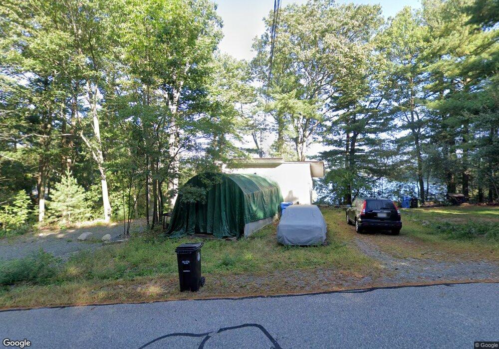
600 Eastside Rd Wrentham, MA 02093
Estimated Value: $523,000 - $637,000
2
Beds
2
Baths
723
Sq Ft
$802/Sq Ft
Est. Value
About This Home
This home is located at 600 Eastside Rd, Wrentham, MA 02093 and is currently estimated at $579,734, approximately $801 per square foot. 600 Eastside Rd is a home located in Norfolk County with nearby schools including Delaney Elementary School and Charles E Roderick.
Ownership History
Date
Name
Owned For
Owner Type
Purchase Details
Closed on
Jun 24, 2022
Sold by
Oconnell Kevin
Bought by
Kevin Oconnell T
Current Estimated Value
Purchase Details
Closed on
Jul 1, 1998
Sold by
Cannon Mary F
Bought by
Oconnell Kevin
Home Financials for this Owner
Home Financials are based on the most recent Mortgage that was taken out on this home.
Original Mortgage
$89,651
Interest Rate
7.04%
Mortgage Type
Purchase Money Mortgage
Create a Home Valuation Report for This Property
The Home Valuation Report is an in-depth analysis detailing your home's value as well as a comparison with similar homes in the area
Purchase History
| Date | Buyer | Sale Price | Title Company |
|---|---|---|---|
| Kevin Oconnell T | -- | None Available | |
| Oconnell Kevin | $77,000 | -- |
Source: Public Records
Mortgage History
| Date | Status | Borrower | Loan Amount |
|---|---|---|---|
| Previous Owner | Oconnell Kevin | $144,000 | |
| Previous Owner | Oconnell Kevin | $21,313 | |
| Previous Owner | Oconnell Kevin | $89,651 |
Source: Public Records
Tax History
| Year | Tax Paid | Tax Assessment Tax Assessment Total Assessment is a certain percentage of the fair market value that is determined by local assessors to be the total taxable value of land and additions on the property. | Land | Improvement |
|---|---|---|---|---|
| 2025 | $6,599 | $569,400 | $416,100 | $153,300 |
| 2024 | $6,467 | $538,900 | $416,100 | $122,800 |
| 2023 | $6,012 | $476,400 | $373,000 | $103,400 |
| 2022 | $5,352 | $391,500 | $306,800 | $84,700 |
| 2021 | $5,946 | $422,600 | $339,100 | $83,500 |
| 2020 | $6,182 | $433,800 | $345,200 | $88,600 |
| 2019 | $6,259 | $443,300 | $357,500 | $85,800 |
| 2018 | $6,378 | $447,900 | $359,000 | $88,900 |
| 2017 | $6,152 | $431,700 | $352,100 | $79,600 |
| 2016 | $5,956 | $417,100 | $341,900 | $75,200 |
| 2015 | $5,928 | $395,700 | $328,700 | $67,000 |
| 2014 | $5,827 | $380,600 | $316,100 | $64,500 |
Source: Public Records
Map
Nearby Homes
- 12 Earle Stewart Ln
- 2 Earle Stewart Ln
- 10 Earle Stewart Ln Unit Lot 5
- 3 Earle Stewart Ln
- 135 Creek St Unit 2
- 500 Franklin St
- 10 Nature View Dr
- 15 Nature View Dr
- 440 Chestnut St
- 50 Reed Fulton Ave Unit Lot 61
- 613 West St
- 1222 South St
- 955 Summer St
- 282 Thurston St
- 45 Joshua Rd
- 75 Jordan Rd
- 246 Forest Grove Ave
- 3 Oak View Terrace Unit 3
- 0 Fall Ln
- 9 Elliot Mills Unit 5
- 610 Eastside Rd
- 590 Eastside Rd
- 580 Eastside Rd
- 560 Eastside Rd
- 640 Eastside Rd
- 550 Eastside Rd
- 650 Eastside Rd
- 660 Eastside Rd
- 540 Eastside Rd
- 540 E Side Rd
- 670 Eastside Rd
- 530 Eastside Rd
- 680 Eastside Rd
- 735 Eastside Rd
- 690 Eastside Rd
- 165 Pokanoket Path
- 155 Pokanoket Path
- 145 Pokanoket Path
- 135 Pokanoket Path
- 175 Pokanoket Path
Your Personal Tour Guide
Ask me questions while you tour the home.