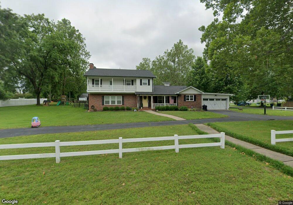
600 Euclid Blvd Carthage, MO 64836
Estimated Value: $289,000 - $355,000
--
Bed
2
Baths
3,300
Sq Ft
$101/Sq Ft
Est. Value
About This Home
This home is located at 600 Euclid Blvd, Carthage, MO 64836 and is currently estimated at $333,368, approximately $101 per square foot. 600 Euclid Blvd is a home located in Jasper County with nearby schools including Carthage High School, St. Ann's Catholic School, and Victory Academy.
Ownership History
Date
Name
Owned For
Owner Type
Purchase Details
Closed on
May 10, 2021
Sold by
Campbell Patrick D and Campbell Hillary C
Bought by
Terry Johnathan and Terry Katelyn
Current Estimated Value
Home Financials for this Owner
Home Financials are based on the most recent Mortgage that was taken out on this home.
Original Mortgage
$29,400
Outstanding Balance
$26,587
Interest Rate
3.1%
Mortgage Type
Unknown
Estimated Equity
$306,781
Purchase Details
Closed on
Nov 30, 2007
Sold by
Cook Mary Martha
Bought by
Campbell Patrick Dale and Campbell Hillary C
Home Financials for this Owner
Home Financials are based on the most recent Mortgage that was taken out on this home.
Original Mortgage
$249,000
Interest Rate
6.43%
Mortgage Type
Purchase Money Mortgage
Create a Home Valuation Report for This Property
The Home Valuation Report is an in-depth analysis detailing your home's value as well as a comparison with similar homes in the area
Home Values in the Area
Average Home Value in this Area
Purchase History
| Date | Buyer | Sale Price | Title Company |
|---|---|---|---|
| Terry Johnathan | -- | None Available | |
| Campbell Patrick Dale | -- | Jct |
Source: Public Records
Mortgage History
| Date | Status | Borrower | Loan Amount |
|---|---|---|---|
| Open | Terry Johnathan | $29,400 | |
| Open | Terry Johnathan | $197,600 | |
| Previous Owner | Campbell Patrick Dale | $249,000 |
Source: Public Records
Tax History Compared to Growth
Tax History
| Year | Tax Paid | Tax Assessment Tax Assessment Total Assessment is a certain percentage of the fair market value that is determined by local assessors to be the total taxable value of land and additions on the property. | Land | Improvement |
|---|---|---|---|---|
| 2025 | $2,301 | $49,820 | $8,520 | $41,300 |
| 2024 | $2,301 | $44,700 | $8,520 | $36,180 |
| 2023 | $2,301 | $44,700 | $8,520 | $36,180 |
| 2022 | $2,333 | $45,480 | $8,520 | $36,960 |
| 2021 | $2,308 | $45,480 | $8,520 | $36,960 |
| 2020 | $2,245 | $42,400 | $8,520 | $33,880 |
| 2019 | $2,249 | $42,400 | $8,520 | $33,880 |
| 2018 | $2,162 | $40,860 | $0 | $0 |
| 2017 | $2,167 | $40,860 | $0 | $0 |
| 2016 | $2,160 | $40,860 | $0 | $0 |
| 2015 | -- | $40,860 | $0 | $0 |
| 2014 | -- | $40,860 | $0 | $0 |
Source: Public Records
Map
Nearby Homes
- 702 E Centennial Ave
- 824 Euclid Blvd
- 1529 S Grand Ave
- 1610 S Main St
- 839 Euclid Blvd
- 421 E 14th St
- 1743 S River St
- 1421 Grand Ave
- 1513 S Main St
- 1910 Wynwood Dr
- 2816 S Maple St
- 1922 Southwood Ln
- 1830 S Maple St
- 1012 Euclid Blvd
- 1335 S Main St
- 1221 Clinton St
- 1211 James St
- xxxx Lilac Ln
- 1204 Grand Ave
- 1515 S Garrison Ave
- 530 Euclid Blvd
- 618 Euclid Blvd
- 526 Euclid Blvd
- 603 Belle Air Place
- 611 Belle Air Place
- 605 Euclid Blvd
- 522 Euclid Blvd
- 531 Belle Air Place
- 624 Euclid Blvd
- 615 Euclid Blvd
- 527 Belle Air Place
- Lot 1 Belle Aire Place
- 529 Euclid Blvd
- 518 Euclid Blvd
- 625 Belle Air Place
- 523 Belle Air Place
- 523 Euclid Blvd
- 623 Euclid Blvd
- 706 Euclid Blvd
- 519 Belle Air Place