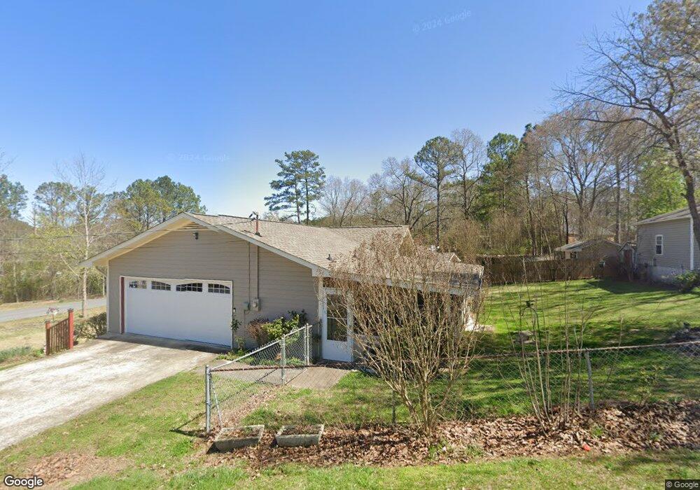
600 Harris Cir Cedartown, GA 30125
Estimated Value: $253,000 - $285,000
3
Beds
2
Baths
1,802
Sq Ft
$149/Sq Ft
Est. Value
About This Home
This home is located at 600 Harris Cir, Cedartown, GA 30125 and is currently estimated at $268,703, approximately $149 per square foot. 600 Harris Cir is a home located in Polk County with nearby schools including Cedar Christian School and Vineyard Harvester Christian Academy.
Ownership History
Date
Name
Owned For
Owner Type
Purchase Details
Closed on
Jul 9, 1999
Sold by
Smith Gregory A and Sharon Denise
Bought by
East Joe David & Mary M
Current Estimated Value
Purchase Details
Closed on
Jul 31, 1996
Sold by
Hamilton Judson H and Hamilton June T
Bought by
Smith Gregory A and Smith Sharon D
Purchase Details
Closed on
Jul 31, 1991
Sold by
Smith Gregory A and Smith Saron D
Bought by
Hamilton Judson and Hamilton Jane
Purchase Details
Closed on
Mar 2, 1988
Sold by
Charlotte Enterprise
Bought by
Smith Gregory A
Purchase Details
Closed on
Feb 6, 1987
Sold by
Gentry Charles W
Bought by
Charlotte Enterp Inc
Purchase Details
Closed on
Nov 4, 1986
Sold by
Gentry & Harris Inc
Bought by
Gentry Charles W
Purchase Details
Closed on
Aug 25, 1981
Bought by
Gentry & Harris Inc
Create a Home Valuation Report for This Property
The Home Valuation Report is an in-depth analysis detailing your home's value as well as a comparison with similar homes in the area
Home Values in the Area
Average Home Value in this Area
Purchase History
| Date | Buyer | Sale Price | Title Company |
|---|---|---|---|
| East Joe David & Mary M | $85,000 | -- | |
| Smith Gregory A | -- | -- | |
| Hamilton Judson | -- | -- | |
| Smith Gregory A | $62,900 | -- | |
| Charlotte Enterp Inc | $12,000 | -- | |
| Gentry Charles W | -- | -- | |
| Gentry & Harris Inc | -- | -- |
Source: Public Records
Tax History Compared to Growth
Tax History
| Year | Tax Paid | Tax Assessment Tax Assessment Total Assessment is a certain percentage of the fair market value that is determined by local assessors to be the total taxable value of land and additions on the property. | Land | Improvement |
|---|---|---|---|---|
| 2024 | $1,339 | $96,077 | $12,000 | $84,077 |
| 2023 | $790 | $65,288 | $8,000 | $57,288 |
| 2022 | $511 | $53,548 | $4,400 | $49,148 |
| 2021 | $518 | $53,548 | $4,400 | $49,148 |
| 2020 | $967 | $53,548 | $4,400 | $49,148 |
| 2019 | $852 | $45,061 | $4,000 | $41,061 |
| 2018 | $790 | $42,007 | $3,328 | $38,679 |
| 2017 | $776 | $42,007 | $3,328 | $38,679 |
| 2016 | $776 | $42,007 | $3,328 | $38,679 |
| 2015 | $776 | $41,978 | $3,328 | $38,650 |
| 2014 | $770 | $41,616 | $3,023 | $38,593 |
Source: Public Records
Map
Nearby Homes
- 202 Ridgewood Rd
- 209 Ridgewood Rd
- 10 Woodglen Dr
- 1101 East Ave
- 618 Valley Rd
- 00 Juliette St
- 645 Valley Rd
- 662 Hillside Dr
- 109 Perry St
- 0 Coaling Rd Unit 9221-D 10352096
- 0 Coaling Rd Unit 9221-C 10352086
- 0 Coaling Rd Unit 9221 10352063
- 0 Coaling Rd Unit 9221-B 10352079
- 660 Valley Rd
- 537 Fletcher St
- 427 Park St
- 205 Pinecrest Rd
- 728 Hutto Rd
- 254 E Girard Ave
- 328 330 Stubbs
- 602 Harris Cir
- 530 Harris Cir
- 603 Harris Cir
- 676 Harris Cir
- 37 Gentry Ct
- 521 Harris Cir
- 540 Harris Cir
- 40 Gentry Ct
- 680 Harris Cir
- 0 Harris Cir
- 0 Harris Cir Unit 10224262
- 0 Harris Cir Unit 7302494
- 0 Harris Cir Unit 10157135
- 0 Harris Cir Unit 7209766
- 0 Harris Cir Unit 8494889
- 0 Harris Cir Unit 7439236
- 0 Harris Cir Unit 8385752
- 101 Harris Cir
- 47 Gentry Ct
- 102 Ridgewood Rd
