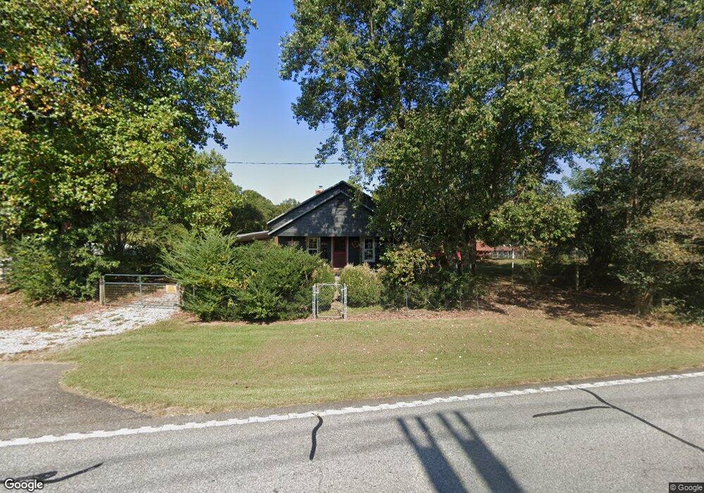
600 Highway 254 Unit T1/T2 Cleveland, GA 30528
Estimated Value: $238,621 - $478,000
2
Beds
1
Bath
976
Sq Ft
$349/Sq Ft
Est. Value
About This Home
This home is located at 600 Highway 254 Unit T1/T2, Cleveland, GA 30528 and is currently estimated at $340,405, approximately $348 per square foot. 600 Highway 254 Unit T1/T2 is a home located in White County with nearby schools including Mount Yonah Elementary School, White County 9th Grade Academy, and White County Middle School.
Ownership History
Date
Name
Owned For
Owner Type
Purchase Details
Closed on
Aug 21, 2013
Sold by
Savage Margie
Bought by
Guinn Jeffrey Karl and Guinn Alicia Ann
Current Estimated Value
Home Financials for this Owner
Home Financials are based on the most recent Mortgage that was taken out on this home.
Original Mortgage
$36,824
Interest Rate
4.31%
Mortgage Type
New Conventional
Create a Home Valuation Report for This Property
The Home Valuation Report is an in-depth analysis detailing your home's value as well as a comparison with similar homes in the area
Home Values in the Area
Average Home Value in this Area
Purchase History
| Date | Buyer | Sale Price | Title Company |
|---|---|---|---|
| Guinn Jeffrey Karl | $45,000 | -- | |
| Nix Janice | -- | -- |
Source: Public Records
Mortgage History
| Date | Status | Borrower | Loan Amount |
|---|---|---|---|
| Closed | Nix Janice | $36,824 |
Source: Public Records
Tax History Compared to Growth
Tax History
| Year | Tax Paid | Tax Assessment Tax Assessment Total Assessment is a certain percentage of the fair market value that is determined by local assessors to be the total taxable value of land and additions on the property. | Land | Improvement |
|---|---|---|---|---|
| 2025 | $1,104 | $64,208 | $29,456 | $34,752 |
| 2024 | $1,104 | $61,260 | $26,508 | $34,752 |
| 2023 | $400 | $41,400 | $23,564 | $17,836 |
| 2022 | $782 | $36,668 | $20,620 | $16,048 |
| 2021 | $810 | $32,200 | $18,480 | $13,720 |
| 2020 | $800 | $30,420 | $17,160 | $13,260 |
| 2019 | $802 | $30,420 | $17,160 | $13,260 |
| 2018 | $802 | $30,420 | $17,160 | $13,260 |
| 2017 | $650 | $23,240 | $12,828 | $10,412 |
| 2016 | $650 | $23,240 | $12,828 | $10,412 |
| 2015 | $512 | $47,940 | $12,828 | $6,348 |
| 2014 | $491 | $45,910 | $0 | $0 |
Source: Public Records
Map
Nearby Homes
- 0 Duncan Bridge Rd Unit 10645363
- 51 Shelter Cove Rd
- 332 Mineral Springs Trail
- 416 Nelms Rd
- 116 Savannah Terrace
- 2301 Highway 254
- 3787 Webster Lake Rd
- 00 Freeman Rd
- 0 Freeman Rd Unit LOT 3 10539998
- 0 Freeman Rd Unit LOT 4
- 0 Freeman Rd Unit LOT 2 10539989
- 10454 Duncan Bridge Rd
- 0 Holiness Campground Rd Unit 10648171
- 915 Holiness Campground Rd
- 1008 River Estates Rd
- 573 Mineral Springs Trl Conn
- 618 Riverside Dr
- 518 Riverside Dr
- 552 LOT 47 Riverside Dr
- 0 Waterside Trail Unit 10497096
- 600 Highway 254
- 600 Highway 254
- 600 Highway 254
- 600 Georgia 254
- 655 Highway 254
- 550 Highway 254
- 549 Georgia 254
- 549 Highway 254
- 672 Highway 254
- 498 Highway 254
- 36 Countryside Dr
- 50 Countryside Dr
- 460 Highway 254
- 685 Highway 254
- 453 Highway 254
- 775 Highway 254
- 775 Highway 254
- 775 Highway 254
- 410 Highway 254
- 814 Highway 254