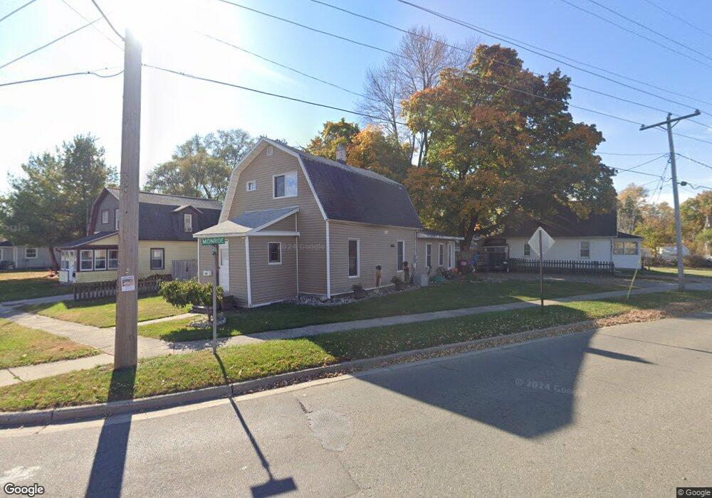
600 Lincoln Ave Owosso, MI 48867
Estimated Value: $97,872 - $141,000
--
Bed
--
Bath
--
Sq Ft
4,792
Sq Ft Lot
About This Home
This home is located at 600 Lincoln Ave, Owosso, MI 48867 and is currently estimated at $122,718. 600 Lincoln Ave is a home located in Shiawassee County with nearby schools including Owosso High School, Salem Lutheran School, and St. Paul Catholic School.
Ownership History
Date
Name
Owned For
Owner Type
Purchase Details
Closed on
Jan 9, 2023
Sold by
Palmer Raymond B
Bought by
Clapp Alesha M and Palmer Raymond B
Current Estimated Value
Home Financials for this Owner
Home Financials are based on the most recent Mortgage that was taken out on this home.
Original Mortgage
$55,453
Outstanding Balance
$53,591
Interest Rate
6.33%
Mortgage Type
FHA
Estimated Equity
$69,127
Purchase Details
Closed on
Mar 31, 2021
Sold by
Estate Of Harlan Gilliam
Bought by
Palmer Raymond
Purchase Details
Closed on
Feb 24, 2016
Sold by
White Rachel L
Bought by
Gilliam Joyce L and Gilliam Harlan A
Create a Home Valuation Report for This Property
The Home Valuation Report is an in-depth analysis detailing your home's value as well as a comparison with similar homes in the area
Home Values in the Area
Average Home Value in this Area
Purchase History
| Date | Buyer | Sale Price | Title Company |
|---|---|---|---|
| Clapp Alesha M | -- | -- | |
| Palmer Raymond | $60,000 | Cislo Title Company | |
| Gilliam Joyce L | $988,372 | -- |
Source: Public Records
Mortgage History
| Date | Status | Borrower | Loan Amount |
|---|---|---|---|
| Open | Clapp Alesha M | $55,453 |
Source: Public Records
Tax History Compared to Growth
Tax History
| Year | Tax Paid | Tax Assessment Tax Assessment Total Assessment is a certain percentage of the fair market value that is determined by local assessors to be the total taxable value of land and additions on the property. | Land | Improvement |
|---|---|---|---|---|
| 2025 | $1,834 | $52,200 | $0 | $0 |
| 2024 | $1,834 | $48,100 | $0 | $0 |
| 2023 | $1,113 | $43,200 | $0 | $0 |
| 2022 | $1,793 | $38,600 | $0 | $0 |
| 2021 | $1,304 | $36,900 | $0 | $0 |
| 2020 | $1,808 | $32,900 | $0 | $0 |
| 2019 | $1,776 | $15,400 | $0 | $0 |
| 2018 | $1,437 | $15,000 | $0 | $0 |
| 2017 | $1,437 | $8,100 | $0 | $0 |
| 2016 | $1,437 | $8,100 | $0 | $0 |
| 2015 | $1,437 | $25,800 | $0 | $0 |
| 2014 | -- | $25,700 | $0 | $0 |
Source: Public Records
Map
Nearby Homes
- 626 Lincoln Ave
- 808 Corunna Ave
- 915 Corunna Ave
- 702 Glenwood Ave
- 755 Woodlawn Ave
- 609 Broadway Ave
- 715 Glenwood Ave
- 827 Lingle Ave
- 809 Grand Ave
- 942 Division St
- 432 Oakwood Ave
- 611 Beck Ave
- 1605 Corunna Ave
- 624 E Comstock St
- 540 E Comstock St
- 520 E Comstock St
- 628 Aiken St
- 1833 Owosso Ave
- 1856 Owosso Ave
- 209 W Stewart St
- 604 Lincoln Ave
- 904 E Monroe St
- 606 Lincoln Ave
- 611 Glenwood Ave
- 613 Glenwood Ave
- 619 Glenwood Ave
- 621 Glenwood Ave
- 622 Lincoln Ave
- 623 Glenwood Ave
- 627 Glenwood Ave
- 612 Glenwood Ave
- 608 Glenwood Ave
- 616 Glenwood Ave
- 520 S Gould St
- 604 Glenwood Ave
- 618 Glenwood Ave
- 527 Glenwood Ave
- 600 Glenwood Ave
- 620 Glenwood Ave
- 631 Glenwood Ave