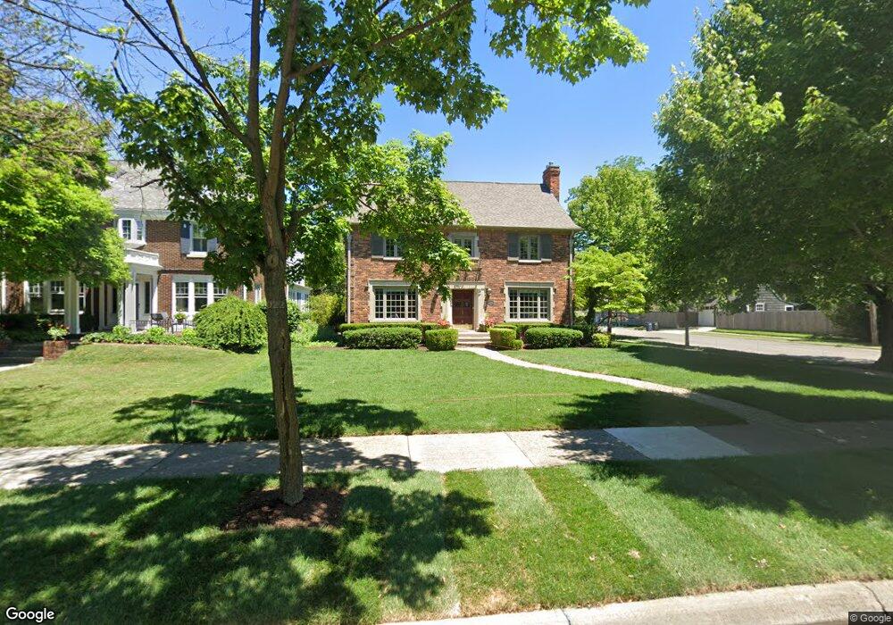
600 Lincoln Rd Unit Bldg-Unit Grosse Pointe, MI 48230
Estimated Value: $645,000 - $769,000
--
Bed
5
Baths
2,366
Sq Ft
$296/Sq Ft
Est. Value
About This Home
This home is located at 600 Lincoln Rd Unit Bldg-Unit, Grosse Pointe, MI 48230 and is currently estimated at $700,923, approximately $296 per square foot. 600 Lincoln Rd Unit Bldg-Unit is a home located in Wayne County with nearby schools including Richard Elementary School, Brownell Middle School, and Grosse Pointe South High School.
Ownership History
Date
Name
Owned For
Owner Type
Purchase Details
Closed on
Jun 5, 2020
Sold by
Slowik David C and Feringa Lauren A
Bought by
Beallin Edward and Baumgarten Chelsea E
Current Estimated Value
Purchase Details
Closed on
Apr 30, 2018
Sold by
Livingston Peter B and Livingston Jane J
Bought by
Slowik David C
Home Financials for this Owner
Home Financials are based on the most recent Mortgage that was taken out on this home.
Original Mortgage
$429,600
Interest Rate
3.75%
Mortgage Type
Adjustable Rate Mortgage/ARM
Purchase Details
Closed on
Aug 27, 2003
Sold by
Thibault Mark R and Thibault Johnese N
Bought by
Livingston Peter B
Create a Home Valuation Report for This Property
The Home Valuation Report is an in-depth analysis detailing your home's value as well as a comparison with similar homes in the area
Home Values in the Area
Average Home Value in this Area
Purchase History
| Date | Buyer | Sale Price | Title Company |
|---|---|---|---|
| Beallin Edward | $515,000 | Ata National Title Group Llc | |
| Slowik David C | $537,000 | Ata National Title Group | |
| Livingston Peter B | $510,000 | -- |
Source: Public Records
Mortgage History
| Date | Status | Borrower | Loan Amount |
|---|---|---|---|
| Previous Owner | Slowik David C | $429,600 |
Source: Public Records
Tax History Compared to Growth
Tax History
| Year | Tax Paid | Tax Assessment Tax Assessment Total Assessment is a certain percentage of the fair market value that is determined by local assessors to be the total taxable value of land and additions on the property. | Land | Improvement |
|---|---|---|---|---|
| 2025 | $9,060 | $292,400 | $0 | $0 |
| 2024 | $9,060 | $284,800 | $0 | $0 |
| 2023 | $8,641 | $260,100 | $0 | $0 |
| 2022 | $12,505 | $241,700 | $0 | $0 |
| 2021 | $12,117 | $239,100 | $0 | $0 |
| 2019 | $11,176 | $205,500 | $0 | $0 |
| 2018 | $5,631 | $193,500 | $0 | $0 |
| 2017 | $5,945 | $191,100 | $0 | $0 |
| 2016 | $8,474 | $182,900 | $0 | $0 |
| 2015 | $16,070 | $160,700 | $0 | $0 |
| 2013 | $16,159 | $170,200 | $0 | $0 |
| 2012 | -- | $157,800 | $0 | $0 |
Source: Public Records
Map
Nearby Homes
- 180 Fisher Rd
- 201 Mcmillan Rd
- 240 Mckinley Ave
- 233 Mcmillan Rd
- 213 Muir Rd
- 745 Lincoln Rd
- 459 Washington Rd
- 276 Lewiston Rd
- 674 Neff Rd
- 166 Lewiston Rd
- 818 Neff Rd
- 194 Charlevoix Ave
- 355 Lincoln Rd
- 425 Rivard Blvd
- 827 Fisher Rd
- 795 Grosse Pointe Ct
- 341 Mcmillan Rd
- 872 University Place
- 352 Mckinley Ave
- 876 Washington Rd