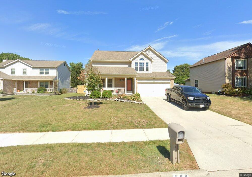
600 Locust Ct Westerville, OH 43082
Genoa NeighborhoodEstimated Value: $419,785 - $490,000
3
Beds
3
Baths
1,963
Sq Ft
$227/Sq Ft
Est. Value
About This Home
This home is located at 600 Locust Ct, Westerville, OH 43082 and is currently estimated at $445,196, approximately $226 per square foot. 600 Locust Ct is a home located in Delaware County with nearby schools including Robert Frost Elementary School, Heritage Middle School, and Westerville-North High School.
Ownership History
Date
Name
Owned For
Owner Type
Purchase Details
Closed on
Aug 10, 1999
Sold by
Williams James V
Bought by
Sellke Carl A and Sellke Mary J
Current Estimated Value
Home Financials for this Owner
Home Financials are based on the most recent Mortgage that was taken out on this home.
Original Mortgage
$115,200
Outstanding Balance
$33,182
Interest Rate
7.68%
Mortgage Type
New Conventional
Estimated Equity
$412,014
Create a Home Valuation Report for This Property
The Home Valuation Report is an in-depth analysis detailing your home's value as well as a comparison with similar homes in the area
Home Values in the Area
Average Home Value in this Area
Purchase History
| Date | Buyer | Sale Price | Title Company |
|---|---|---|---|
| Sellke Carl A | $144,000 | -- |
Source: Public Records
Mortgage History
| Date | Status | Borrower | Loan Amount |
|---|---|---|---|
| Open | Sellke Carl A | $115,200 |
Source: Public Records
Tax History Compared to Growth
Tax History
| Year | Tax Paid | Tax Assessment Tax Assessment Total Assessment is a certain percentage of the fair market value that is determined by local assessors to be the total taxable value of land and additions on the property. | Land | Improvement |
|---|---|---|---|---|
| 2024 | $5,680 | $111,480 | $30,870 | $80,610 |
| 2023 | $5,615 | $111,480 | $30,870 | $80,610 |
| 2022 | $5,557 | $85,370 | $21,140 | $64,230 |
| 2021 | $5,605 | $85,370 | $21,140 | $64,230 |
| 2020 | $5,642 | $85,370 | $21,140 | $64,230 |
| 2019 | $4,885 | $70,600 | $18,380 | $52,220 |
| 2018 | $4,802 | $70,600 | $18,380 | $52,220 |
| 2017 | $4,692 | $65,070 | $13,370 | $51,700 |
| 2016 | $4,829 | $65,070 | $13,370 | $51,700 |
| 2015 | $4,619 | $65,070 | $13,370 | $51,700 |
| 2014 | $4,665 | $65,070 | $13,370 | $51,700 |
| 2013 | $4,457 | $62,130 | $13,370 | $48,760 |
Source: Public Records
Map
Nearby Homes
- 718 Sugar Ct
- 547 County Line Rd
- 200 Matthew Ave
- 150 Matthew Ave
- 656 Olde Mill Dr
- 175 Nottingham Ct
- 912 Lakeway Ct E
- 589 E College Ave
- 267 Windemere Place
- 974 Lakeland Dr
- 754 Kingsmead Rd Unit 18754
- 368 E College Ave
- 364 E College Ave
- 768 Collingwood Dr
- 223 Dogwood Ln
- 348 Buck Run Trail
- 192 Buckeye Ct
- 137 Abbeycross Ln
- 182 Hillcrest Dr
- 199 E College Ave
- 594 Locust Ct
- 606 Locust Ct
- 597 Mulberry Way S
- 603 Mulberry Way S
- 305 Burns Dr N
- 590 Locust Ct
- 589 Mulberry Way S
- 603 Locust Ct
- 315 Burns Dr N
- 609 Locust Ct
- 597 Locust Ct
- 586 Locust Ct
- 583 Mulberry Way S
- 289 Burns Dr N
- 589 Locust Ct
- 593 Locust Ct
- 575 Mulberry Way S
- 598 Mulberry Way S
- 331 Burns Dr N
- 292 Burns Dr N