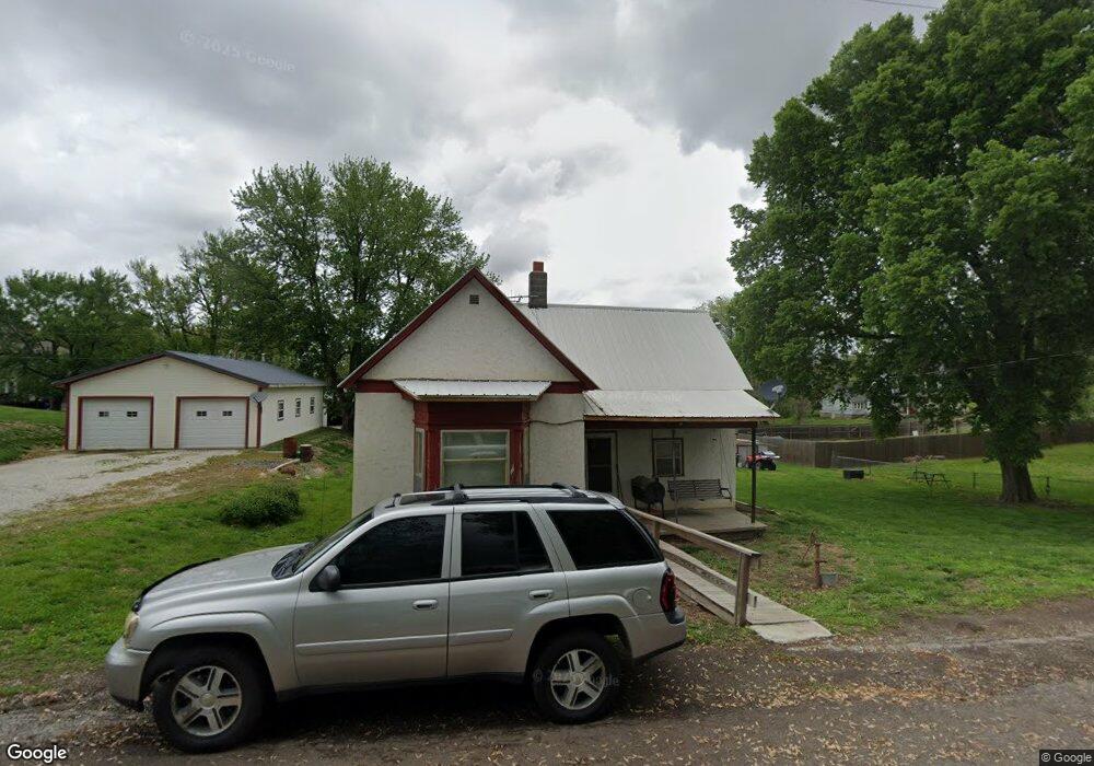
600 Main St de Kalb, MO 64440
Estimated Value: $67,766 - $184,000
Studio
--
Bath
1,018
Sq Ft
$136/Sq Ft
Est. Value
About This Home
This home is located at 600 Main St, de Kalb, MO 64440 and is currently estimated at $138,442, approximately $135 per square foot. 600 Main St is a home located in Buchanan County with nearby schools including DeKalb Middle/High School.
Ownership History
Date
Name
Owned For
Owner Type
Purchase Details
Closed on
Dec 13, 2023
Sold by
Robert W Hatch Revocable Trust
Bought by
Grable Bryon K and Grable Penny S
Current Estimated Value
Purchase Details
Closed on
Feb 9, 2021
Sold by
Hatch Robert W
Bought by
Hatch Robert W and Robert W Hatch Revocable Trust
Purchase Details
Closed on
Apr 30, 2009
Sold by
Grable Nancy K and Grable Jesse
Bought by
Hatch Robert W
Home Financials for this Owner
Home Financials are based on the most recent Mortgage that was taken out on this home.
Original Mortgage
$21,068
Interest Rate
4.84%
Mortgage Type
Future Advance Clause Open End Mortgage
Create a Home Valuation Report for This Property
The Home Valuation Report is an in-depth analysis detailing your home's value as well as a comparison with similar homes in the area
Purchase History
| Date | Buyer | Sale Price | Title Company |
|---|---|---|---|
| Grable Bryon K | -- | None Listed On Document | |
| Hatch Robert W | -- | None Available | |
| Hatch Robert W | -- | Platte County Title & Abstra |
Source: Public Records
Mortgage History
| Date | Status | Borrower | Loan Amount |
|---|---|---|---|
| Previous Owner | Hatch Robert W | $21,068 |
Source: Public Records
Tax History
| Year | Tax Paid | Tax Assessment Tax Assessment Total Assessment is a certain percentage of the fair market value that is determined by local assessors to be the total taxable value of land and additions on the property. | Land | Improvement |
|---|---|---|---|---|
| 2025 | $446 | $6,070 | $950 | $5,120 |
| 2024 | $420 | $5,710 | $950 | $4,760 |
| 2023 | $420 | $5,710 | $950 | $4,760 |
| 2022 | $262 | $3,550 | $760 | $2,790 |
| 2021 | $260 | $3,550 | $760 | $2,790 |
| 2020 | $259 | $3,550 | $760 | $2,790 |
| 2019 | $259 | $3,550 | $760 | $2,790 |
| 2018 | $252 | $3,550 | $760 | $2,790 |
| 2017 | $252 | $3,550 | $0 | $0 |
| 2015 | $0 | $3,550 | $0 | $0 |
| 2014 | $254 | $3,550 | $0 | $0 |
Source: Public Records
Map
Nearby Homes
- 100 Derge St
- 103 Church St
- 0 SW 36 Rd
- 0 SW Old Rd N Unit Lot WP001 23098895
- 0 SW Old Rd N
- 17710 SW 31st Rd
- 1261 SE Mill St
- 901 Valley St
- 301 Valley St
- 12801 SW Henman Rd
- 00 Brown Rd
- 0 Brown Rd Unit HMS2568985
- 22745 King Rd
- SW 59 Hwy
- 9506 SW Punzo Rd
- 0 3rd St
- 63 Houseman St
- 0 Elm St
- 24200 N Us 45 Hwy
- 200 Lakecrest Blvd
Your Personal Tour Guide
Ask me questions while you tour the home.