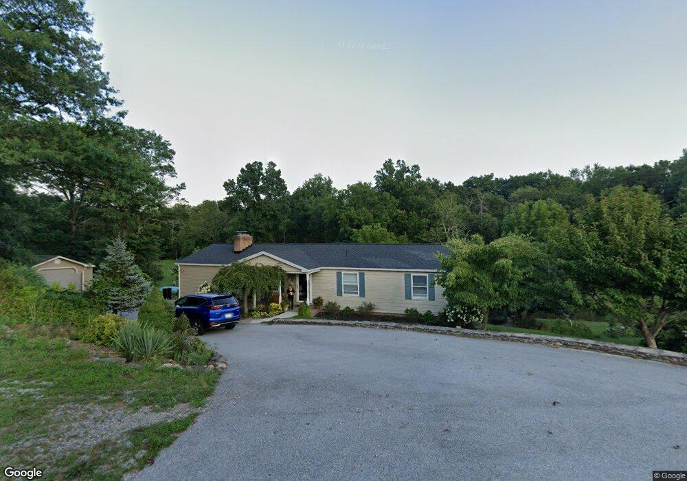
600 Mengus Mill Rd Unit 9 Littlestown, PA 17340
Estimated Value: $354,000 - $605,000
2
Beds
4
Baths
1,674
Sq Ft
$282/Sq Ft
Est. Value
About This Home
This home is located at 600 Mengus Mill Rd Unit 9, Littlestown, PA 17340 and is currently estimated at $471,886, approximately $281 per square foot. 600 Mengus Mill Rd Unit 9 is a home located in Adams County with nearby schools including Rolling Acres El School, Maple Avenue Middle School, and Littlestown Senior High School.
Ownership History
Date
Name
Owned For
Owner Type
Purchase Details
Closed on
Aug 19, 2020
Sold by
Dowgiallo Edward A and Dowgiallo Hoa Thi
Bought by
Germany Township
Current Estimated Value
Purchase Details
Closed on
Nov 21, 2005
Sold by
Fisher Thomas J and Fisher Darlene G
Bought by
Dowgiallo Edward A and Dowgiallo Hoa T
Home Financials for this Owner
Home Financials are based on the most recent Mortgage that was taken out on this home.
Original Mortgage
$235,000
Interest Rate
6.06%
Mortgage Type
New Conventional
Create a Home Valuation Report for This Property
The Home Valuation Report is an in-depth analysis detailing your home's value as well as a comparison with similar homes in the area
Home Values in the Area
Average Home Value in this Area
Purchase History
| Date | Buyer | Sale Price | Title Company |
|---|---|---|---|
| Germany Township | -- | None Available | |
| Dowgiallo Edward A | $315,000 | -- |
Source: Public Records
Mortgage History
| Date | Status | Borrower | Loan Amount |
|---|---|---|---|
| Previous Owner | Dowgiallo Edward A | $235,000 |
Source: Public Records
Tax History Compared to Growth
Tax History
| Year | Tax Paid | Tax Assessment Tax Assessment Total Assessment is a certain percentage of the fair market value that is determined by local assessors to be the total taxable value of land and additions on the property. | Land | Improvement |
|---|---|---|---|---|
| 2025 | $5,603 | $296,000 | $150,000 | $146,000 |
| 2024 | $5,385 | $296,000 | $150,000 | $146,000 |
| 2023 | $5,250 | $296,000 | $150,000 | $146,000 |
| 2022 | $5,211 | $296,000 | $150,000 | $146,000 |
| 2021 | $5,026 | $296,000 | $150,000 | $146,000 |
| 2020 | $4,973 | $297,200 | $151,200 | $146,000 |
| 2019 | $4,867 | $297,200 | $151,200 | $146,000 |
| 2018 | $4,722 | $297,200 | $151,200 | $146,000 |
| 2017 | $4,574 | $297,200 | $151,200 | $146,000 |
| 2016 | -- | $297,200 | $151,200 | $146,000 |
| 2015 | -- | $297,200 | $151,200 | $146,000 |
| 2014 | -- | $297,200 | $151,200 | $146,000 |
Source: Public Records
Map
Nearby Homes
- 15 Yorktowne Ct Unit 97
- 28 Gettysburg Ct Unit 60
- 1024 Frederick Pike Unit 6
- 129 W King St
- 22 Rita Marie Ave
- 117 Charles St
- 115 Charles St
- 52 Stayman Way Unit 81
- 61 E King St
- 161 Stoners Cir
- 2238 Harney Rd Unit 3
- 140 Apple Grove Ln Unit 425
- 135 Apple Grove Ln Unit 438
- 2226 Harney Rd Unit 2
- 211 E King St
- 440 N Queen St
- 2100 Blacks School House Rd
- 4703 Babylon Rd
- 58 Windsor Ct
- 48 Windsor Ct
- 591 Mengus Mill Rd
- 570 Mengus Mill Rd Unit 8
- 656 Mengus Mill Rd Unit 10
- 556 Mengus Mill Rd Unit 7
- 561 Mengus Mill Rd Unit 5
- 575 Mengus Mill Rd Unit 7
- 545 Mengus Mill Rd Unit 4
- 540 Mengus Mill Rd Unit 6
- 529 Mengus Mill Rd Unit 3
- 645 Mengus Mill Rd Unit 2
- 530 Mengus Mill Rd
- 690 Georgetown Rd
- 654 Georgetown Rd
- 670 Georgetown Rd
- 716 Georgetown Rd
- 614 Georgetown Rd
- 640 Georgetown Rd
- 511 Mengus Mill Rd Unit 2
- 624 Georgetown Rd Unit 3
- 520 Mengus Mill Rd Unit 4