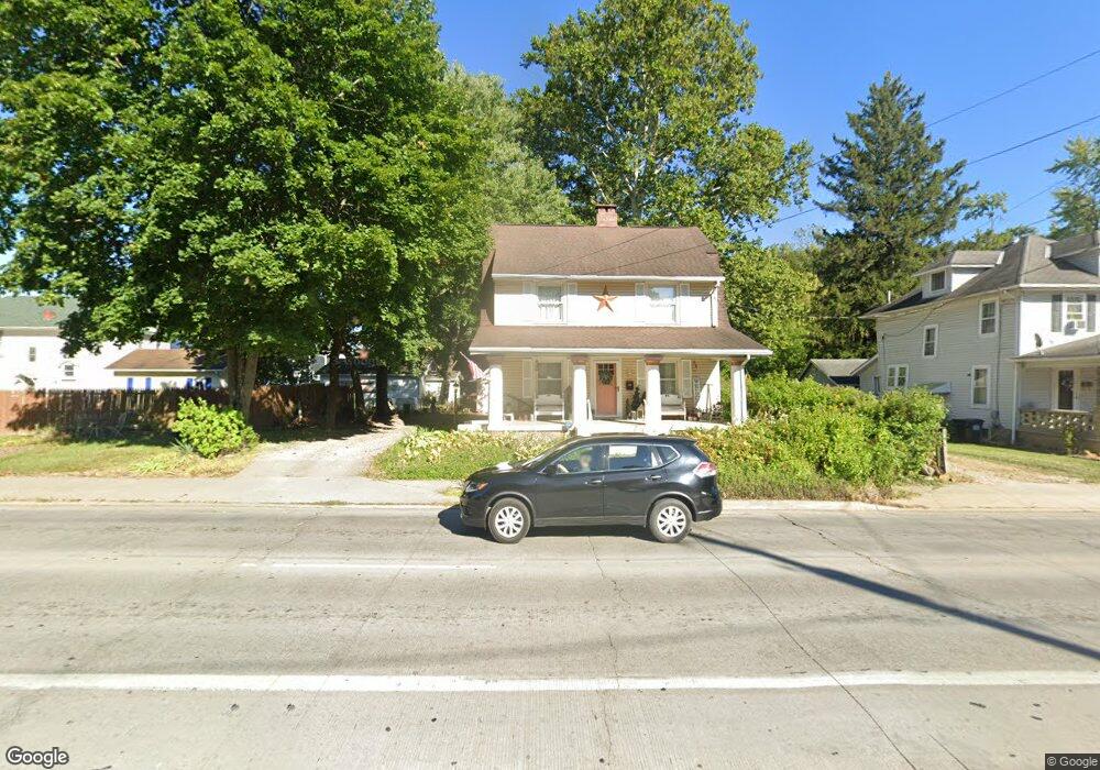
600 N 21st St Newark, OH 43055
Estimated Value: $146,000 - $227,000
3
Beds
2
Baths
1,394
Sq Ft
$143/Sq Ft
Est. Value
About This Home
This home is located at 600 N 21st St, Newark, OH 43055 and is currently estimated at $199,544, approximately $143 per square foot. 600 N 21st St is a home located in Licking County with nearby schools including John Clem Elementary School, Liberty Middle School, and Newark High School.
Ownership History
Date
Name
Owned For
Owner Type
Purchase Details
Closed on
May 13, 2010
Sold by
Wilson Henry E and Wilson Mary A
Bought by
Wilson Vickers Brandy Louise
Current Estimated Value
Purchase Details
Closed on
Aug 16, 2007
Sold by
Homesales Inc
Bought by
Wilson Henry E and Wilson Mary A
Home Financials for this Owner
Home Financials are based on the most recent Mortgage that was taken out on this home.
Original Mortgage
$50,400
Interest Rate
6.5%
Mortgage Type
Unknown
Purchase Details
Closed on
Mar 2, 2007
Sold by
Mcvay Lawrence Neal
Bought by
Homesales Inc
Create a Home Valuation Report for This Property
The Home Valuation Report is an in-depth analysis detailing your home's value as well as a comparison with similar homes in the area
Home Values in the Area
Average Home Value in this Area
Purchase History
| Date | Buyer | Sale Price | Title Company |
|---|---|---|---|
| Wilson Vickers Brandy Louise | -- | Attorney | |
| Wilson Henry E | $56,000 | Attorney | |
| Homesales Inc | $56,405 | None Available |
Source: Public Records
Mortgage History
| Date | Status | Borrower | Loan Amount |
|---|---|---|---|
| Previous Owner | Wilson Henry E | $50,400 |
Source: Public Records
Tax History Compared to Growth
Tax History
| Year | Tax Paid | Tax Assessment Tax Assessment Total Assessment is a certain percentage of the fair market value that is determined by local assessors to be the total taxable value of land and additions on the property. | Land | Improvement |
|---|---|---|---|---|
| 2024 | $1,967 | $53,630 | $12,150 | $41,480 |
| 2023 | $1,964 | $53,630 | $12,150 | $41,480 |
| 2022 | $1,491 | $36,230 | $8,020 | $28,210 |
| 2021 | $1,565 | $36,230 | $8,020 | $28,210 |
| 2020 | $1,600 | $36,230 | $8,020 | $28,210 |
| 2019 | $1,413 | $30,800 | $7,280 | $23,520 |
| 2018 | $1,414 | $0 | $0 | $0 |
| 2017 | $1,145 | $0 | $0 | $0 |
| 2016 | $915 | $0 | $0 | $0 |
| 2015 | $935 | $0 | $0 | $0 |
| 2014 | $1,165 | $0 | $0 | $0 |
| 2013 | $1,045 | $0 | $0 | $0 |
Source: Public Records
Map
Nearby Homes
- 594 N 21st St
- 565 Granville St
- 562 Jutlew Rd
- 632 Granville Rd
- 533 Leslie Dr
- 752 Maxola Ave
- 830 Walker St
- 188 Meadow Dr
- 184 Meadow Dr
- 408 Granville St
- 855 E Village Dr
- 584 Moull St Unit A
- 361 Granville St
- 188 Neal Ave
- 180 Neal Ave
- 473 Meadowbrook Dr
- 131 Linden Ave
- 440 Reverie Place
- 250 N 26th St
- 120 Neal Ave
- 611 Granville St
- 595 Granville St
- 571 Granville St
- 569 Granville St
- 617 Granville St
- 586 N 21st St
- 586 Blakeley Place
- 567 Granville St
- 584 Blakeley Place
- 621 Granville Rd
- 582 Blakeley Place
- 572 Blakeley Place
- 623 Granville Rd
- 580 Blakeley Place Unit 580
- 606 Granville St
- 604 Granville St
- 578 Blakeley Place Unit 578
- 596 Granville St
- 612 Granville St
- 572 Jutlew Rd