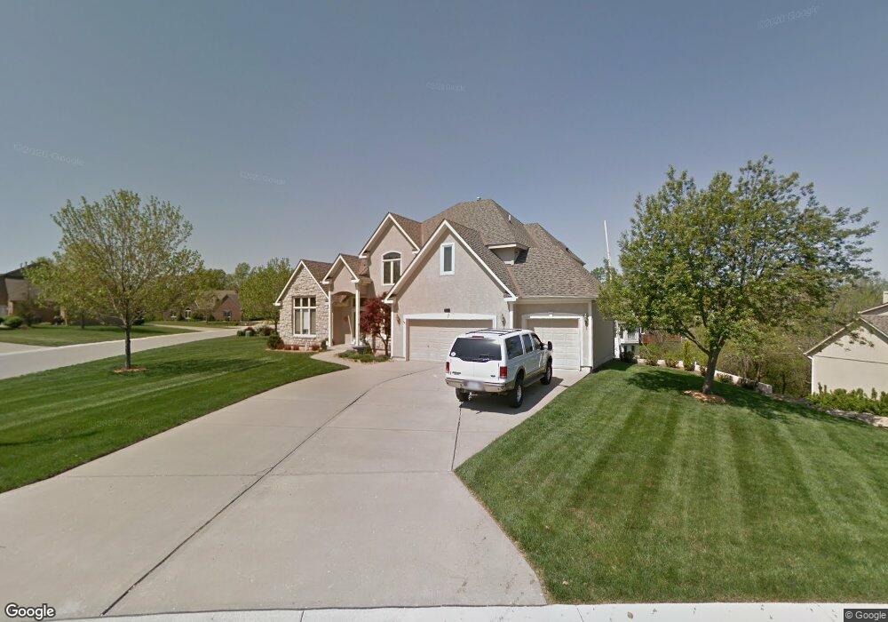
600 NW Cliffside Ct Lees Summit, MO 64081
Estimated Value: $553,153 - $781,000
About This Home
This home is located at 600 NW Cliffside Ct, Lees Summit, MO 64081 and is currently estimated at $622,538, approximately $207 per square foot. 600 NW Cliffside Ct is a home located in Jackson County with nearby schools including Cedar Creek Elementary School, Pleasant Lea Middle School, and Lee's Summit Senior High School.
Ownership History
We collect this data history from publicly available records. To have your information removed, we recommend requesting removal directly through your county’s website.
Purchase Details
Purchase Details
Purchase Details
Purchase Details
Purchase Details
Home Values in the Area
Average Home Value in this Area
Purchase History
We collect this data history from publicly available records. To have your information removed, we recommend requesting removal directly through your county’s website.
| Date | Buyer | Sale Price | Title Company |
|---|---|---|---|
| -- | None Available | ||
| -- | None Listed On Document | ||
| -- | Stewart Title Co Midwest Div | ||
| -- | None Available | ||
| -- | None Available | ||
| -- | -- |
Tax History
We collect this data history from publicly available records. To have your information removed, we recommend requesting removal directly through your county’s website.
| Year | Tax Paid | Tax Assessment Tax Assessment Total Assessment is a certain percentage of the fair market value that is determined by local assessors to be the total taxable value of land and additions on the property. | Land | Improvement |
|---|---|---|---|---|
| 2025 | $5,831 | $82,920 | $14,562 | $68,358 |
| 2024 | $5,831 | $80,750 | $9,553 | $71,197 |
| 2023 | $5,788 | $80,750 | $9,553 | $71,197 |
| 2022 | $5,061 | $62,700 | $12,151 | $50,549 |
| 2021 | $5,166 | $62,700 | $12,151 | $50,549 |
| 2020 | $5,217 | $62,701 | $12,151 | $50,550 |
| 2019 | $6,233 | $77,016 | $12,151 | $64,865 |
| 2018 | $1,010,504 | $59,113 | $6,516 | $52,597 |
| 2017 | $5,155 | $59,113 | $6,516 | $52,597 |
| 2016 | $4,785 | $54,302 | $8,626 | $45,676 |
| 2014 | $4,474 | $49,780 | $8,623 | $41,157 |
Map
- 321 NW Earle Ln
- 317 NW Lovins
- 316 NW Lovins
- 320 NW Lovins
- 321 NW Lovins
- 3104 NW Berkebile Ln
- 316 NW Earle Ln
- 308 NW Earle Ln
- 325 NW Earle Ln
- 10401 View High Dr
- 2702 NW Cedar Brook
- 3121 SW Merriam Dr
- 336 NW Thoreau Cir
- 2508 NW Bent Tree Cir
- 2648 NW Ashurst Ln
- 341 NW Thoreau Cir
- 183 SW Roosevelt Ridge
- 194 SW Roosevelt Ridge
- 2905 SW Muir Dr
- 510 NW Ashurst Place
- 608 NW Cliffside Ct
- 612 NW Cliffside Ct
- 604 NW Cliffside Ct
- 605 NW Cliffside Ct
- 609 NW Cliffside Ct
- 613 NW Edgewood Dr
- 609 NW Edgewood Dr
- 605 NW Edgewood Dr
- 601 NW Cliffside Ct
- 601 NW Edgewood Dr
- 3004 NW Ashurst Dr
- 608 NW Edgewood Dr
- 608 NW Timber Ridge Trail
- 604 NW Edgewood Dr
- 617 NW Edgewood Ct
- 604 NW Timber Ridge Trail
- 612 NW Edgewood Dr
- 621 NW Edgewood Ct
- 600 NW Edgewood Dr
- 616 NW Edgewood Ct
Ask me questions while you tour the home.