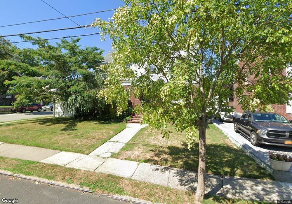
600 Oakland Ave Unit A Staten Island, NY 10310
West Brighton NeighborhoodEstimated Value: $770,000 - $921,705
2
Beds
1
Bath
2,072
Sq Ft
$416/Sq Ft
Est. Value
About This Home
This home is located at 600 Oakland Ave Unit A, Staten Island, NY 10310 and is currently estimated at $862,426, approximately $416 per square foot. 600 Oakland Ave Unit A is a home located in Richmond County with nearby schools including P.S. 45 John Tyler, Is 61 William A Morris, and Curtis High School.
Ownership History
Date
Name
Owned For
Owner Type
Purchase Details
Closed on
Jul 8, 2009
Sold by
Daszkowski Walter L and Daszkowski Donald M
Bought by
Cardone Vito and Cardone Giuseppina
Current Estimated Value
Home Financials for this Owner
Home Financials are based on the most recent Mortgage that was taken out on this home.
Original Mortgage
$150,000
Outstanding Balance
$97,900
Interest Rate
5.31%
Mortgage Type
Purchase Money Mortgage
Estimated Equity
$764,526
Purchase Details
Closed on
Jan 7, 2000
Sold by
Scanlon John M and Scanlon Elayne Carnegie
Bought by
Daszkowski Walter L and Daszkowski Donald M
Home Financials for this Owner
Home Financials are based on the most recent Mortgage that was taken out on this home.
Original Mortgage
$283,500
Interest Rate
8.31%
Create a Home Valuation Report for This Property
The Home Valuation Report is an in-depth analysis detailing your home's value as well as a comparison with similar homes in the area
Home Values in the Area
Average Home Value in this Area
Purchase History
| Date | Buyer | Sale Price | Title Company |
|---|---|---|---|
| Cardone Vito | $629,000 | First Amer Title Ins Co Ny | |
| Daszkowski Walter L | $315,000 | -- |
Source: Public Records
Mortgage History
| Date | Status | Borrower | Loan Amount |
|---|---|---|---|
| Open | Cardone Vito | $150,000 | |
| Previous Owner | Daszkowski Walter L | $283,500 |
Source: Public Records
Tax History Compared to Growth
Tax History
| Year | Tax Paid | Tax Assessment Tax Assessment Total Assessment is a certain percentage of the fair market value that is determined by local assessors to be the total taxable value of land and additions on the property. | Land | Improvement |
|---|---|---|---|---|
| 2025 | $8,902 | $53,520 | $16,149 | $37,371 |
| 2024 | $8,902 | $44,340 | $19,493 | $24,847 |
| 2023 | $8,641 | $42,548 | $16,802 | $25,746 |
| 2022 | $7,592 | $40,140 | $19,500 | $20,640 |
| 2021 | $8,239 | $41,400 | $19,500 | $21,900 |
| 2020 | $7,818 | $45,780 | $19,500 | $26,280 |
| 2019 | $7,727 | $44,880 | $19,500 | $25,380 |
| 2018 | $7,175 | $36,657 | $14,529 | $22,128 |
| 2017 | $6,750 | $34,583 | $16,626 | $17,957 |
| 2016 | $6,212 | $32,626 | $19,456 | $13,170 |
| 2015 | $5,602 | $30,780 | $17,940 | $12,840 |
| 2014 | $5,602 | $30,780 | $17,940 | $12,840 |
Source: Public Records
Map
Nearby Homes
- 152 Harvest Ave
- 677 Bement Ave
- 100 Lawrence Ave
- 34 Harvest Ave
- 710 Oakland Ave
- 20 Baker Place
- 605 Bard Ave
- 706 Broadway
- 751 Oakland Ave
- 54 City Blvd
- 1 Whitewood Ave
- 432 Pelton Ave
- 12 Freeman Place
- 145 Norma Place
- 54 Purcell St
- 0 Hardin Ave
- 244 Delafield Ave
- 386 N Burgher Ave
- 1 Sunset Hill Dr
- 372 Sharon Ave
- 600 Oakland Ave
- 596 Oakland Ave
- 592 Oakland Ave
- 21 Nutly Place
- 610 Oakland Ave
- 17 Nutly Place
- 588 Oakland Ave
- 22 Nutly Place
- 603 Oakland Ave
- 599 Oakland Ave
- 24 Nutly Place
- 607 Oakland Ave
- 15 Nutly Place
- 595 Oakland Ave
- 618 Oakland Ave
- 22 Nutly Place
- 584 Oakland Ave
- 142 Harvest Ave
- 611 Oakland Ave
- 591 Oakland Ave