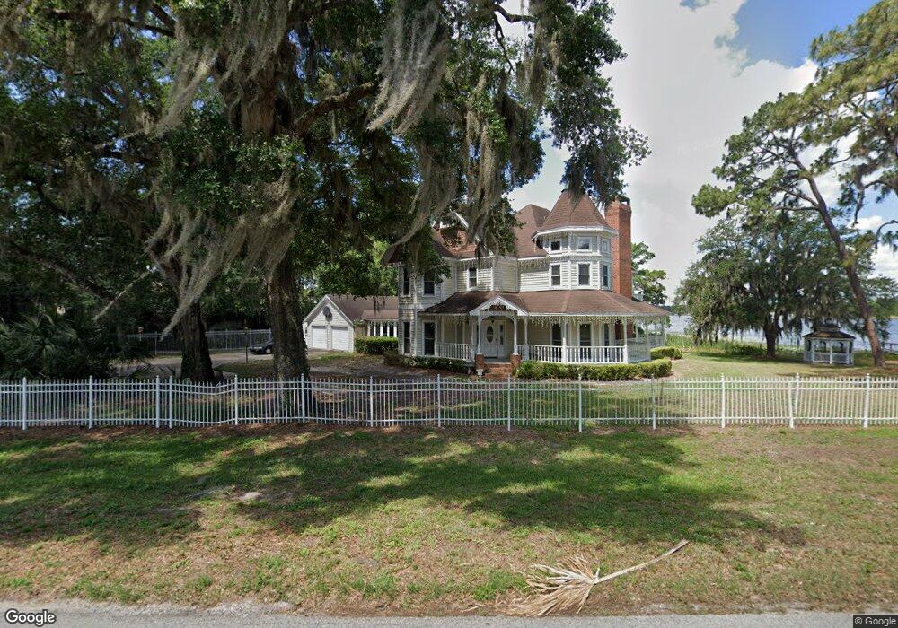
600 Old Eustis Rd Mount Dora, FL 32757
Estimated Value: $656,000 - $1,130,000
4
Beds
3
Baths
2,866
Sq Ft
$306/Sq Ft
Est. Value
About This Home
This home is located at 600 Old Eustis Rd, Mount Dora, FL 32757 and is currently estimated at $876,293, approximately $305 per square foot. 600 Old Eustis Rd is a home located in Lake County with nearby schools including Triangle Elementary School, Mt. Dora Middle School, and Mt. Dora High School.
Ownership History
Date
Name
Owned For
Owner Type
Purchase Details
Closed on
Jan 30, 2001
Sold by
Grasso Gia
Bought by
Pearson Joy D
Current Estimated Value
Home Financials for this Owner
Home Financials are based on the most recent Mortgage that was taken out on this home.
Original Mortgage
$337,500
Interest Rate
7.14%
Purchase Details
Closed on
Aug 11, 1999
Sold by
Lenze Richard J and Flachlenze Joan M
Bought by
Grasso Gia
Create a Home Valuation Report for This Property
The Home Valuation Report is an in-depth analysis detailing your home's value as well as a comparison with similar homes in the area
Home Values in the Area
Average Home Value in this Area
Purchase History
| Date | Buyer | Sale Price | Title Company |
|---|---|---|---|
| Pearson Joy D | $450,000 | -- | |
| Grasso Gia | $475,000 | -- |
Source: Public Records
Mortgage History
| Date | Status | Borrower | Loan Amount |
|---|---|---|---|
| Previous Owner | Pearson Joy D | $337,500 |
Source: Public Records
Tax History
| Year | Tax Paid | Tax Assessment Tax Assessment Total Assessment is a certain percentage of the fair market value that is determined by local assessors to be the total taxable value of land and additions on the property. | Land | Improvement |
|---|---|---|---|---|
| 2026 | $9,104 | $542,750 | -- | -- |
| 2025 | $8,593 | $527,970 | -- | -- |
| 2024 | $8,593 | $527,970 | -- | -- |
| 2023 | $8,593 | $497,670 | $0 | $0 |
| 2022 | $8,511 | $483,180 | $0 | $0 |
| 2021 | $8,212 | $469,111 | $0 | $0 |
| 2020 | $8,526 | $462,635 | $0 | $0 |
| 2019 | $8,495 | $449,693 | $0 | $0 |
| 2018 | $8,241 | $441,309 | $0 | $0 |
| 2017 | $8,105 | $441,309 | $0 | $0 |
| 2016 | $8,087 | $440,344 | $0 | $0 |
| 2015 | $8,239 | $437,284 | $0 | $0 |
| 2014 | $8,173 | $433,814 | $0 | $0 |
Source: Public Records
Map
Nearby Homes
- 611 Old Eustis Rd
- 2108 Dogwood Cir
- 2314 Hillside Dr
- 2312 Hillside Dr
- 809 Northside Dr
- 333 Forest Rd
- 1824 Crestview Dr
- 1765 Hilltop Dr
- 1630 Crestview Dr
- 2013 Donnelly Place
- 1438 Crestview Dr
- 0 E Jackson Ave Unit MFRG5108158
- 576 Casey Loop
- 2722 Maywood St
- 2851 Little Laurel Way
- 1405 Hilltop Dr
- 319 Eastridge Dr
- 224 August Fern Loop
- 1212 Hilltop Dr
- 1780 Sylvan Point Dr
- 2425 Overlook Dr
- 621 Old Eustis Rd
- 651 Old Eustis Rd
- 671 Old Eustis Rd
- 2232 Dogwood Cir
- 2234 Dogwood Cir
- 2319 Overlook Dr
- 2230 Dogwood Cir
- 2105 Dogwood Cir
- 711 Old Eustis Rd
- 2107 Dogwood Cir
- 2103 Dogwood Cir
- 2228 Dogwood Cir
- 2101 Dogwood Cir
- 2229 Dogwood Cir
- 751 Old Eustis Rd
- 2450 Overlook Dr
- 2311 Overlook Dr
- 2201 Dogwood Cir
- 2314 Overlook Dr
Your Personal Tour Guide
Ask me questions while you tour the home.
