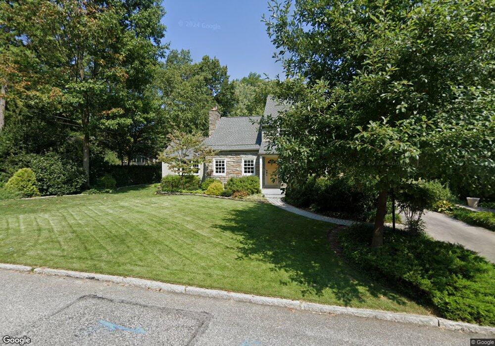
600 Parrish Rd Swarthmore, PA 19081
Estimated Value: $617,260 - $714,000
4
Beds
2
Baths
1,663
Sq Ft
$396/Sq Ft
Est. Value
About This Home
This home is located at 600 Parrish Rd, Swarthmore, PA 19081 and is currently estimated at $658,065, approximately $395 per square foot. 600 Parrish Rd is a home located in Delaware County with nearby schools including Swarthmore-Rutledge School, Strath Haven Middle School, and Strath Haven High School.
Ownership History
Date
Name
Owned For
Owner Type
Purchase Details
Closed on
Jul 31, 2000
Sold by
Zaklad Allen L and Zaklad Loretta R
Bought by
Oneill Charles Timothy and Oneill Elizabeth G
Current Estimated Value
Home Financials for this Owner
Home Financials are based on the most recent Mortgage that was taken out on this home.
Original Mortgage
$125,000
Outstanding Balance
$41,412
Interest Rate
7%
Mortgage Type
Purchase Money Mortgage
Estimated Equity
$616,653
Create a Home Valuation Report for This Property
The Home Valuation Report is an in-depth analysis detailing your home's value as well as a comparison with similar homes in the area
Home Values in the Area
Average Home Value in this Area
Purchase History
| Date | Buyer | Sale Price | Title Company |
|---|---|---|---|
| Oneill Charles Timothy | $224,500 | -- |
Source: Public Records
Mortgage History
| Date | Status | Borrower | Loan Amount |
|---|---|---|---|
| Open | Oneill Charles Timothy | $125,000 |
Source: Public Records
Tax History
| Year | Tax Paid | Tax Assessment Tax Assessment Total Assessment is a certain percentage of the fair market value that is determined by local assessors to be the total taxable value of land and additions on the property. | Land | Improvement |
|---|---|---|---|---|
| 2025 | $13,268 | $368,190 | $154,590 | $213,600 |
| 2024 | $13,268 | $368,190 | $154,590 | $213,600 |
| 2023 | $12,754 | $368,190 | $154,590 | $213,600 |
| 2022 | $12,416 | $368,190 | $154,590 | $213,600 |
| 2021 | $20,223 | $368,190 | $154,590 | $213,600 |
| 2020 | $11,831 | $202,790 | $115,280 | $87,510 |
| 2019 | $11,533 | $202,790 | $115,280 | $87,510 |
| 2018 | $11,343 | $202,790 | $0 | $0 |
| 2017 | $11,088 | $202,790 | $0 | $0 |
| 2016 | $1,113 | $202,790 | $0 | $0 |
| 2015 | $1,136 | $202,790 | $0 | $0 |
| 2014 | $1,113 | $202,790 | $0 | $0 |
Source: Public Records
Map
Nearby Homes
- 519 Walnut Ln Unit 1
- 1588 Nicklaus Dr Unit H65
- 1433 Country Club Dr Unit T214
- 1299 Country Club Dr Unit Q141
- 1291 Country Club Dr Unit Q137
- 131 Dartmouth Ave
- 110 Park Ave Unit 370
- 110 Park Ave Unit 350
- 110 Park Ave Unit 250
- 110 Park Ave Unit 320
- 110 Park Ave Unit 220
- 110 Park Ave Unit 430
- 110 Park Ave Unit 340
- 493 Wheatsheaf Rd
- 411 Marie Dr
- 339 Plush Mill Rd
- 603 Harvard Ave
- 103 Avonbrook Rd
- 364 S Rolling Rd
- 630 Yale Ave
Your Personal Tour Guide
Ask me questions while you tour the home.