Estimated Value: $287,816 - $313,000
4
Beds
4
Baths
1,964
Sq Ft
$153/Sq Ft
Est. Value
About This Home
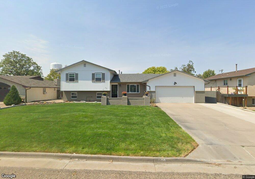
This home is located at 600 Reynolds Ave, Swink, CO 81077 and is currently estimated at $300,454, approximately $152 per square foot. 600 Reynolds Ave is a home located in Otero County with nearby schools including Swink Elementary School and Swink Junior/Senior High School.
Ownership History
Date
Name
Owned For
Owner Type
Purchase Details
Closed on
Jan 22, 2021
Sold by
Nuschy Daniel W and Nuschy Cheryl A
Bought by
Nuschy Daniel W and Nuschy Cheryl A
Current Estimated Value
Purchase Details
Closed on
Jun 30, 2006
Sold by
Thomas Richard D and Thomas Gloria S
Bought by
Nuschy Daniel W and Nuschy Cheryl A
Home Financials for this Owner
Home Financials are based on the most recent Mortgage that was taken out on this home.
Original Mortgage
$166,250
Outstanding Balance
$98,317
Interest Rate
6.58%
Mortgage Type
New Conventional
Estimated Equity
$202,137
Create a Home Valuation Report for This Property
The Home Valuation Report is an in-depth analysis detailing your home's value as well as a comparison with similar homes in the area
Home Values in the Area
Average Home Value in this Area
Purchase History
| Date | Buyer | Sale Price | Title Company |
|---|---|---|---|
| Nuschy Daniel W | -- | None Available | |
| Nuschy Daniel W | -- | None Available | |
| Nuschy Daniel W | $175,000 | None Available |
Source: Public Records
Mortgage History
| Date | Status | Borrower | Loan Amount |
|---|---|---|---|
| Open | Nuschy Daniel W | $166,250 |
Source: Public Records
Tax History Compared to Growth
Tax History
| Year | Tax Paid | Tax Assessment Tax Assessment Total Assessment is a certain percentage of the fair market value that is determined by local assessors to be the total taxable value of land and additions on the property. | Land | Improvement |
|---|---|---|---|---|
| 2024 | $1,442 | $13,597 | $745 | $12,852 |
| 2023 | $1,442 | $13,597 | $745 | $12,852 |
| 2022 | $1,296 | $12,369 | $773 | $11,596 |
| 2021 | $1,313 | $12,725 | $795 | $11,930 |
| 2020 | $1,153 | $11,276 | $795 | $10,481 |
| 2019 | $1,160 | $11,276 | $795 | $10,481 |
| 2018 | $969 | $9,392 | $801 | $8,591 |
| 2017 | $971 | $9,392 | $801 | $8,591 |
| 2016 | $1,092 | $10,535 | $885 | $9,650 |
| 2015 | $1,211 | $10,535 | $885 | $9,650 |
| 2014 | $1,211 | $10,285 | $885 | $9,400 |
Source: Public Records
Map
Nearby Homes
- 404 Holly Ave
- 522 Columbia Ave
- 411 Kimble Ave
- 305 Kimble Ave
- 25037 Road Bb
- 27967 Road 25
- 0 Road 24
- 22661 Road 24
- 22661 Road 24
- 22661 County Road 24
- 27000 Frontage Rd
- 1429 W 6th St
- 1405 W Sunset Dr Unit 6
- 1206 Holt Ln Unit 71
- 315 Belmont Ave
- 1414 W Sunrise Dr Unit 33
- 1406 W Sunrise Dr Unit 37
- 1114 Reed Ln Unit 49
- 402 Barnes Ave
- 26020 Highway 50
- 602 Reynolds Ave
- 515 Reynolds Ave
- 519 Reynolds Ave
- 504 Reynolds Ave
- 523 Reynolds Ave
- 511 Reynolds Ave
- 503 Reynolds Ave
- 507 Reynolds Ave
- 502 Reynolds Ave
- 508 Reynolds Ave
- 506 Reynolds Ave
- TBD Kimble Ave Unit 12
- 621 Holly Ave
- 623 Holly Ave
- 625 Holly Ave
- 606 Holly Ave
- 408 Reynolds Ave
- 503 Holly Ave
- 515 Holly Ave
- 506 Holly Ave