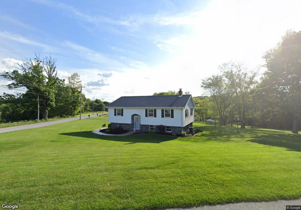
600 S Franklin St Red Lion, PA 17356
Estimated Value: $319,000 - $342,000
3
Beds
2
Baths
1,964
Sq Ft
$169/Sq Ft
Est. Value
About This Home
This home is located at 600 S Franklin St, Red Lion, PA 17356 and is currently estimated at $332,083, approximately $169 per square foot. 600 S Franklin St is a home located in York County with nearby schools including Loganville-Springfield Elementary School, Dallastown Area Middle School, and Dallastown Area High School.
Ownership History
Date
Name
Owned For
Owner Type
Purchase Details
Closed on
Jun 29, 2007
Sold by
Reachard Mary E
Bought by
Fetrow Robert W and Fetrow Lisa A
Current Estimated Value
Home Financials for this Owner
Home Financials are based on the most recent Mortgage that was taken out on this home.
Original Mortgage
$165,000
Outstanding Balance
$103,023
Interest Rate
6.48%
Mortgage Type
Purchase Money Mortgage
Estimated Equity
$229,060
Create a Home Valuation Report for This Property
The Home Valuation Report is an in-depth analysis detailing your home's value as well as a comparison with similar homes in the area
Home Values in the Area
Average Home Value in this Area
Purchase History
| Date | Buyer | Sale Price | Title Company |
|---|---|---|---|
| Fetrow Robert W | $213,930 | None Available |
Source: Public Records
Mortgage History
| Date | Status | Borrower | Loan Amount |
|---|---|---|---|
| Open | Fetrow Robert W | $165,000 |
Source: Public Records
Tax History Compared to Growth
Tax History
| Year | Tax Paid | Tax Assessment Tax Assessment Total Assessment is a certain percentage of the fair market value that is determined by local assessors to be the total taxable value of land and additions on the property. | Land | Improvement |
|---|---|---|---|---|
| 2025 | $5,072 | $147,760 | $32,380 | $115,380 |
| 2024 | $4,998 | $147,760 | $32,380 | $115,380 |
| 2023 | $4,998 | $147,760 | $32,380 | $115,380 |
| 2022 | $4,835 | $147,760 | $32,380 | $115,380 |
| 2021 | $4,606 | $147,760 | $32,380 | $115,380 |
| 2020 | $4,606 | $147,760 | $32,380 | $115,380 |
| 2019 | $4,591 | $147,760 | $32,380 | $115,380 |
| 2018 | $4,560 | $147,760 | $32,380 | $115,380 |
| 2017 | $4,378 | $147,760 | $32,380 | $115,380 |
| 2016 | $0 | $147,760 | $32,380 | $115,380 |
| 2015 | -- | $147,760 | $32,380 | $115,380 |
| 2014 | -- | $147,760 | $32,380 | $115,380 |
Source: Public Records
Map
Nearby Homes
- 420 Greenway Dr
- 600 S Duke St
- 211 Country Ridge Dr
- 156 Country Ridge Dr
- 131 Country Ridge Dr
- 126 Country Ridge Dr
- 357 Country Club Rd Unit 26
- 260 Country Ridge Dr
- 840 Country Club Rd
- 126 Linden Ave
- 503 W Broadway
- 321 Atlantic Ave
- 338 Atlantic Ave
- 131 Country Club Rd
- 220 W Broadway
- 81 1st Ave Unit E
- 79 1st Ave
- 445 S Main St
- 46 S Main St
- 400 Carriage Ln Unit 400
- 415 Greenway Dr
- 590 S Franklin St
- 580 S Franklin St
- 570 S Franklin St
- 620 S Franklin St
- 625 S Franklin St
- 630 S Franklin St
- 560 S Franklin St
- 610 S Franklin St
- 455 Greenway Dr
- 632 S Franklin St
- 635 S Franklin St
- 645 S Franklin St
- 500 Arbor Dr
- 655 S Franklin St
- 566 Arbor Dr
- 650 S Franklin St
- 510 Arbor Dr
- 490 Greenway Dr
- 460 Greenway Dr