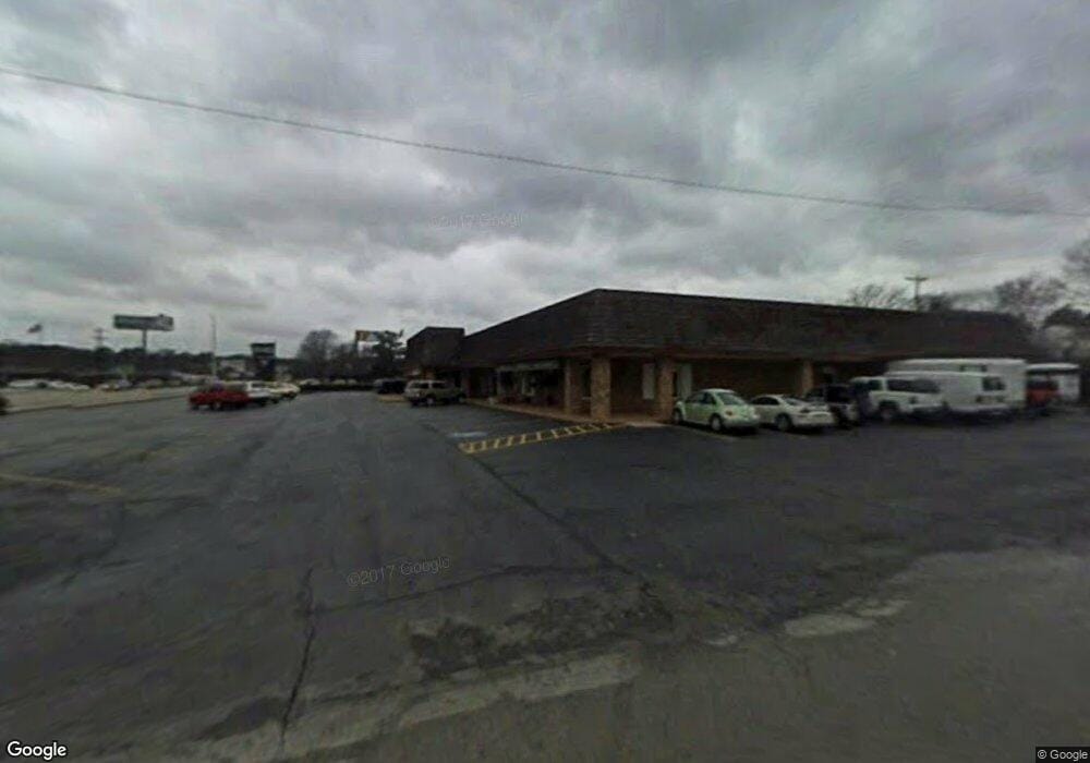
600 Southwest Dr Jonesboro, AR 72401
Estimated Value: $2,269,130
--
Bed
1
Bath
2,100
Sq Ft
$1,081/Sq Ft
Est. Value
About This Home
This home is located at 600 Southwest Dr, Jonesboro, AR 72401 and is currently estimated at $2,269,130, approximately $1,080 per square foot. 600 Southwest Dr is a home located in Craighead County with nearby schools including Douglas Macarthur Junior High School, The Academies at Jonesboro High School, and Concordia Christian Academy.
Ownership History
Date
Name
Owned For
Owner Type
Purchase Details
Closed on
Dec 28, 2012
Sold by
Lamco Lp
Bought by
L & L Land Company Llc
Current Estimated Value
Home Financials for this Owner
Home Financials are based on the most recent Mortgage that was taken out on this home.
Original Mortgage
$1,000,000
Interest Rate
3.35%
Mortgage Type
Commercial
Purchase Details
Closed on
Jul 11, 1997
Bought by
Lamco
Create a Home Valuation Report for This Property
The Home Valuation Report is an in-depth analysis detailing your home's value as well as a comparison with similar homes in the area
Home Values in the Area
Average Home Value in this Area
Purchase History
| Date | Buyer | Sale Price | Title Company |
|---|---|---|---|
| L & L Land Company Llc | $1,000,000 | None Available | |
| Lamco | -- | -- |
Source: Public Records
Mortgage History
| Date | Status | Borrower | Loan Amount |
|---|---|---|---|
| Closed | L & L Land Company Llc | $1,000,000 |
Source: Public Records
Tax History Compared to Growth
Tax History
| Year | Tax Paid | Tax Assessment Tax Assessment Total Assessment is a certain percentage of the fair market value that is determined by local assessors to be the total taxable value of land and additions on the property. | Land | Improvement |
|---|---|---|---|---|
| 2025 | $16,812 | $305,527 | $108,288 | $197,239 |
| 2024 | $16,812 | $398,397 | $108,288 | $290,109 |
| 2023 | $16,414 | $398,397 | $108,288 | $290,109 |
| 2022 | $16,414 | $398,397 | $108,288 | $290,109 |
| 2021 | $15,719 | $372,490 | $108,290 | $264,200 |
| 2020 | $15,439 | $372,490 | $108,290 | $264,200 |
| 2019 | $14,337 | $372,490 | $108,290 | $264,200 |
| 2018 | $13,234 | $372,490 | $108,290 | $264,200 |
| 2017 | $12,131 | $372,490 | $108,290 | $264,200 |
| 2016 | $11,029 | $275,960 | $67,680 | $208,280 |
| 2015 | $11,646 | $275,960 | $67,680 | $208,280 |
| 2014 | $11,646 | $275,960 | $67,680 | $208,280 |
Source: Public Records
Map
Nearby Homes
- 718 Owens Ave
- 801 Parkview St
- 2717 Greenbriar Dr
- 2607 Greenbriar Dr
- 805 Southwest Dr
- 305 W Concord St
- 2305 Anne St
- 100 Briarcrest Ct
- 800 Southwest Dr
- 808 Melton Dr
- 700 Amberwood Cove
- 202 W Stroud St
- 900 Marcom Dr
- 1919 Sherwood Dr
- 2817 S Culberhouse St
- 795 S Hill Dr
- 1202 Wood Cove
- 900 Melton Dr
- 0 Woodland Point Unit 10119898
- 0 Woodland Point Unit 10119897
- 616 Southwest Dr
- 620 Southwest Dr
- 2619 Circle Dr Unit 955
- 2605 Circle Dr
- 2603 Circle Dr
- 2512 S Culberhouse St
- 2512 S Culberhouse St
- 513 Ridgecrest St
- 2601 Circle Dr
- 511 Ridgecrest St
- 2409 Circle Dr
- 509 Ridgecrest St
- 521 Southwest Dr
- 2504 S Culberhouse St
- 701 Locust Dr
- 2506 S Culberhouse St
- 608 Marlo Dr
- 508 Ridgecrest St
- 604 Marlo Dr
- 600 W Stroud St