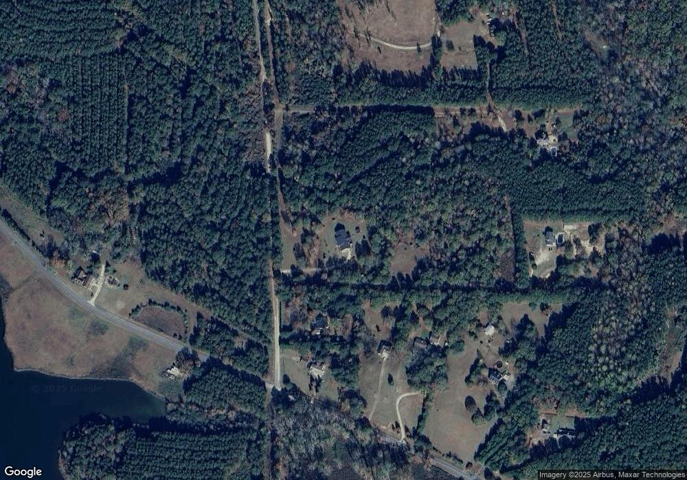
600 West Rd Unit 7 Williamson, GA 30292
Estimated Value: $547,313 - $593,000
--
Bed
4
Baths
4,144
Sq Ft
$137/Sq Ft
Est. Value
About This Home
This home is located at 600 West Rd Unit 7, Williamson, GA 30292 and is currently estimated at $568,828, approximately $137 per square foot. 600 West Rd Unit 7 is a home located in Pike County with nearby schools including Pike County Primary School, Pike County Elementary School, and Pike County Middle School.
Ownership History
Date
Name
Owned For
Owner Type
Purchase Details
Closed on
Dec 28, 2004
Sold by
Neal Maxine
Bought by
Neal Gary
Current Estimated Value
Home Financials for this Owner
Home Financials are based on the most recent Mortgage that was taken out on this home.
Original Mortgage
$155,000
Interest Rate
5.71%
Mortgage Type
New Conventional
Purchase Details
Closed on
Oct 26, 1995
Sold by
Limited Georgia Partnership
Bought by
Neal Gary and Neal Maxine
Purchase Details
Closed on
Jun 6, 1994
Sold by
Green Norris Lamar
Bought by
Walters John C
Create a Home Valuation Report for This Property
The Home Valuation Report is an in-depth analysis detailing your home's value as well as a comparison with similar homes in the area
Home Values in the Area
Average Home Value in this Area
Purchase History
| Date | Buyer | Sale Price | Title Company |
|---|---|---|---|
| Neal Gary | -- | -- | |
| Neal Gary | -- | -- | |
| Neal Gary | -- | -- | |
| Neal Gary | $20,000 | -- | |
| Walters John C | $318,100 | -- |
Source: Public Records
Mortgage History
| Date | Status | Borrower | Loan Amount |
|---|---|---|---|
| Closed | Neal Gary | $155,000 |
Source: Public Records
Tax History Compared to Growth
Tax History
| Year | Tax Paid | Tax Assessment Tax Assessment Total Assessment is a certain percentage of the fair market value that is determined by local assessors to be the total taxable value of land and additions on the property. | Land | Improvement |
|---|---|---|---|---|
| 2024 | $3,493 | $162,928 | $34,098 | $128,830 |
| 2023 | $4,097 | $162,928 | $34,098 | $128,830 |
| 2022 | $3,373 | $122,274 | $34,098 | $88,176 |
| 2021 | $3,155 | $106,976 | $18,800 | $88,176 |
| 2020 | $2,773 | $104,463 | $18,800 | $85,663 |
| 2019 | $3,047 | $90,138 | $18,800 | $71,338 |
| 2018 | $3,049 | $90,138 | $18,800 | $71,338 |
| 2017 | $3,024 | $90,138 | $18,800 | $71,338 |
| 2016 | $2,806 | $90,138 | $18,800 | $71,338 |
| 2015 | $2,672 | $90,138 | $18,800 | $71,338 |
| 2014 | $2,710 | $90,138 | $18,800 | $71,338 |
| 2013 | -- | $90,138 | $18,800 | $71,338 |
Source: Public Records
Map
Nearby Homes
- 0 West Rd Unit 10536330
- 0 West Rd Unit 10541322
- 1337 Green St
- 10000 Highway 18 W
- 2505 Plan at Ashley Glen
- 2604 Plan at Ashley Glen
- 2316 Plan at Ashley Glen
- 1902 Plan at Ashley Glen
- 2100 Plan at Ashley Glen
- 2246 Concord Rd
- LOT 11 Flint Farms Dr
- TRACT 5 Bates Rd (13 98acs)
- 2310 Hollonville Rd
- L-8 Strickland Rd
- 4091 Hollonville Rd
- LOT 12 Flint Farms Dr
- 184 Flint Farms Dr
- 243 Flint Farms Dr
- 126 Flint Farms Dr
- 0 Green St Unit 20083878
- 544 West Rd
- 524 Bottoms Rd
- 488 Bottoms Rd
- 576 Bottoms Rd
- 800 Bottoms Rd
- 424 Bottoms Rd
- 744 West Rd
- 828 West Rd
- 382 West Rd
- 414 Bottoms Rd
- 414 Bottoms Rd Unit 1
- 351 Bottoms Rd Unit LOT4
- 0 West Rd Unit LOT 1 3085144
- 920 West Rd
- 336 West Rd
- 287 Bottoms Rd
- 183 Bottoms Rd
- 0 West Rd Unit TRACT 3 20158426
- 0 West Rd Unit TRACT 2 20158429
- 0 West Rd Unit TRACT 1 20158424
