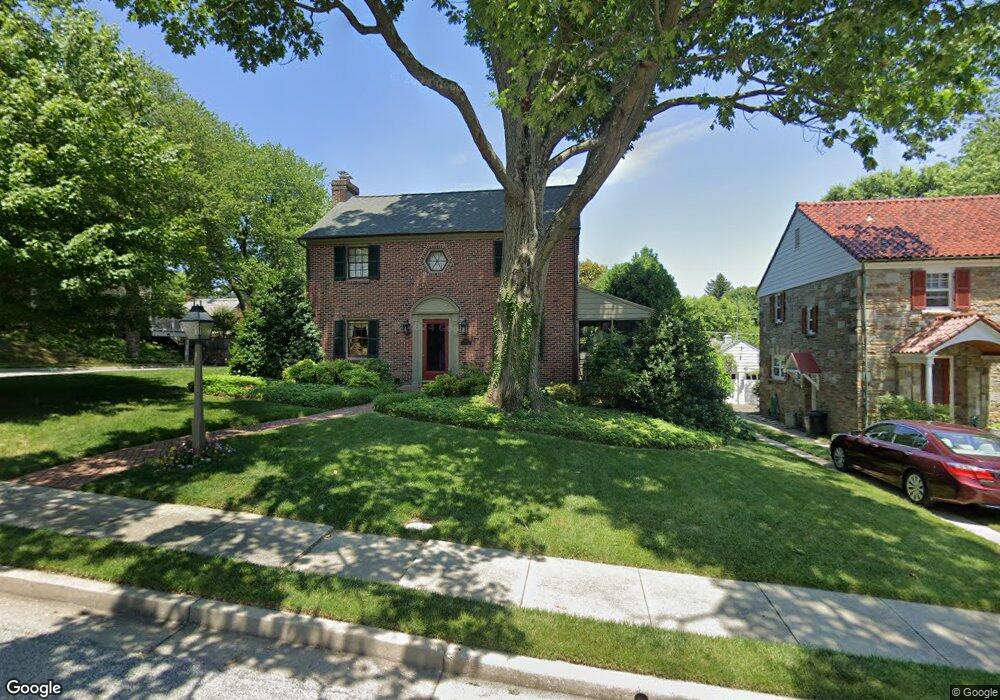
600 Wilton Rd Towson, MD 21286
Estimated Value: $583,000 - $724,000
3
Beds
2
Baths
--
Sq Ft
8,276
Sq Ft Lot
About This Home
This home is located at 600 Wilton Rd, Towson, MD 21286 and is currently estimated at $657,433. 600 Wilton Rd is a home located in Baltimore County with nearby schools including Stoneleigh Elementary School, Dumbarton Middle School, and Towson High Law & Public Policy.
Ownership History
Date
Name
Owned For
Owner Type
Purchase Details
Closed on
Nov 12, 2003
Sold by
Fokas Kathy A
Bought by
Thompson Leslie and Thompson James
Current Estimated Value
Purchase Details
Closed on
Dec 17, 2002
Sold by
Ulatowski John A
Bought by
Fokas Kathy A
Purchase Details
Closed on
Aug 14, 1996
Sold by
Simon Albert F
Bought by
Ulatowski John A and Fokas Kathy A
Create a Home Valuation Report for This Property
The Home Valuation Report is an in-depth analysis detailing your home's value as well as a comparison with similar homes in the area
Home Values in the Area
Average Home Value in this Area
Purchase History
| Date | Buyer | Sale Price | Title Company |
|---|---|---|---|
| Thompson Leslie | $375,000 | -- | |
| Fokas Kathy A | -- | -- | |
| Ulatowski John A | $220,000 | -- |
Source: Public Records
Tax History Compared to Growth
Tax History
| Year | Tax Paid | Tax Assessment Tax Assessment Total Assessment is a certain percentage of the fair market value that is determined by local assessors to be the total taxable value of land and additions on the property. | Land | Improvement |
|---|---|---|---|---|
| 2025 | $7,312 | $489,700 | $137,500 | $352,200 |
| 2024 | $7,312 | $466,233 | $0 | $0 |
| 2023 | $3,335 | $442,767 | $0 | $0 |
| 2022 | $6,103 | $419,300 | $129,500 | $289,800 |
| 2021 | $5,573 | $408,167 | $0 | $0 |
| 2020 | $5,573 | $397,033 | $0 | $0 |
| 2019 | $5,463 | $385,900 | $129,500 | $256,400 |
| 2018 | $5,340 | $374,400 | $0 | $0 |
| 2017 | $5,151 | $362,900 | $0 | $0 |
| 2016 | $4,161 | $351,400 | $0 | $0 |
| 2015 | $4,161 | $351,400 | $0 | $0 |
| 2014 | $4,161 | $351,400 | $0 | $0 |
Source: Public Records
Map
Nearby Homes
- 625 Yarmouth Rd
- 612 Coventry Rd
- 28 Stone Ridge Ct
- 908 Stevenson Ln
- 7512 Far Hills Dr
- 425 Rodgers Ct
- 12 Stone Ridge Ct
- 500 Fairway Ct
- 418 Chumleigh Rd
- 63 Burkshire Rd
- 6931 Summit Cir
- 6923 Summit Cir
- 112 E Burke Ave
- 664 Regester Ave
- 212 E Burke Ave
- 240 E Burke Ave
- 324 Stanmore Rd
- 421 Regester Ave
- 104 Willow Ave
- 1204 Saint Andrews Way