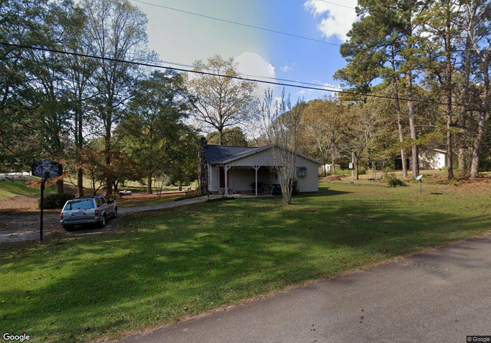
6000 Old West Point Rd Lagrange, GA 30240
Estimated Value: $186,000 - $234,000
3
Beds
2
Baths
1,377
Sq Ft
$152/Sq Ft
Est. Value
About This Home
This home is located at 6000 Old West Point Rd, Lagrange, GA 30240 and is currently estimated at $209,140, approximately $151 per square foot. 6000 Old West Point Rd is a home located in Troup County with nearby schools including Long Cane Elementary School, Berta Weathersbee Elementary School, and Whitesville Road Elementary School.
Ownership History
Date
Name
Owned For
Owner Type
Purchase Details
Closed on
May 31, 2017
Sold by
Aspinwall Renae
Bought by
Stephen Eva
Current Estimated Value
Home Financials for this Owner
Home Financials are based on the most recent Mortgage that was taken out on this home.
Original Mortgage
$124,699
Outstanding Balance
$102,534
Interest Rate
3.87%
Mortgage Type
FHA
Estimated Equity
$106,607
Purchase Details
Closed on
Dec 21, 2016
Sold by
Carrington Mtg Svcs Llc
Bought by
Aspinwall Renae
Purchase Details
Closed on
Oct 4, 2016
Sold by
Anthony C
Bought by
Carrington Mtg Svcs Llc
Purchase Details
Closed on
Jul 30, 2004
Sold by
Househols Realty Corp
Bought by
Burke Anthony and Burke Catrina
Purchase Details
Closed on
Apr 6, 2004
Sold by
Patsy Billy R and Patsy Daniel
Bought by
Househols Realty Corp
Purchase Details
Closed on
Dec 1, 1984
Bought by
Patsy Billy R and Patsy Daniel
Purchase Details
Closed on
Jul 16, 1977
Purchase Details
Closed on
May 26, 1977
Purchase Details
Closed on
May 30, 1975
Create a Home Valuation Report for This Property
The Home Valuation Report is an in-depth analysis detailing your home's value as well as a comparison with similar homes in the area
Purchase History
We collect this data history from publicly available records. To have your information removed, we recommend requesting removal directly through your county’s website.
| Date | Buyer | Sale Price | Title Company |
|---|---|---|---|
| Stephen Eva | $127,000 | -- | |
| Aspinwall Renae | $63,750 | -- | |
| Carrington Mtg Svcs Llc | $63,750 | -- | |
| Burke Anthony | $93,900 | -- | |
| Househols Realty Corp | $84,600 | -- | |
| Patsy Billy R | $55,600 | -- | |
| -- | $36,000 | -- | |
| -- | -- | -- | |
| -- | -- | -- |
Source: Public Records
Mortgage History
We collect this data history from publicly available records. To have your information removed, we recommend requesting removal directly through your county’s website.
| Date | Status | Borrower | Loan Amount |
|---|---|---|---|
| Open | Stephen Eva | $124,699 |
Source: Public Records
Tax History
| Year | Tax Paid | Tax Assessment Tax Assessment Total Assessment is a certain percentage of the fair market value that is determined by local assessors to be the total taxable value of land and additions on the property. | Land | Improvement |
|---|---|---|---|---|
| 2025 | $1,859 | $75,280 | $14,000 | $61,280 |
| 2024 | $1,606 | $60,880 | $14,000 | $46,880 |
| 2023 | $1,607 | $60,920 | $14,000 | $46,920 |
| 2022 | $1,455 | $54,120 | $10,000 | $44,120 |
| 2021 | $1,543 | $53,160 | $10,000 | $43,160 |
| 2020 | $1,423 | $49,160 | $6,000 | $43,160 |
| 2019 | $1,354 | $46,880 | $6,000 | $40,880 |
| 2018 | $1,292 | $44,840 | $6,160 | $38,680 |
| 2017 | $769 | $29,680 | $6,160 | $23,520 |
| 2016 | $823 | $29,257 | $6,160 | $23,097 |
| 2015 | $785 | $27,948 | $6,160 | $21,788 |
| 2014 | $751 | $26,802 | $6,160 | $20,642 |
| 2013 | -- | $28,161 | $6,160 | $22,001 |
Source: Public Records
Map
Nearby Homes
- 105 Redwood Dr
- 3658 W Point Rd
- 22 Freeman Rd
- 2663-2683 W Point Rd
- 801 Glass Bridge Rd
- 245 Teaver Rd
- 20 Hill Rd
- 36 Hill Rd
- 0 Bradfield Dr Unit 10568803
- 53 Horace Carter Rd
- 5047 W Point Rd
- 104 Independence Ct
- 102 Bridgewater Dr
- 6 Hastings Ct
- 1054 Glass Bridge Rd
- 107 Waters Edge Dr
- 311 Cumberland Dr
- 101 Ivy Springs Dr
- 300 Cumberland Dr
- 1408 New Hutchinson Mill Rd
- 6002 Old West Point Rd
- 5042 Old West Point Rd
- 35 Maefield Dr
- 6004 Old West Point Rd
- 5043 Old West Point Rd
- 5040 Old West Point Rd
- 40 Maefield Dr
- 6003 Old West Point Rd
- 49 Maefield Dr
- 6006 Old West Point Rd
- 147 Rob Roy Rd
- 6015 Old West Point Rd
- 5038 Old West Point Rd
- 5041 Old West Point Rd
- 5037 Old West Point Rd
- 55 Maefield Dr
- 145 Rob Roy Rd
- 6035 Old West Point Rd
- 5036 Old Point W
- 5036 Old West Point Rd
Your Personal Tour Guide
Ask me questions while you tour the home.