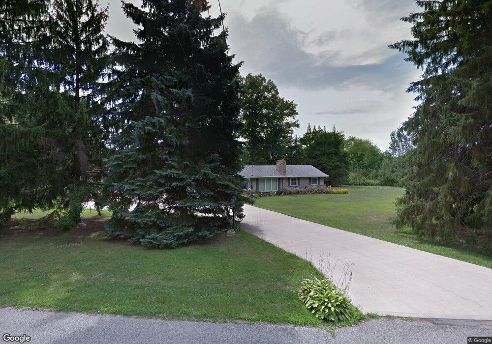
6000 Sampson Dr Girard, OH 44420
Churchill NeighborhoodEstimated Value: $158,551 - $191,000
3
Beds
1
Bath
1,056
Sq Ft
$168/Sq Ft
Est. Value
About This Home
This home is located at 6000 Sampson Dr, Girard, OH 44420 and is currently estimated at $177,888, approximately $168 per square foot. 6000 Sampson Dr is a home located in Trumbull County with nearby schools including E.J. Blott Elementary School, William S. Guy Middle School, and Liberty High School.
Ownership History
Date
Name
Owned For
Owner Type
Purchase Details
Closed on
Apr 25, 1995
Sold by
Berlin David K
Bought by
Cochran Johnny F
Current Estimated Value
Home Financials for this Owner
Home Financials are based on the most recent Mortgage that was taken out on this home.
Original Mortgage
$50,000
Interest Rate
8.64%
Mortgage Type
New Conventional
Purchase Details
Closed on
Jan 1, 1990
Bought by
David David K and David Mildred I
Create a Home Valuation Report for This Property
The Home Valuation Report is an in-depth analysis detailing your home's value as well as a comparison with similar homes in the area
Home Values in the Area
Average Home Value in this Area
Purchase History
| Date | Buyer | Sale Price | Title Company |
|---|---|---|---|
| Cochran Johnny F | $64,700 | -- | |
| David David K | -- | -- |
Source: Public Records
Mortgage History
| Date | Status | Borrower | Loan Amount |
|---|---|---|---|
| Closed | Cochran Johnny F | $50,000 |
Source: Public Records
Tax History Compared to Growth
Tax History
| Year | Tax Paid | Tax Assessment Tax Assessment Total Assessment is a certain percentage of the fair market value that is determined by local assessors to be the total taxable value of land and additions on the property. | Land | Improvement |
|---|---|---|---|---|
| 2024 | $1,146 | $43,720 | $9,870 | $33,850 |
| 2023 | $2,278 | $43,720 | $9,870 | $33,850 |
| 2022 | $2,289 | $35,250 | $9,140 | $26,110 |
| 2021 | $2,293 | $35,250 | $9,140 | $26,110 |
| 2020 | $2,298 | $35,250 | $9,140 | $26,110 |
| 2019 | $2,276 | $30,800 | $8,470 | $22,330 |
| 2018 | $2,262 | $30,800 | $8,470 | $22,330 |
| 2017 | $2,201 | $30,800 | $8,470 | $22,330 |
| 2016 | $2,476 | $33,990 | $8,470 | $25,520 |
| 2015 | $2,473 | $33,990 | $8,470 | $25,520 |
| 2014 | $2,469 | $33,990 | $8,470 | $25,520 |
| 2013 | $2,403 | $33,990 | $8,470 | $25,520 |
Source: Public Records
Map
Nearby Homes
- 6170 Sodom Hutchings Rd
- 5602 Greenbrier Dr
- 200 Terra Bella Dr Unit 1
- 279 Potters Cir
- 5320 Sampson Dr
- 5612 Belmont Ave
- 1929 Twin Oaks Dr
- 583 Santa Monica Cir
- 4810 Logan Way
- 639 Aurora Dr
- 4785 Logan Arms Dr
- 4900 5th Ave
- 1171 Logan Wood Dr
- 615 Ventura Dr
- 1120 Timbercrest St
- 0 Appaloosa Trail
- 0 Naylor Lloyd Rd Unit 5066608
- 4628 Middle Rd
- 4593 Michigan Blvd
- 1146 Townsend Ave
- 5980 Sampson Dr
- 2105 Tibbetts Wick Rd
- 5900 Sampson Dr
- 5981 Sampson Dr
- 5897 Sampson Dr
- 2111 Tibbetts Wick Rd
- 5894 Sampson Dr
- 2100 Tibbetts Wick Rd
- 2110 Tibbetts Wick Rd
- 5893 Sampson Dr
- 5762 Logan Arms Dr
- 5890 Sampson Dr
- 2117 Tibbetts Wick Rd
- 5758 Logan Arms Dr
- 5891 Sampson Dr
- 2114 Tibbetts Wick Rd
- 5884 Sampson Dr
- 5754 Logan Arms Dr
- 5885 Sampson
- 5750 Logan Arms Dr