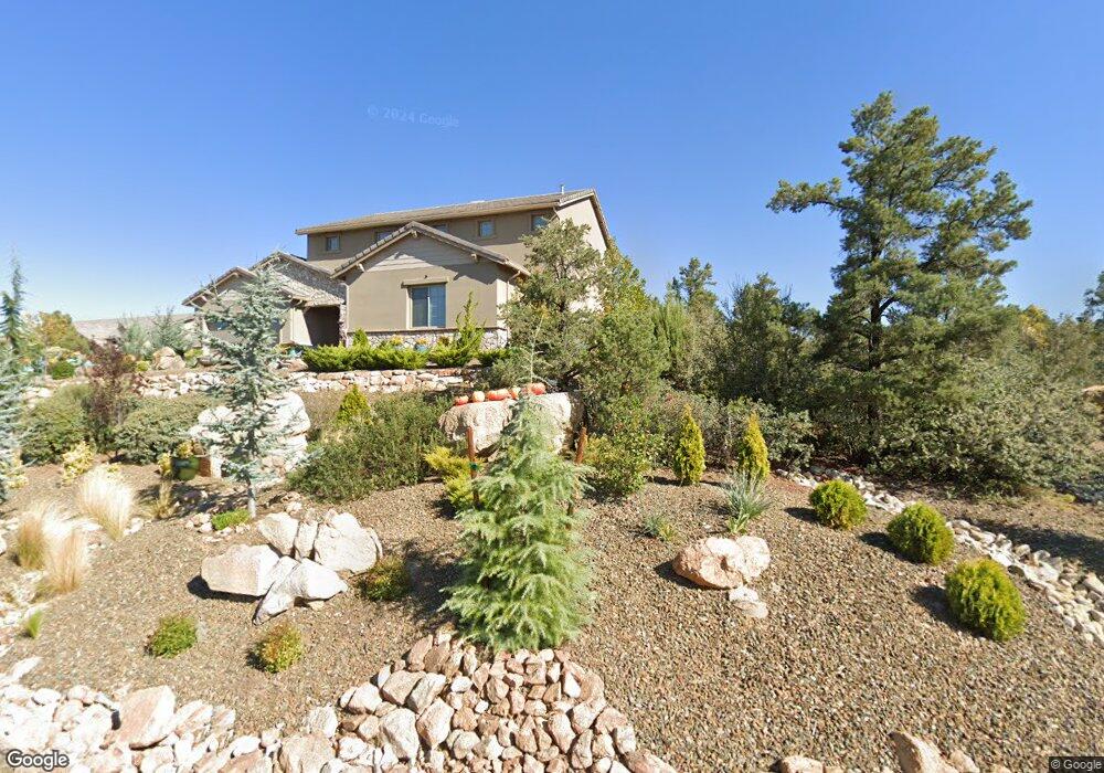
6000 W Harmony Rd Prescott, AZ 86305
Williamson Valley Road NeighborhoodEstimated Value: $885,282 - $1,036,000
--
Bed
--
Bath
2,876
Sq Ft
$336/Sq Ft
Est. Value
About This Home
This home is located at 6000 W Harmony Rd, Prescott, AZ 86305 and is currently estimated at $967,571, approximately $336 per square foot. 6000 W Harmony Rd is a home located in Yavapai County with nearby schools including Granite Mountain Middle School, Abia Judd Elementary School, and Prescott Mile High Middle School.
Ownership History
Date
Name
Owned For
Owner Type
Purchase Details
Closed on
Aug 17, 2020
Sold by
Copper Tree Construction Group Llc
Bought by
Foley William E and Foley Betty F
Current Estimated Value
Home Financials for this Owner
Home Financials are based on the most recent Mortgage that was taken out on this home.
Original Mortgage
$496,000
Outstanding Balance
$439,987
Interest Rate
3%
Mortgage Type
New Conventional
Estimated Equity
$527,584
Purchase Details
Closed on
Feb 21, 2020
Sold by
Old Capitol Investments Llc
Bought by
Copper Tree Construction Group Llc
Home Financials for this Owner
Home Financials are based on the most recent Mortgage that was taken out on this home.
Original Mortgage
$318,966
Interest Rate
3.2%
Mortgage Type
Construction
Create a Home Valuation Report for This Property
The Home Valuation Report is an in-depth analysis detailing your home's value as well as a comparison with similar homes in the area
Home Values in the Area
Average Home Value in this Area
Purchase History
| Date | Buyer | Sale Price | Title Company |
|---|---|---|---|
| Foley William E | $620,000 | Yavapai Title | |
| Copper Tree Construction Group Llc | -- | Yavapai Title Agency Inc |
Source: Public Records
Mortgage History
| Date | Status | Borrower | Loan Amount |
|---|---|---|---|
| Open | Foley William E | $496,000 | |
| Previous Owner | Copper Tree Construction Group Llc | $318,966 |
Source: Public Records
Tax History Compared to Growth
Tax History
| Year | Tax Paid | Tax Assessment Tax Assessment Total Assessment is a certain percentage of the fair market value that is determined by local assessors to be the total taxable value of land and additions on the property. | Land | Improvement |
|---|---|---|---|---|
| 2026 | $4,183 | $72,374 | -- | -- |
| 2024 | $3,806 | $75,649 | -- | -- |
| 2023 | $4,109 | $63,807 | $0 | $0 |
| 2022 | $3,806 | $55,091 | $7,564 | $47,527 |
| 2021 | $3,874 | $52,234 | $6,815 | $45,419 |
| 2020 | $326 | $0 | $0 | $0 |
| 2019 | $315 | $0 | $0 | $0 |
| 2018 | $314 | $0 | $0 | $0 |
| 2017 | $284 | $0 | $0 | $0 |
| 2016 | $282 | $0 | $0 | $0 |
| 2015 | -- | $0 | $0 | $0 |
| 2014 | -- | $0 | $0 | $0 |
Source: Public Records
Map
Nearby Homes
- 6246 W Omar (Lot 208) Rd
- 12204 N Petra (Lot 236) Cir
- 12234 N Petra (Lot 234) Cir
- 6095 W Mira Rd
- 5900 W Vesta (Lot 251) Cir
- 6217 W Omar (Lot 214) Rd
- 12205 N Petra (Lot 237) Cir
- 12265 N Petra (Lot 240) Cir
- 6236 W Omar (Lot 207) Rd
- 12285 N Petra (Lot 241) Cir
- 6120 W Mira Rd
- 6267 W Omar (Lot 212) Rd
- 12290 N Thrine (Lot 227) Cir
- 5980 W Vesta (Lot 247) Cir
- 12665 N Gyda Cir
- 12312 N Otto (Lot 219) Cir
- 12284 N Petra (Lot 233) Cir
- 6010 W Vesta (Lot 246) Cir
- 5865 W Dare Cir
- 6140 W Mira Rd
- 12670 N Idalia Cir
- 6005 W Harmony Rd
- 6030 W Harmony Rd
- 6030 Harmony (Lot 111) Rd
- 6005 Harmony Rd
- 12665 N Idalia
- 6005 W Harmony (Lot 114) Rd
- 6035 W Harmony Rd
- 6035 W Harmony Rd
- 6035 W Harmony Rd Unit 112
- 5965 W Harmony Rd
- 6025 W Harmony Rd Unit 113
- 12690 N Idalia Cir Unit 109
- 12690 N Idalia Cir
- 12685 N Idalia
- 12685 N Idalia Unit 108
- 12660 N Cosima Cir
- 6105 W Frederick Cir Unit 154
- 6105 W Frederick Cir
- 6105 W Frederick Rd