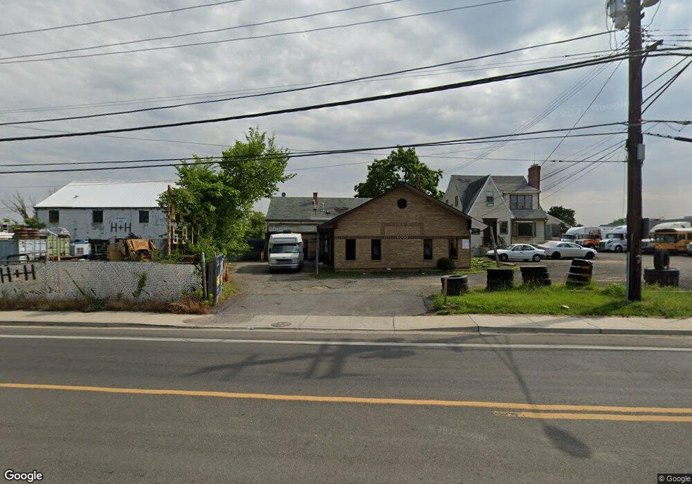
6000 Walker Mill Rd Capitol Heights, MD 20743
Estimated Value: $594,094
Studio
--
Bath
3,788
Sq Ft
$157/Sq Ft
Est. Value
About This Home
This home is located at 6000 Walker Mill Rd, Capitol Heights, MD 20743 and is currently estimated at $594,094, approximately $156 per square foot. 6000 Walker Mill Rd is a home located in Prince George's County with nearby schools including Concord Elementary School, Walker Mill Middle School, and Suitland High School.
Ownership History
Date
Name
Owned For
Owner Type
Purchase Details
Closed on
Aug 12, 2021
Sold by
T & Fj Enterprises Llc
Bought by
6000 Walker Mill Rd Llc
Current Estimated Value
Home Financials for this Owner
Home Financials are based on the most recent Mortgage that was taken out on this home.
Original Mortgage
$488,000
Interest Rate
2.8%
Mortgage Type
Commercial
Purchase Details
Closed on
Mar 22, 2019
Sold by
Alston Roger and Jones Fritz
Bought by
T & Fj Enterprises Llc
Purchase Details
Closed on
Feb 21, 2014
Sold by
Alston Roger L and Alston Michelle
Bought by
Jones Fritz and Alston Roger L
Purchase Details
Closed on
May 3, 1984
Sold by
Flood Sheetm
Bought by
Alston Roger L and Alston Michelle
Create a Home Valuation Report for This Property
The Home Valuation Report is an in-depth analysis detailing your home's value as well as a comparison with similar homes in the area
Home Values in the Area
Average Home Value in this Area
Purchase History
| Date | Buyer | Sale Price | Title Company |
|---|---|---|---|
| 6000 Walker Mill Rd Llc | $500,000 | Bancstar Title Llc | |
| T & Fj Enterprises Llc | $140,139 | None Available | |
| Jones Fritz | $185,000 | Attorney | |
| Alston Roger L | $105,000 | -- |
Source: Public Records
Mortgage History
| Date | Status | Borrower | Loan Amount |
|---|---|---|---|
| Previous Owner | 6000 Walker Mill Rd Llc | $488,000 |
Source: Public Records
Tax History
| Year | Tax Paid | Tax Assessment Tax Assessment Total Assessment is a certain percentage of the fair market value that is determined by local assessors to be the total taxable value of land and additions on the property. | Land | Improvement |
|---|---|---|---|---|
| 2025 | $7,764 | $485,500 | $135,700 | $349,800 |
| 2024 | $7,764 | $485,500 | $135,700 | $349,800 |
| 2023 | $7,749 | $485,500 | $135,700 | $349,800 |
| 2022 | $7,749 | $485,500 | $135,700 | $349,800 |
| 2021 | $7,749 | $485,500 | $135,700 | $349,800 |
| 2020 | $0 | $485,500 | $135,700 | $349,800 |
| 2019 | $6,368 | $444,700 | $0 | $0 |
| 2018 | $6,537 | $403,900 | $0 | $0 |
| 2017 | $5,493 | $363,100 | $0 | $0 |
| 2016 | -- | $333,667 | $0 | $0 |
| 2015 | $4,695 | $304,233 | $0 | $0 |
| 2014 | $4,695 | $274,800 | $0 | $0 |
Source: Public Records
Map
Nearby Homes
- 2017 County Rd
- 6206 Atwood St
- 1702 Rollins Place
- 1510 Brooke Rd
- 5409 Walker Mill Rd
- 6406 Elmhurst St
- 2319 Barkley Place
- 5919 Applegarth Place
- 5625 Oakford Rd
- 0 Rollins Ave Unit MDPG2158618
- 6602 Foster St
- 5814 Folgate Ct
- 1631 Addison Rd S Unit 1631
- 1891 Addison Rd S
- 1621 Addison Rd S
- 1705 Addison Rd S
- 6400 Halleck St
- 1733 Addison Rd S Unit 1733
- 5505 Vergo Rd
- 1301 Karen Blvd Unit 201
- 6004 Walker Mill Rd
- 5916 Walker Mill Rd
- 5912 Walker Mill Rd
- 6008 Walker Mill Rd
- 5924 Walker Mill Rd
- 5910 Walker Mill Rd
- 5410 Walker Mill Roa Walker Mill Rd
- 0 Walker Mill Rd
- 6020 Walker Mill Rd
- 2100 Scott Key Dr
- 5909 Walker Mill Rd
- 2101 Scott Key Dr
- 5908 Walker Mill Rd
- 2103 Scott Key Dr
- 5905 Walker Mill Rd
- 5816 Walker Mill Rd
- 2105 Scott Key Dr
- 5901 Walker Mill Rd
- 2104 Scott Key Dr
- 2107 Scott Key Dr
Your Personal Tour Guide
Ask me questions while you tour the home.