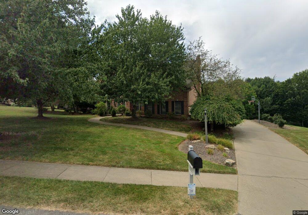
6001 W Grove Cir Gibsonia, PA 15044
Pine Township NeighborhoodEstimated Value: $818,000 - $898,000
5
Beds
4
Baths
3,206
Sq Ft
$262/Sq Ft
Est. Value
About This Home
This home is located at 6001 W Grove Cir, Gibsonia, PA 15044 and is currently estimated at $840,999, approximately $262 per square foot. 6001 W Grove Cir is a home located in Allegheny County with nearby schools including Eden Hall Upper Elementary, Richland Elementary School, and Pine-Richland Middle School.
Ownership History
Date
Name
Owned For
Owner Type
Purchase Details
Closed on
Jun 21, 2002
Sold by
Cendant Mobility Financial Corp
Bought by
Eastburn Patrick R and Eastburn Karen
Current Estimated Value
Purchase Details
Closed on
Jun 17, 2002
Sold by
Olsavsky Brian T and Olsavsky Susan H
Bought by
Cendant Mobility Financial Corp
Purchase Details
Closed on
Apr 11, 1997
Sold by
Mamounas Eleftherios P and Mamounas Lisa M
Bought by
Olsavsky Brian T and Olsavsky Susan H
Create a Home Valuation Report for This Property
The Home Valuation Report is an in-depth analysis detailing your home's value as well as a comparison with similar homes in the area
Home Values in the Area
Average Home Value in this Area
Purchase History
| Date | Buyer | Sale Price | Title Company |
|---|---|---|---|
| Eastburn Patrick R | $425,000 | -- | |
| Cendant Mobility Financial Corp | $425,000 | -- | |
| Olsavsky Brian T | $402,000 | -- |
Source: Public Records
Tax History Compared to Growth
Tax History
| Year | Tax Paid | Tax Assessment Tax Assessment Total Assessment is a certain percentage of the fair market value that is determined by local assessors to be the total taxable value of land and additions on the property. | Land | Improvement |
|---|---|---|---|---|
| 2025 | $10,602 | $418,800 | $122,000 | $296,800 |
| 2024 | $10,602 | $418,800 | $122,000 | $296,800 |
| 2023 | $10,602 | $418,800 | $122,000 | $296,800 |
| 2022 | $10,602 | $418,800 | $122,000 | $296,800 |
| 2021 | $1,981 | $418,800 | $122,000 | $296,800 |
| 2020 | $10,602 | $418,800 | $122,000 | $296,800 |
| 2019 | $10,602 | $418,800 | $122,000 | $296,800 |
| 2018 | $1,981 | $418,800 | $122,000 | $296,800 |
| 2017 | $10,443 | $418,800 | $122,000 | $296,800 |
| 2016 | $1,981 | $418,800 | $122,000 | $296,800 |
| 2015 | $1,981 | $418,800 | $122,000 | $296,800 |
| 2014 | $10,445 | $418,800 | $122,000 | $296,800 |
Source: Public Records
Map
Nearby Homes
- 5003 Old Orchard Ln
- 7002 Eagle Rd
- 1804 Appleridge Ct
- 2104 Pointe View Dr
- 3001 Pointe View Dr
- 1703 Pointe View Dr
- 304 Northglen Ct
- 1304 Pointe View Dr
- 131 Birch Dr
- 300 Mccutcheon Ct
- 104 Broadstone Dr
- (Lot 323) 214 Macfadden Dr
- (Lot 133) 310 Mccutcheon Ct
- 227 Adams Pointe Blvd Unit 3
- 246 Adams Pointe Blvd Unit 1
- 219 Adams Pointe Blvd Unit 9
- 2013 Cherry Rd
- 2015 Cherry Rd
- 109 Ontario Ct
- 313 Crest Ln
- 2121 W Grove Dr
- 6003 W Grove Cir
- 6000 W Grove Cir
- 6002 W Grove Cir
- 6005 W Grove Cir
- 2126 W Grove Dr
- 6004 W Grove Cir
- 2124 W Grove Dr
- 2127 W Grove Dr
- 6006 W Grove Cir
- 6007 W Grove Cir
- 2122 W Grove Dr
- 2117 W Grove Dr
- 6008 W Grove Cir
- 2129 W Grove Dr
- 2128 W Grove Dr
- 2120 W Grove Dr
- 6009 W Grove Cir
- 2035 W Grove Dr
- 2118 W Grove Dr