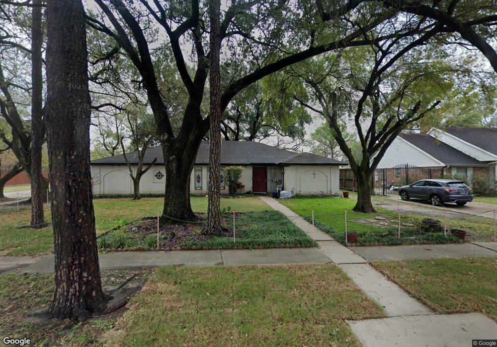
6003 Redding Rd Houston, TX 77036
Sharpstown NeighborhoodEstimated Value: $273,000 - $333,000
3
Beds
2
Baths
2,001
Sq Ft
$150/Sq Ft
Est. Value
About This Home
This home is located at 6003 Redding Rd, Houston, TX 77036 and is currently estimated at $299,767, approximately $149 per square foot. 6003 Redding Rd is a home located in Harris County with nearby schools including Emerson Elementary School, Paul Revere Middle School, and Wisdom High School.
Ownership History
Date
Name
Owned For
Owner Type
Purchase Details
Closed on
Apr 13, 2000
Sold by
Cook Emerson E and Cook Lenora D
Bought by
Schneider Ronald Phil
Current Estimated Value
Home Financials for this Owner
Home Financials are based on the most recent Mortgage that was taken out on this home.
Original Mortgage
$89,954
Outstanding Balance
$30,840
Interest Rate
8.24%
Mortgage Type
FHA
Estimated Equity
$268,927
Create a Home Valuation Report for This Property
The Home Valuation Report is an in-depth analysis detailing your home's value as well as a comparison with similar homes in the area
Home Values in the Area
Average Home Value in this Area
Purchase History
| Date | Buyer | Sale Price | Title Company |
|---|---|---|---|
| Schneider Ronald Phil | -- | Texas American Title Company |
Source: Public Records
Mortgage History
| Date | Status | Borrower | Loan Amount |
|---|---|---|---|
| Open | Schneider Ronald Phil | $89,954 |
Source: Public Records
Tax History
| Year | Tax Paid | Tax Assessment Tax Assessment Total Assessment is a certain percentage of the fair market value that is determined by local assessors to be the total taxable value of land and additions on the property. | Land | Improvement |
|---|---|---|---|---|
| 2025 | $209 | $278,326 | $74,039 | $204,287 |
| 2024 | $209 | $253,398 | $74,039 | $179,359 |
| 2023 | $209 | $281,632 | $74,039 | $207,593 |
| 2022 | $5,699 | $259,835 | $74,039 | $185,796 |
| 2021 | $5,291 | $227,034 | $66,106 | $160,928 |
| 2020 | $5,386 | $215,320 | $55,529 | $159,791 |
| 2019 | $5,179 | $215,320 | $55,529 | $159,791 |
| 2018 | $3,367 | $202,745 | $55,529 | $147,216 |
| 2017 | $4,277 | $198,999 | $55,529 | $143,470 |
| 2016 | $3,888 | $175,090 | $55,529 | $119,561 |
| 2015 | $2,367 | $175,090 | $55,529 | $119,561 |
| 2014 | $2,367 | $156,595 | $55,529 | $101,066 |
Source: Public Records
Map
Nearby Homes
- 8435 Sands Point Dr
- 8511 Hornwood Dr
- 8365 Sands Point Dr Unit 221
- 8359 Sands Point Dr Unit 218
- 8335 Sands Point Dr Unit 206
- 8275 Sands Point Dr Unit 176
- 8301 Sands Point Dr Unit 189
- 8267 Sands Point Dr Unit 172
- 8257 Sands Point Dr Unit 167
- 8030 Sands Point Dr Unit C
- 8030 Sands Point Dr Unit D
- 4001 Tanglewilde St Unit 1402
- 4001 Tanglewilde St Unit 1204
- 4001 Tanglewilde St Unit 1203
- 4001 Tanglewilde St Unit 1103
- 6602 Harbor Town Dr Unit 1202
- 6602 Harbor Town Dr Unit 1207
- 3800 Tanglewilde St Unit 504
- 3800 Tanglewilde St Unit 109
- 3800 Tanglewilde St Unit 605
- 6007 Redding Rd
- 5911 Redding Rd
- 6002 Burning Tree Dr
- 6011 Redding Rd
- 6006 Burning Tree Dr
- 5910 Burning Tree Dr
- 6002 Redding Rd
- 5907 Redding Rd
- 6010 Burning Tree Dr
- 6006 Redding Rd
- 6103 Redding Rd
- 5910 Redding Rd
- 6010 Redding Rd
- 6102 Burning Tree Dr
- 6107 Redding Rd
- 5906 Redding Rd
- 6102 Redding Rd
- 6106 Burning Tree Dr
- 5904 Burning Tree Dr
- 6005 Burning Tree Dr
Your Personal Tour Guide
Ask me questions while you tour the home.