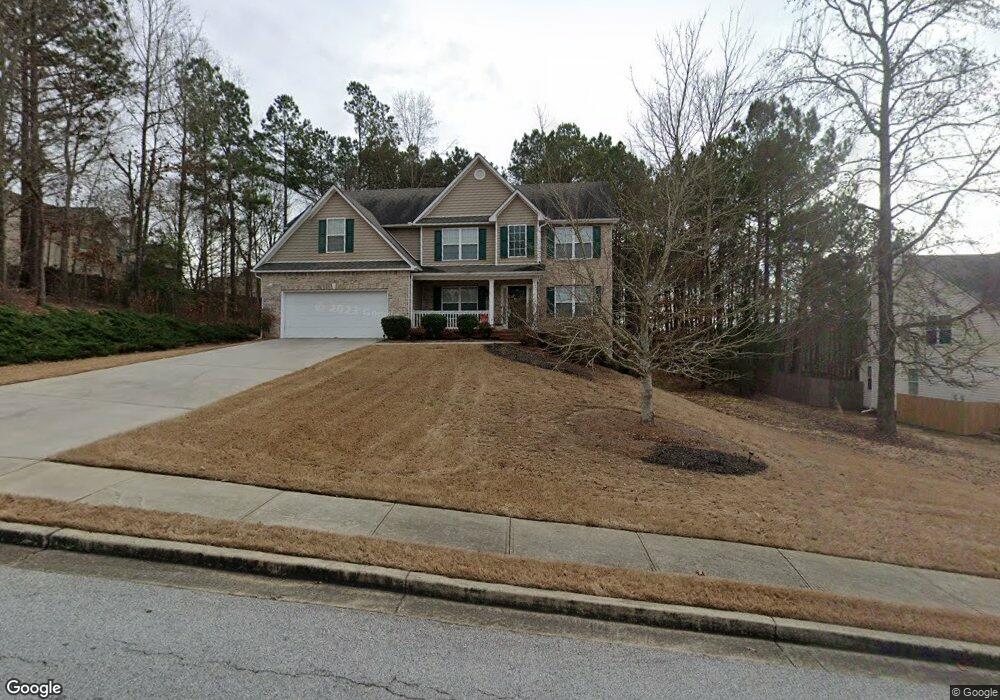
6004 Cole Ln Loganville, GA 30052
Walnut Grove NeighborhoodEstimated Value: $433,225 - $472,000
4
Beds
3
Baths
2,844
Sq Ft
$161/Sq Ft
Est. Value
About This Home
This home is located at 6004 Cole Ln, Loganville, GA 30052 and is currently estimated at $458,806, approximately $161 per square foot. 6004 Cole Ln is a home located in Walton County with nearby schools including Walnut Grove Elementary School, Youth Middle School, and Walnut Grove High School.
Ownership History
Date
Name
Owned For
Owner Type
Purchase Details
Closed on
Jan 14, 2010
Sold by
Federal Home Loan Mortgage Corporation
Bought by
Weke Philip and Kavishe Mary
Current Estimated Value
Home Financials for this Owner
Home Financials are based on the most recent Mortgage that was taken out on this home.
Original Mortgage
$157,102
Outstanding Balance
$104,762
Interest Rate
5.5%
Mortgage Type
FHA
Estimated Equity
$354,044
Purchase Details
Closed on
Oct 6, 2009
Sold by
Saxon Mtg Svcs Inc
Bought by
Federal Home Loan Mortgage Corporation
Purchase Details
Closed on
Mar 7, 2006
Sold by
Meridian Hms Of Brookstone Llc
Bought by
Houston Iris
Home Financials for this Owner
Home Financials are based on the most recent Mortgage that was taken out on this home.
Original Mortgage
$203,900
Interest Rate
6.05%
Mortgage Type
New Conventional
Create a Home Valuation Report for This Property
The Home Valuation Report is an in-depth analysis detailing your home's value as well as a comparison with similar homes in the area
Home Values in the Area
Average Home Value in this Area
Purchase History
| Date | Buyer | Sale Price | Title Company |
|---|---|---|---|
| Weke Philip | $160,000 | -- | |
| Federal Home Loan Mortgage Corporation | -- | -- | |
| Saxon Mtg Svcs Inc | $189,737 | -- | |
| Houston Iris | $214,700 | -- |
Source: Public Records
Mortgage History
| Date | Status | Borrower | Loan Amount |
|---|---|---|---|
| Open | Weke Philip | $157,102 | |
| Previous Owner | Houston Iris | $203,900 |
Source: Public Records
Tax History
| Year | Tax Paid | Tax Assessment Tax Assessment Total Assessment is a certain percentage of the fair market value that is determined by local assessors to be the total taxable value of land and additions on the property. | Land | Improvement |
|---|---|---|---|---|
| 2025 | $3,640 | $170,440 | $26,000 | $144,440 |
| 2024 | $3,640 | $167,080 | $26,000 | $141,080 |
| 2023 | $3,248 | $163,040 | $26,000 | $137,040 |
| 2022 | $3,409 | $133,560 | $20,000 | $113,560 |
| 2021 | $3,252 | $119,960 | $19,200 | $100,760 |
| 2020 | $2,928 | $100,920 | $14,000 | $86,920 |
| 2019 | $2,804 | $91,440 | $12,960 | $78,480 |
| 2018 | $2,712 | $91,440 | $12,960 | $78,480 |
| 2017 | $2,978 | $86,440 | $12,960 | $73,480 |
| 2016 | $2,609 | $84,160 | $12,960 | $71,200 |
| 2015 | $2,468 | $75,920 | $12,000 | $63,920 |
| 2014 | $2,346 | $68,040 | $0 | $0 |
Source: Public Records
Map
Nearby Homes
- 4983 Guthrie Cemetery Rd
- 5117 Ashley Falls Ct
- 0 Emmett Still Rd Unit TRACT 04
- 1230 Park St Unit 1
- 1265 Industrial Pkwy
- 0 Emmett Still #4 Rd
- 1393 Silver Thorne Ct
- 4935 Old Highway 138
- 1006 Silver Thorne Dr
- 1030 Silver Thorne Dr
- 1050 Silver Thorne Dr
- 232 Cambridge Dr
- 608 Cambridge Terrace
- 2340 Emerald Dr
- LOT 12 Guthrie Cemetery Rd
- LOT 13 Guthrie Cemetery Rd
- 4820 Old Highway 138
- 2361 Emerald Dr
- 302 Mountberry Ct Unit 2
- 0 Old Highway 138 Unit TRACT 2 10443767
- 6008 Cole Ln Unit 28
- 6008 Cole Ln
- 6008 Cole Ln
- 5016 Brookstone Ln
- 6012 Cole Ln
- 5012 Brookstone Ln
- 6005 Cole Ln
- 5008 Brookstone Ln
- 6009 Cole Ln
- 6001 Cole Ln
- 6016 Cole Ln
- 1129 Brookstone Estates Dr
- 5004 Brookstone Ln
- 6013 Cole Ln
- 5013 Brookstone Ln
- 5021 Brookstone Ln
- 5009 Brookstone Ln
- 6020 Cole Ln
- 1121 Brookstone Estates Dr
- 5001 Brookstone Ln
Your Personal Tour Guide
Ask me questions while you tour the home.