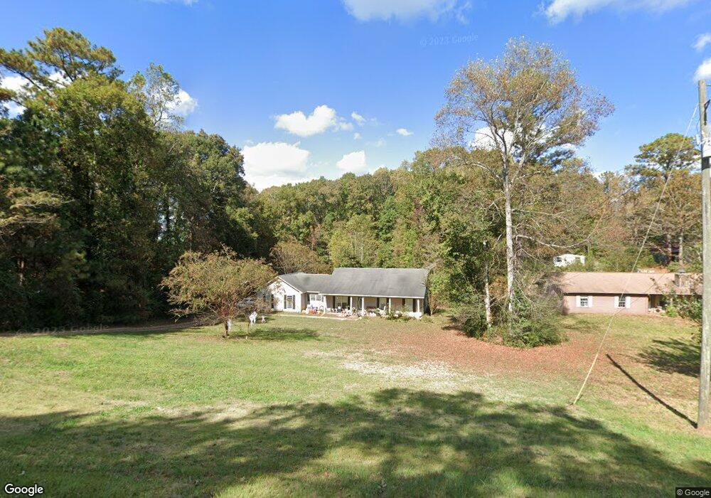
6004 Old West Point Rd Lagrange, GA 30240
Estimated Value: $228,000 - $268,000
3
Beds
2
Baths
2,015
Sq Ft
$126/Sq Ft
Est. Value
About This Home
This home is located at 6004 Old West Point Rd, Lagrange, GA 30240 and is currently estimated at $254,363, approximately $126 per square foot. 6004 Old West Point Rd is a home located in Troup County with nearby schools including Long Cane Elementary School, Berta Weathersbee Elementary School, and Whitesville Road Elementary School.
Ownership History
Date
Name
Owned For
Owner Type
Purchase Details
Closed on
Aug 10, 1992
Bought by
Hester David K and Hester Donna
Current Estimated Value
Purchase Details
Closed on
Feb 5, 1990
Purchase Details
Closed on
Mar 20, 1989
Purchase Details
Closed on
Feb 1, 1989
Purchase Details
Closed on
Aug 1, 1985
Purchase Details
Closed on
May 30, 1975
Create a Home Valuation Report for This Property
The Home Valuation Report is an in-depth analysis detailing your home's value as well as a comparison with similar homes in the area
Home Values in the Area
Average Home Value in this Area
Purchase History
| Date | Buyer | Sale Price | Title Company |
|---|---|---|---|
| Hester David K | -- | -- | |
| -- | -- | -- | |
| -- | -- | -- | |
| -- | -- | -- | |
| -- | -- | -- | |
| -- | -- | -- |
Source: Public Records
Tax History Compared to Growth
Tax History
| Year | Tax Paid | Tax Assessment Tax Assessment Total Assessment is a certain percentage of the fair market value that is determined by local assessors to be the total taxable value of land and additions on the property. | Land | Improvement |
|---|---|---|---|---|
| 2024 | $2,018 | $75,964 | $14,000 | $61,964 |
| 2023 | $2,015 | $75,888 | $14,000 | $61,888 |
| 2022 | $1,846 | $68,128 | $10,000 | $58,128 |
| 2021 | $1,709 | $58,660 | $10,000 | $48,660 |
| 2020 | $1,589 | $54,660 | $6,000 | $48,660 |
| 2019 | $1,599 | $54,996 | $6,000 | $48,996 |
| 2018 | $1,528 | $52,668 | $4,920 | $47,748 |
| 2017 | $1,529 | $52,668 | $4,920 | $47,748 |
| 2016 | $1,510 | $52,058 | $4,928 | $47,130 |
| 2015 | $1,455 | $50,140 | $4,928 | $45,212 |
| 2014 | $1,457 | $50,140 | $4,928 | $45,212 |
| 2013 | -- | $50,140 | $4,928 | $45,212 |
Source: Public Records
Map
Nearby Homes
- 0 Hanson Dr Unit 10641272
- 275 Hanson Dr
- 22 Freeman Rd
- 266 Glass Bridge Rd
- 103 Hawthorne Cir
- 1248 Cannonville Rd
- 288 Bradfield Dr
- 110 Hawthorne Cir
- 808 S Fling Rd
- 114 Westgate Dr
- 0 Bradfield Dr Unit 10568803
- 102 Foxdale Dr
- 102 Franklin Place
- 0 Robert Hayes Rd Unit 10611067
- 610 Ginger Cir
- 119 Plymouth Dr
- 509 Connie Dr
- 190 Hill Rd
- 124 Foxdale Dr
- 118 Woodstream Trail
- 6002 Old West Point Rd
- 6006 Old West Point Rd
- 35 Maefield Dr
- 6000 Old West Point Rd
- 6015 Old West Point Rd
- 6003 Old West Point Rd
- 49 Maefield Dr
- 6035 Old West Point Rd
- 5042 Old West Point Rd
- 6010 Old West Point Rd
- 5043 Old West Point Rd
- 40 Maefield Dr
- 16 Hudson Rd
- 55 Maefield Dr
- 5040 Old West Point Rd
- 1941 Cannonville Rd
- 1922 Cannonville Rd
- 147 Rob Roy Rd
- 5041 Old West Point Rd
- 5038 Old West Point Rd