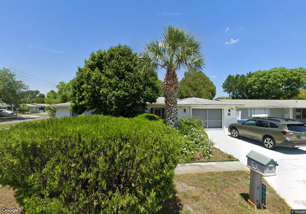
6005 11th Ave New Port Richey, FL 34653
Estimated Value: $236,702 - $278,000
3
Beds
2
Baths
1,556
Sq Ft
$171/Sq Ft
Est. Value
About This Home
This home is located at 6005 11th Ave, New Port Richey, FL 34653 and is currently estimated at $265,676, approximately $170 per square foot. 6005 11th Ave is a home located in Pasco County with nearby schools including Cotee River Elementary School, Gulf Middle School, and Gulf High School.
Ownership History
Date
Name
Owned For
Owner Type
Purchase Details
Closed on
Jul 30, 2024
Bought by
Schlemmer Daniel Benjamin and Schlemmer Evelyn May
Current Estimated Value
Purchase Details
Closed on
Oct 8, 1994
Sold by
Schlemmer Daniel Benjamin and Schlemmer Evelyn May
Bought by
Schlemmer Daniel Benjamin
Purchase Details
Closed on
Apr 29, 1994
Sold by
Schlemmer Daniel Benjamin and Schelmmer Evelyn May
Bought by
Schlemmer Daniel Benjamin
Create a Home Valuation Report for This Property
The Home Valuation Report is an in-depth analysis detailing your home's value as well as a comparison with similar homes in the area
Home Values in the Area
Average Home Value in this Area
Purchase History
| Date | Buyer | Sale Price | Title Company |
|---|---|---|---|
| Schlemmer Daniel Benjamin | -- | None Listed On Document | |
| Schlemmer Daniel Benjamin | -- | None Listed On Document | |
| Schlemmer Daniel Benjamin | -- | -- | |
| Schlemmer Daniel Benjamin | -- | -- |
Source: Public Records
Tax History Compared to Growth
Tax History
| Year | Tax Paid | Tax Assessment Tax Assessment Total Assessment is a certain percentage of the fair market value that is determined by local assessors to be the total taxable value of land and additions on the property. | Land | Improvement |
|---|---|---|---|---|
| 2025 | $567 | $63,370 | -- | -- |
| 2024 | $567 | $61,590 | -- | -- |
| 2023 | $551 | $59,800 | $0 | $0 |
| 2022 | $510 | $58,060 | $0 | $0 |
| 2021 | $501 | $56,370 | $23,503 | $32,867 |
| 2020 | $491 | $55,600 | $12,793 | $42,807 |
| 2019 | $481 | $54,350 | $0 | $0 |
| 2018 | $471 | $53,339 | $0 | $0 |
| 2017 | $471 | $53,339 | $0 | $0 |
| 2016 | $428 | $51,167 | $0 | $0 |
| 2015 | $432 | $50,811 | $0 | $0 |
| 2014 | $415 | $59,639 | $10,710 | $48,929 |
Source: Public Records
Map
Nearby Homes
- 6026 12th Ave
- 6019 7th Ave
- 5851 Lanate Ave
- 5753 10th Ave
- 4832 Elmwood St
- 4833 Dogwood St
- 4915 Daphne St
- 5746 Embay Ave
- 6307 Shane Ln
- 4548 Somerset Place
- 4853 Alcea St
- 6309 Lodge Dr
- 4614 Croton Dr
- 4535 Uzzle Way
- 5831 1st Ave
- 4923 Alcea St
- 6338 Spring Flower Dr Unit 21
- 5843 Ashen Ave
- 4239 Memphis Ave
- 5744 Sunshine Park Dr