Estimated Value: $227,451 - $242,000
3
Beds
3
Baths
1,928
Sq Ft
$121/Sq Ft
Est. Value
About This Home
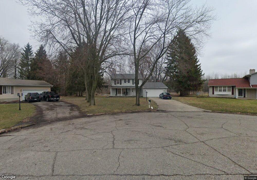
This home is located at 6005 Lancaster Dr Unit Bldg-Unit, Flint, MI 48532 and is currently estimated at $233,613, approximately $121 per square foot. 6005 Lancaster Dr Unit Bldg-Unit is a home located in Genesee County with nearby schools including Carman-Ainsworth High School, Genesee STEM Academy, and Genesee Academy.
Ownership History
Date
Name
Owned For
Owner Type
Purchase Details
Closed on
Jun 7, 2018
Sold by
Kelley Dearmon and Kelley Lisa
Bought by
Muex Terrence D
Current Estimated Value
Create a Home Valuation Report for This Property
The Home Valuation Report is an in-depth analysis detailing your home's value as well as a comparison with similar homes in the area
Home Values in the Area
Average Home Value in this Area
Purchase History
| Date | Buyer | Sale Price | Title Company |
|---|---|---|---|
| Muex Terrence D | $134,000 | Lighthouse Title Inc |
Source: Public Records
Tax History Compared to Growth
Tax History
| Year | Tax Paid | Tax Assessment Tax Assessment Total Assessment is a certain percentage of the fair market value that is determined by local assessors to be the total taxable value of land and additions on the property. | Land | Improvement |
|---|---|---|---|---|
| 2025 | $2,933 | $99,200 | $0 | $0 |
| 2024 | $1,733 | $97,500 | $0 | $0 |
| 2023 | $1,547 | $83,300 | $0 | $0 |
| 2022 | $1,353 | $76,200 | $0 | $0 |
| 2021 | $2,993 | $69,300 | $0 | $0 |
| 2020 | $1,327 | $57,500 | $0 | $0 |
| 2019 | $1,325 | $50,600 | $0 | $0 |
| 2018 | $1,758 | $45,500 | $0 | $0 |
| 2017 | $1,720 | $45,500 | $0 | $0 |
| 2016 | $1,765 | $43,600 | $0 | $0 |
| 2015 | $1,589 | $41,000 | $0 | $0 |
| 2014 | $942 | $39,500 | $0 | $0 |
| 2012 | -- | $46,700 | $46,700 | $0 |
Source: Public Records
Map
Nearby Homes
- 6090 Lancaster Dr
- 1442 Mintola Ave
- 1417 Grassmere Ave
- oo Walnut Creek Dr
- 1192 Citation Dr
- 1184 Citation Dr
- 00 Graham St
- 6172 W Court St
- 6098 Corunna Rd
- 0 Country Ridge Trail
- Integrity 1880 Plan at Country Ridge of Flint
- 5325 N Dyewood Dr
- 5345 Birchtree Ct
- 6142 Noel Dr
- 6007 Corunna Rd
- 1460 S Dye Rd
- 0000 Reuben Reuben St
- 5297 Oaktree Dr
- 000 Corunna Rd
- 5406 Litchfield Dr
- 6005 Lancaster Dr
- 6005 Lancaster Dr
- 6007 Lancaster Dr
- 6003 Lancaster Dr
- 6009 Lancaster Dr
- 6004 Lancaster Dr
- 6008 Lancaster Dr
- 6011 Lancaster Dr
- 6011 Lancaster Dr
- 6033 Trenton Dr
- 6062 Ridgewood Ct
- 6013 Lancaster Dr
- 6013 Lancaster Dr
- 6058 Ridgewood Ct
- 6043 Trenton Dr
- 6015 Lancaster Dr
- 5490 W Court St
- 6053 Trenton Dr
- 6066 Ridgewood Ct
- 6028 Lancaster Dr