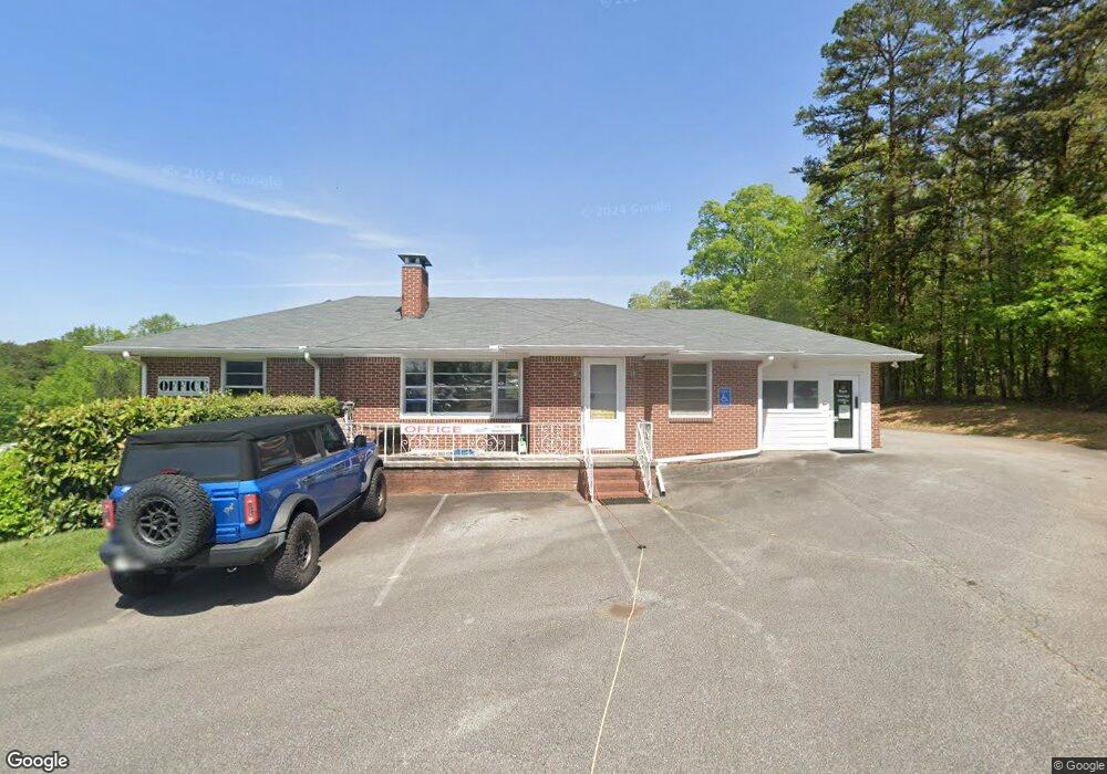
6005 Lanier Islands Pkwy Buford, GA 30518
Estimated Value: $4,725,869
--
Bed
--
Bath
1,716
Sq Ft
$2,754/Sq Ft
Est. Value
About This Home
This home is located at 6005 Lanier Islands Pkwy, Buford, GA 30518 and is currently priced at $4,725,869, approximately $2,754 per square foot. 6005 Lanier Islands Pkwy is a home located in Hall County with nearby schools including Buford Elementary School, Buford Academy, and Buford Senior Academy.
Ownership History
Date
Name
Owned For
Owner Type
Purchase Details
Closed on
Dec 27, 2021
Sold by
Markert Phillip J Sr Family Trust
Bought by
Buford Dam Boat And Rv Storage Llc
Current Estimated Value
Home Financials for this Owner
Home Financials are based on the most recent Mortgage that was taken out on this home.
Original Mortgage
$6,993,520
Interest Rate
3.12%
Mortgage Type
New Conventional
Purchase Details
Closed on
Jul 15, 2020
Sold by
Markert Phillip J Sr Estate
Bought by
Markert Carolyn Clancy
Purchase Details
Closed on
Jul 8, 1999
Sold by
Beard Eva Adeline
Bought by
Market Phillip J
Create a Home Valuation Report for This Property
The Home Valuation Report is an in-depth analysis detailing your home's value as well as a comparison with similar homes in the area
Home Values in the Area
Average Home Value in this Area
Purchase History
| Date | Buyer | Sale Price | Title Company |
|---|---|---|---|
| Buford Dam Boat And Rv Storage Llc | $3,875,000 | -- | |
| Markert Carolyn Clancy | -- | -- | |
| Market Phillip J | $650,000 | -- |
Source: Public Records
Mortgage History
| Date | Status | Borrower | Loan Amount |
|---|---|---|---|
| Closed | Buford Dam Boat And Rv Storage Llc | $6,993,520 |
Source: Public Records
Tax History Compared to Growth
Tax History
| Year | Tax Paid | Tax Assessment Tax Assessment Total Assessment is a certain percentage of the fair market value that is determined by local assessors to be the total taxable value of land and additions on the property. | Land | Improvement |
|---|---|---|---|---|
| 2024 | $30,492 | $1,607,680 | $800,120 | $807,560 |
| 2023 | $11,314 | $1,338,200 | $530,640 | $807,560 |
| 2022 | $10,844 | $1,184,320 | $530,640 | $653,680 |
| 2021 | $5,422 | $561,840 | $449,000 | $112,840 |
| 2020 | $5,544 | $561,840 | $449,000 | $112,840 |
| 2019 | $5,682 | $561,840 | $449,000 | $112,840 |
| 2018 | $4,846 | $467,040 | $355,120 | $111,920 |
| 2017 | $5,130 | $475,920 | $364,000 | $111,920 |
| 2016 | $4,662 | $475,920 | $364,000 | $111,920 |
| 2015 | $5,217 | $475,920 | $364,000 | $111,920 |
| 2014 | $5,217 | $525,966 | $232,480 | $293,486 |
Source: Public Records
Map
Nearby Homes
- 3617 Shoreland Dr
- 5989 Lanier Islands Pkwy
- 6132 Hutchins Dr
- 6120 Hutchins Dr
- 6181 Shoreland Cir
- 6313 Shoreland Cir
- 3180 Lee Dr
- 3441 Shoreland Dr
- 3374 Lee Dr
- 3394 Lee Dr
- 6205 Bridgewood Dr
- 6225 Bridgewood Dr
- 6119 Bethany View Trail
- 6111 Blackberry Ln
- 6095 Blackberry Ln
- 5862 Bay View Dr
- 5885 Bay View Dr
- 6005 Lanier Islands Pkwy
- 3240 Shoreland Dr
- 3564 Shoreland Dr
- 3246 Shoreland Dr
- 3558 Shoreland Dr
- 6005 Holiday Rd
- 3236 Shoreland Dr
- 3256 Shoreland Dr
- 3226 Shoreland Dr
- 3616 Shoreland Dr
- 3360 Shoreland Dr
- 3621 Shoreland Dr
- 0 Shoreland Dr Unit 8435420
- 0 Shoreland Dr Unit 8183434
- 0 Shoreland Dr Unit 2749470
- E Shoreland Dr
- 0 Shoreland Dr Unit 7174149
- 0 Shoreland Dr Unit 3284810
- 0 Shoreland Dr Unit 8980090
- 0 Shoreland Dr Unit 8292546