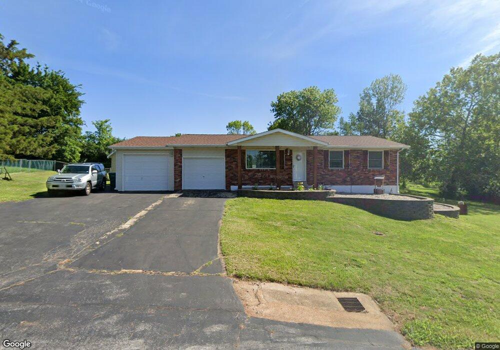
6007 Carol St House Springs, MO 63051
Estimated Value: $238,000 - $262,000
--
Bed
1
Bath
1,064
Sq Ft
$232/Sq Ft
Est. Value
About This Home
This home is located at 6007 Carol St, House Springs, MO 63051 and is currently estimated at $247,176, approximately $232 per square foot. 6007 Carol St is a home located in Jefferson County with nearby schools including Northwest High School and St. Anthony School.
Ownership History
Date
Name
Owned For
Owner Type
Purchase Details
Closed on
Dec 28, 2023
Sold by
Rezek Kaylea S
Bought by
Hutchison Kaylea S and Hutchison Blake M
Current Estimated Value
Purchase Details
Closed on
Mar 30, 2022
Sold by
Walker Pamela J
Bought by
Rezek Kaylea S and Hutchinson Blake M
Home Financials for this Owner
Home Financials are based on the most recent Mortgage that was taken out on this home.
Original Mortgage
$201,286
Interest Rate
4.42%
Mortgage Type
FHA
Purchase Details
Closed on
Jun 8, 2017
Sold by
Walker Pamela J and Walker Johnnie E
Bought by
Walker Pamela J
Purchase Details
Closed on
Jul 9, 2015
Sold by
Walker Johnnie E and Wells Pamela J
Bought by
Walker Johnnie E and Walker Pamela J
Purchase Details
Closed on
Jan 26, 2001
Sold by
Pflanz Timothy M
Bought by
Walker Johnnie E and Wells Pamela J
Home Financials for this Owner
Home Financials are based on the most recent Mortgage that was taken out on this home.
Original Mortgage
$40,000
Interest Rate
7.21%
Create a Home Valuation Report for This Property
The Home Valuation Report is an in-depth analysis detailing your home's value as well as a comparison with similar homes in the area
Home Values in the Area
Average Home Value in this Area
Purchase History
| Date | Buyer | Sale Price | Title Company |
|---|---|---|---|
| Hutchison Kaylea S | -- | None Listed On Document | |
| Rezek Kaylea S | -- | True Title | |
| Walker Pamela J | -- | None Available | |
| Walker Johnnie E | -- | None Available | |
| Walker Johnnie E | -- | First American Title |
Source: Public Records
Mortgage History
| Date | Status | Borrower | Loan Amount |
|---|---|---|---|
| Previous Owner | Rezek Kaylea S | $201,286 | |
| Previous Owner | Walker Johnnie E | $40,000 |
Source: Public Records
Tax History Compared to Growth
Tax History
| Year | Tax Paid | Tax Assessment Tax Assessment Total Assessment is a certain percentage of the fair market value that is determined by local assessors to be the total taxable value of land and additions on the property. | Land | Improvement |
|---|---|---|---|---|
| 2025 | $1,365 | $20,400 | $1,900 | $18,500 |
| 2024 | $1,365 | $18,900 | $1,900 | $17,000 |
| 2023 | $1,365 | $18,900 | $1,900 | $17,000 |
| 2022 | $1,359 | $18,900 | $1,900 | $17,000 |
| 2021 | $1,314 | $18,400 | $1,900 | $16,500 |
| 2020 | $1,229 | $16,800 | $1,600 | $15,200 |
| 2019 | $1,228 | $16,800 | $1,600 | $15,200 |
| 2018 | $1,244 | $16,800 | $1,600 | $15,200 |
| 2017 | $1,137 | $16,800 | $1,600 | $15,200 |
| 2016 | $1,065 | $15,600 | $1,700 | $13,900 |
| 2015 | $1,094 | $15,600 | $1,700 | $13,900 |
| 2013 | -- | $15,200 | $1,700 | $13,500 |
Source: Public Records
Map
Nearby Homes
- 6042 Carol St
- 173 Cardinal Ln Unit 173
- 5899 Midridge Dr
- 74 Mockingbird Hill Unit 74
- 65 Mockingbird Hill Unit 65
- 0 Manor Crest Dr Unit MIS25054810
- 6144 Misty Meadow Dr
- 4138 Elizabeth Dr
- 3833 Dorchester Ct
- 5916 Roger Rd
- 5814 Mayfair Ct
- 5919 Brookside Place
- 5916 Brookside Place
- 3734 Carol Park Rd
- 0 Lots 6 Cedar Dr
- 6302 Upper Byrnes Mill Rd
- 0 Lot 40 & 41 Fernwood Unit 21026109
- 0 Lot 45fernwood
- 2 Royal II at Manors at Bear Ridge
- 5975 Ridge Dr
- 6006 Carol St
- 6013 Carol St
- 6001 Carol St
- 6000 Carol St
- 6019 Carol St
- 3969 Carol Park Rd
- 6012 Carol St
- 3963 Carol Park Rd
- 6025 Carol St
- 7012 Brooks Farm Dr
- 6018 Carol St
- 104 Brooks Farm Ct
- 7016 Brooks Farm Dr
- 6024 Carol St
- 3850 Carol Park Rd
- 108 Brooks Farm Ct
- 4001 Carol Park Rd
- 6031 Carol St
- 0TBB Brooks Farm Unit TBB
- 0TBB Brooks Farm