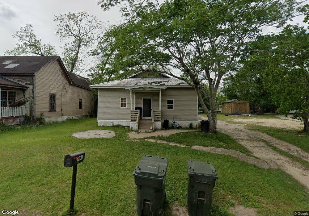
601 1st St NW Moultrie, GA 31768
Estimated Value: $37,000 - $72,000
--
Bed
1
Bath
1,550
Sq Ft
$34/Sq Ft
Est. Value
About This Home
This home is located at 601 1st St NW, Moultrie, GA 31768 and is currently estimated at $52,637, approximately $33 per square foot. 601 1st St NW is a home located in Colquitt County with nearby schools including C.A. Gray Junior High School, Willie J. Williams Middle School, and Colquitt County High School.
Ownership History
Date
Name
Owned For
Owner Type
Purchase Details
Closed on
Oct 19, 2018
Sold by
Dillard Vickie
Bought by
Crawford Annie Lois
Current Estimated Value
Purchase Details
Closed on
Aug 1, 2018
Sold by
A & L Rentalz Inc
Bought by
Dillard Vickie Lee
Purchase Details
Closed on
Nov 11, 2014
Sold by
Solomon Lester C
Bought by
A & L Rentalz Inc
Purchase Details
Closed on
Feb 10, 2006
Sold by
Ponder Cornelius
Bought by
Solomon Lester
Purchase Details
Closed on
May 25, 2000
Sold by
Putman Patricia S
Bought by
Ponder Cornelius
Purchase Details
Closed on
Mar 13, 1997
Bought by
Putman Patricia S
Create a Home Valuation Report for This Property
The Home Valuation Report is an in-depth analysis detailing your home's value as well as a comparison with similar homes in the area
Home Values in the Area
Average Home Value in this Area
Purchase History
| Date | Buyer | Sale Price | Title Company |
|---|---|---|---|
| Crawford Annie Lois | $13,860 | -- | |
| Dillard Vickie Lee | -- | -- | |
| A & L Rentalz Inc | -- | -- | |
| Solomon Lester | -- | -- | |
| Ponder Cornelius | $11,500 | -- | |
| Putman Patricia S | -- | -- |
Source: Public Records
Tax History Compared to Growth
Tax History
| Year | Tax Paid | Tax Assessment Tax Assessment Total Assessment is a certain percentage of the fair market value that is determined by local assessors to be the total taxable value of land and additions on the property. | Land | Improvement |
|---|---|---|---|---|
| 2024 | $151 | $5,852 | $680 | $5,172 |
| 2023 | $177 | $6,489 | $680 | $5,809 |
| 2022 | $204 | $6,106 | $680 | $5,426 |
| 2021 | $182 | $5,379 | $680 | $4,699 |
| 2020 | $185 | $5,379 | $680 | $4,699 |
| 2019 | $209 | $5,379 | $680 | $4,699 |
| 2018 | $221 | $5,544 | $680 | $4,864 |
| 2017 | $213 | $5,544 | $680 | $4,864 |
| 2016 | $221 | $5,544 | $680 | $4,864 |
| 2015 | $222 | $5,544 | $680 | $4,864 |
| 2014 | $227 | $5,544 | $680 | $4,864 |
| 2013 | -- | $5,544 | $680 | $4,864 |
Source: Public Records
Map
Nearby Homes
- 615 1st St NW
- 503 2nd St NW
- 316 5th Ave NW
- 521 5th Ave NW
- 614 2nd Ave NW
- 610 1st Ave NW
- 408 9th St NW
- 310 1st Ave SW
- 417 9th St NW
- 1208 Maple St
- 00 1st Ave SW
- 118 5th St SW
- 722 Martin Luther King jr Dr
- 407 1st Ave SE
- 618 2nd Ave SW
- 221 6th St SW
- 619 E Central Ave
- 610 4th Ave SW
- 908 3rd Ave SW
- 600 1st St SE