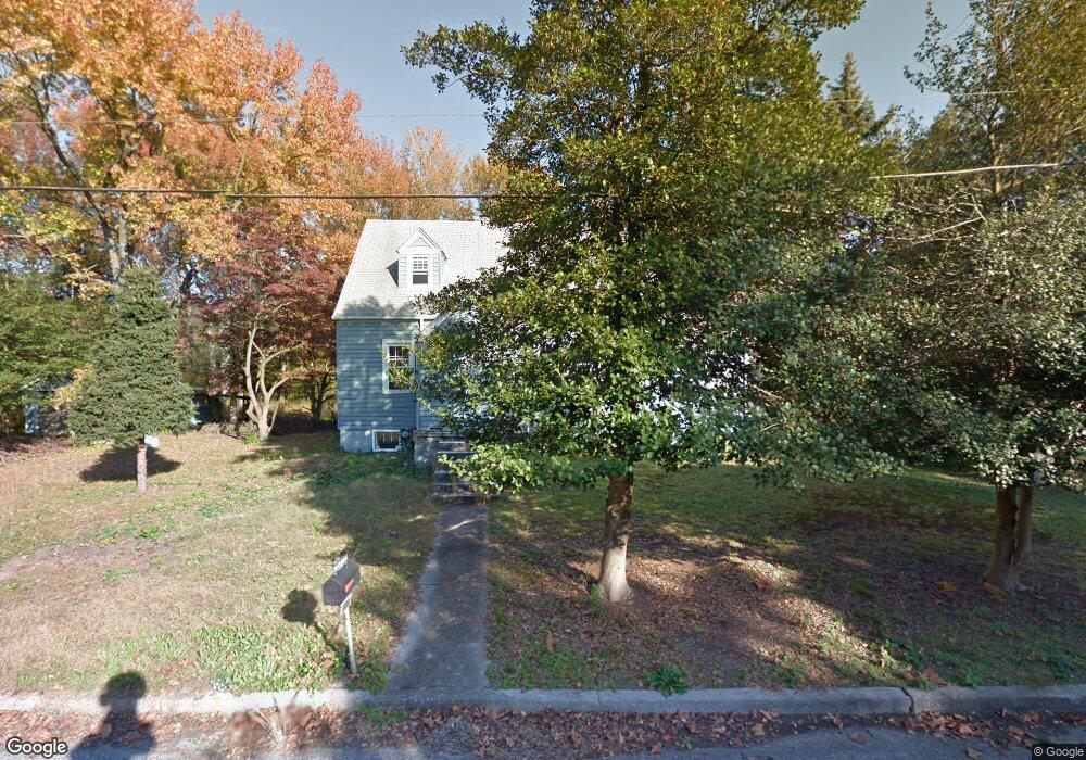
601 Cedar Crest Dr Penns Grove, NJ 08069
Estimated Value: $216,000 - $357,000
--
Bed
--
Bath
1,219
Sq Ft
$217/Sq Ft
Est. Value
About This Home
This home is located at 601 Cedar Crest Dr, Penns Grove, NJ 08069 and is currently estimated at $264,588, approximately $217 per square foot. 601 Cedar Crest Dr is a home located in Salem County with nearby schools including Lafayette-Pershing Elementary School, Paul W. Carleton Elementary School, and Field Street Elementary School.
Ownership History
Date
Name
Owned For
Owner Type
Purchase Details
Closed on
Jun 8, 2015
Sold by
Cedar Crest Investments Llc
Bought by
Lester Christopher M and Lester Danielle A
Current Estimated Value
Home Financials for this Owner
Home Financials are based on the most recent Mortgage that was taken out on this home.
Original Mortgage
$85,000
Interest Rate
3.84%
Mortgage Type
Purchase Money Mortgage
Purchase Details
Closed on
Jun 1, 2015
Sold by
Cedar Crest Investments Llc
Bought by
Cedar Crest Investments Llc
Home Financials for this Owner
Home Financials are based on the most recent Mortgage that was taken out on this home.
Original Mortgage
$85,000
Interest Rate
3.84%
Mortgage Type
Purchase Money Mortgage
Purchase Details
Closed on
Feb 20, 2012
Sold by
Hemenway Richard A
Bought by
Hemenway Richard A
Purchase Details
Closed on
May 9, 2008
Sold by
Hemenway Sam T
Bought by
Hemenway Sam T
Create a Home Valuation Report for This Property
The Home Valuation Report is an in-depth analysis detailing your home's value as well as a comparison with similar homes in the area
Home Values in the Area
Average Home Value in this Area
Purchase History
| Date | Buyer | Sale Price | Title Company |
|---|---|---|---|
| Lester Christopher M | $90,000 | West Jersey Title | |
| Cedar Crest Investments Llc | -- | None Available | |
| Hemenway Richard A | -- | -- | |
| Hemenway Sam T | -- | -- |
Source: Public Records
Mortgage History
| Date | Status | Borrower | Loan Amount |
|---|---|---|---|
| Closed | Lester Christopher M | $85,000 |
Source: Public Records
Tax History Compared to Growth
Tax History
| Year | Tax Paid | Tax Assessment Tax Assessment Total Assessment is a certain percentage of the fair market value that is determined by local assessors to be the total taxable value of land and additions on the property. | Land | Improvement |
|---|---|---|---|---|
| 2025 | $6,190 | $250,000 | $86,000 | $164,000 |
| 2024 | $5,977 | $167,900 | $64,600 | $103,300 |
| 2023 | $5,977 | $167,900 | $64,600 | $103,300 |
| 2022 | $5,625 | $167,900 | $64,600 | $103,300 |
| 2021 | $5,571 | $167,900 | $64,600 | $103,300 |
| 2020 | $5,620 | $167,900 | $64,600 | $103,300 |
| 2019 | $5,667 | $167,900 | $64,600 | $103,300 |
| 2018 | $6,062 | $186,600 | $85,200 | $101,400 |
| 2017 | $5,652 | $192,500 | $85,200 | $107,300 |
| 2016 | $5,446 | $192,500 | $85,200 | $107,300 |
| 2015 | $5,192 | $192,500 | $85,200 | $107,300 |
| 2014 | -- | $192,500 | $85,200 | $107,300 |
Source: Public Records
Map
Nearby Homes
- 609 Hawks Bridge Rd
- 613 Hawks Bridge Rd
- 604 Hawks Bridge Rd
- 371 Route 40
- 370 Route 40
- 371 40 Route
- 613 Soders Rd
- 1 Victory Ave Unit 84
- 1 Victory Ave Unit 82
- 1 Victory Ave Unit 74
- 1 Victory Ave Unit 72
- 1 Victory Ave Unit 8
- 1 Victory Ave Unit 93
- 1 Victory Ave
- 1 Victory Ave Unit 56
- 1 Victory Ave Unit 22
- 62 Penns Ave
- 29 Chester Ave
- 16 Pine St
- 12 Chester Ave
- 603 Cedar Crest Dr
- 600 Cedar Crest Dr
- 602 Cedar Crest Dr
- 598 U S 40
- 601 Hawks Bridge Rd
- 603 Hawks Bridge Rd
- 605 Hawks Bridge Rd
- 610 Cedar Crest Dr
- 611 Cedar Crest Dr
- 613 Cedar Crest Dr
- 611 Hawks Bridge Rd
- 608 Hawks Bridge Rd
- 615 Cedar Crest Dr
- 614 Cedar Crest Dr
- 610 Hawks Bridge Rd
- 615 Hawks Bridge Rd
- 590 Orchard Dr
- 617 Cedar Crest Dr
- 612 Hawks Bridge Rd
- 594 Orchard Dr