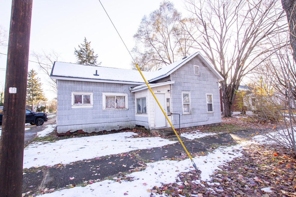
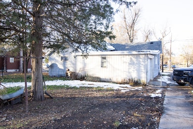
601 Chestnut St Dowagiac, MI 49047
Estimated payment $430/month
Highlights
- No HOA
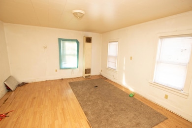
- Living Room
- Family Room
- 1 Car Attached Garage
- Baseboard Heating
- 1-Story Property
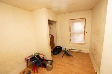
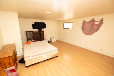
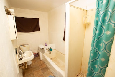
About This Home
Great project home. Large yard. Newer Roofing.
Listing Agent
Cressy & Everett Real Estate License #6506043046 Listed on: 11/13/2025

Home Details
Home Type
- Single Family
Est. Annual Taxes
- $1,383
Year Built
- Built in 1910
Lot Details
- 8,713 Sq Ft Lot
- Lot Dimensions are 66x132
Parking
- 1 Car Attached Garage
- Gravel Driveway
Home Design
- Shingle Siding
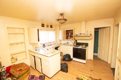
Interior Spaces
- 1,152 Sq Ft Home
- 1-Story Property
- Family Room
- Living Room
- Basement
- Crawl Space
- Laundry on main level
Bedrooms and Bathrooms
- 2 Main Level Bedrooms
- 1 Full Bathroom
Utilities
- Heating System Uses Natural Gas
- Wall Furnace
- Baseboard Heating
Community Details
- No Home Owners Association
Map
Home Values in the Area
Average Home Value in this Area
Tax History
| Year | Tax Paid | Tax Assessment Tax Assessment Total Assessment is a certain percentage of the fair market value that is determined by local assessors to be the total taxable value of land and additions on the property. | Land | Improvement |
|---|---|---|---|---|
| 2025 | $1,417 | $48,000 | $48,000 | $0 |
| 2024 | $669 | $45,800 | $45,800 | $0 |
| 2023 | $615 | $38,700 | $0 | $0 |
| 2022 | $585 | $34,100 | $0 | $0 |
| 2021 | $1,208 | $30,400 | $0 | $0 |
| 2020 | $563 | $25,900 | $0 | $0 |
| 2019 | $1,174 | $26,100 | $0 | $0 |
| 2018 | $537 | $22,600 | $0 | $0 |
| 2017 | $526 | $22,600 | $0 | $0 |
| 2016 | $517 | $21,500 | $0 | $0 |
| 2015 | -- | $23,200 | $0 | $0 |
| 2011 | -- | $18,800 | $0 | $0 |
Property History
| Date | Event | Price | List to Sale | Price per Sq Ft |
|---|---|---|---|---|
| 11/13/2025 11/13/25 | For Sale | $60,000 | -- | $52 / Sq Ft |
Purchase History
| Date | Type | Sale Price | Title Company |
|---|---|---|---|
| Quit Claim Deed | -- | None Available | |
| Quit Claim Deed | $1,100 | None Available | |
| Interfamily Deed Transfer | -- | None Available | |
| Personal Reps Deed | $15,000 | Meridian Title Corp |
Source: MichRIC
MLS Number: 25058209
APN: 14-160-100-252-00
Disclaimer: Certain information contained herein is derived from information provided by parties other than Homes.com. All information provided is deemed reliable, but is not guaranteed to be accurate and should be independently verified.
![]() Information is deemed reliable but not guaranteed.
Information is deemed reliable but not guaranteed.
Copyright 2025 MichRIC, LLC. All rights reserved.
- 608 W High St
- 400 S Lowe St
- 402 Michigan Ave
- 703 Main St
- 527 Main St
- 307 New York Ave
- 208 Halstead St
- 204 E High St
- 512 Green St
- 309 N Front St
- 210 McOmber St
- 604 Orchard St
- 315 McOmber St
- 102 S Mill St
- 105 Lester Ave
- 101 Haines St
- 208 E Prairie Ronde St
- 29460 Michigan 62
- 423 E Division St
- 706 N Front St
- 30490 M 152
- 30896 Christopher Way
- 5134 E Bluffview Dr
- 5134 E Bluffview Dr
- 5134 E Bluffview Dr
- 1819 N 5th St
- 9115 N Main St
- 2203 Spansail Ct
- 9022 US Highway 31
- 9275 1st St
- 16558 Donnell Lake St
- 420 Decker St
- 1721 Bond St
- 8770 Cobblestone Rd
- 4089 Medical Park Dr
- 75512 County Road 665
- 593 S Paw Paw St
- 515 Cecil St
- 2050 Reggie Dr
- 19191 Palisade Ave