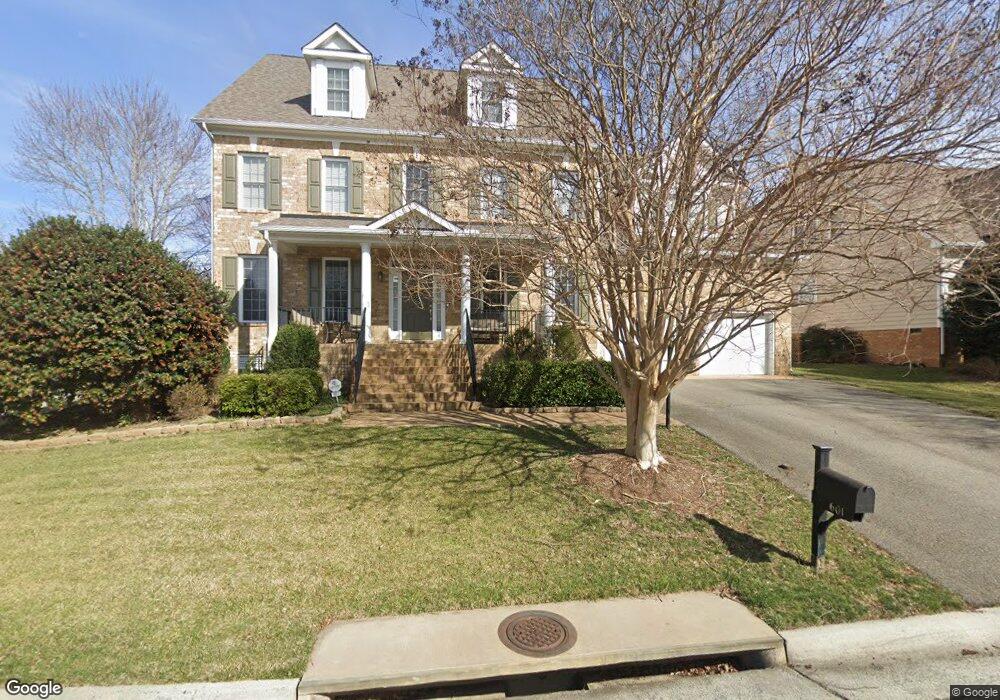
601 Colony Forest Dr Midlothian, VA 23114
Estimated Value: $753,167 - $778,000
6
Beds
5
Baths
4,809
Sq Ft
$160/Sq Ft
Est. Value
About This Home
This home is located at 601 Colony Forest Dr, Midlothian, VA 23114 and is currently estimated at $769,792, approximately $160 per square foot. 601 Colony Forest Dr is a home located in Chesterfield County with nearby schools including J B Watkins Elementary School, Midlothian Middle School, and Midlothian High School.
Ownership History
Date
Name
Owned For
Owner Type
Purchase Details
Closed on
Jan 10, 2007
Sold by
B B Hunt L L C
Bought by
Delacruz Alberto E and Catolico,Maria A
Current Estimated Value
Home Financials for this Owner
Home Financials are based on the most recent Mortgage that was taken out on this home.
Original Mortgage
$411,886
Outstanding Balance
$245,731
Interest Rate
6.18%
Mortgage Type
New Conventional
Estimated Equity
$524,061
Create a Home Valuation Report for This Property
The Home Valuation Report is an in-depth analysis detailing your home's value as well as a comparison with similar homes in the area
Home Values in the Area
Average Home Value in this Area
Purchase History
| Date | Buyer | Sale Price | Title Company |
|---|---|---|---|
| Delacruz Alberto E | $514,857 | -- |
Source: Public Records
Mortgage History
| Date | Status | Borrower | Loan Amount |
|---|---|---|---|
| Open | Delacruz Alberto E | $411,886 |
Source: Public Records
Tax History Compared to Growth
Tax History
| Year | Tax Paid | Tax Assessment Tax Assessment Total Assessment is a certain percentage of the fair market value that is determined by local assessors to be the total taxable value of land and additions on the property. | Land | Improvement |
|---|---|---|---|---|
| 2025 | $6,256 | $700,100 | $96,000 | $604,100 |
| 2024 | $6,256 | $663,500 | $96,000 | $567,500 |
| 2023 | $5,711 | $627,600 | $96,000 | $531,600 |
| 2022 | $5,137 | $558,400 | $92,000 | $466,400 |
| 2021 | $4,661 | $488,000 | $90,000 | $398,000 |
| 2020 | $4,636 | $488,000 | $90,000 | $398,000 |
| 2019 | $4,421 | $465,400 | $90,000 | $375,400 |
| 2018 | $4,565 | $480,500 | $90,000 | $390,500 |
| 2017 | $4,442 | $462,700 | $90,000 | $372,700 |
| 2016 | $4,579 | $477,000 | $90,000 | $387,000 |
| 2015 | $4,413 | $458,400 | $90,000 | $368,400 |
| 2014 | $4,126 | $427,200 | $80,000 | $347,200 |
Source: Public Records
Map
Nearby Homes
- 1111 Briars Ct Unit 303
- 14316 Garnett Ln
- 14424 Aldengate Rd
- Oasis Plan at Landon Village - Clarity Collection
- Haven Plan at Landon Village - Clarity Collection
- Refuge Plan at Landon Village - Clarity Collection
- Retreat Plan at Landon Village - Clarity Collection
- Element Plan at Landon Village - Clarity Collection
- Preserve Plan at Landon Village - Clarity Collection
- 1040 Westwood Village Way Unit 302
- 14010 Briars Cir Unit 204
- 14011 Briars Cir Unit 104
- 937 Landon Laurel Ln
- 423 Dunlin Ct
- 943 Landon Laurel Ln
- 14000 Briars Cir Unit 304
- 1119 Ashton Village Ln
- 1201 Westwood Village Ln Unit 402
- 949 Landon Laurel Ln
- 955 Landon Laurel Ln
- 607 Colony Forest Dr
- 607 Colony Forest Dr
- Lot 12 - 7 Colony Oak Ln
- 601 Colony Oak Ln
- 14385 Charter Landing Dr
- 612 Colony Oak Ln
- 701 Colony Oak Ln
- 606 Colony Oak Ln
- 613 Colony Forest Dr
- 14391 Charter Landing Dr
- 609 Colony Forest Dr
- 700 Colony Oak Ln
- 14379 Charter Landing Dr
- 600 Colony Oak Ln
- 707 Colony Oak Ln
- 618 Colony Forest Dr
- 619 Colony Forest Dr
- 14373 Charter Landing Dr
- 524 Colony Oak Ln
- 519 Colony Oak Ln