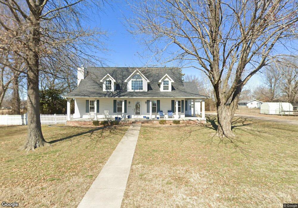
601 Cornell St Carl Junction, MO 64834
Estimated Value: $282,000 - $326,000
4
Beds
2
Baths
3,005
Sq Ft
$102/Sq Ft
Est. Value
About This Home
This home is located at 601 Cornell St, Carl Junction, MO 64834 and is currently estimated at $305,912, approximately $101 per square foot. 601 Cornell St is a home located in Jasper County with nearby schools including Carl Junction Primary School (K-1), Carl Junction Intermediate School, and Carl Junction Primary School (2-3).
Create a Home Valuation Report for This Property
The Home Valuation Report is an in-depth analysis detailing your home's value as well as a comparison with similar homes in the area
Tax History
| Year | Tax Paid | Tax Assessment Tax Assessment Total Assessment is a certain percentage of the fair market value that is determined by local assessors to be the total taxable value of land and additions on the property. | Land | Improvement |
|---|---|---|---|---|
| 2025 | $2,377 | $44,320 | $2,950 | $41,370 |
| 2024 | $2,392 | $40,630 | $2,950 | $37,680 |
| 2023 | $2,392 | $40,630 | $2,950 | $37,680 |
| 2022 | $2,529 | $42,840 | $2,950 | $39,890 |
| 2021 | $2,170 | $42,840 | $2,950 | $39,890 |
| 2020 | $2,027 | $39,340 | $2,950 | $36,390 |
| 2019 | $1,924 | $39,340 | $2,950 | $36,390 |
| 2018 | $1,907 | $39,080 | $0 | $0 |
| 2017 | $1,912 | $39,080 | $0 | $0 |
| 2016 | $2,012 | $41,500 | $0 | $0 |
Source: Public Records
Map
Nearby Homes
- 720 Sheridan Ave
- 604 Pennell St
- 608 Valley View St
- 307 Ashmore St
- TBD Temple St
- 120 Concord St
- 503 S Main St
- 501 S Cowgill St
- 104 Cambridge Dr
- 1308 York St
- 901 Aberdeen Ave
- 809 Aberdeen Ave
- 406 W Walton Ave
- 409 W Walton Ave
- 410 Walton St
- 501 W Walton Ave
- 111 Briarbrook Dr
- 304 Belgian Blue Blvd
- 900 Aberdeen Ave
- 805 Aberdeen Ave
- 306 Hillcrest St
- 310 Hillcrest St
- 509 Brentwood St
- 509 Brentwood St
- 402 Hillcrest St
- 302 Hillcrest St
- 507 Brentwood St
- 228 Hillcrest St
- 311 Hillcrest Dr
- 301 Hillcrest Dr
- 401 Hillcrest St
- 510 Brentwood St
- 508 Brentwood St
- 222 Hillcrest St
- 403 Hillcrest St
- 505 Brentwood St
- 211 Hillcrest St
- 605 Cornell St
- 506 Brentwood St
- 15C Rr 1
Your Personal Tour Guide
Ask me questions while you tour the home.