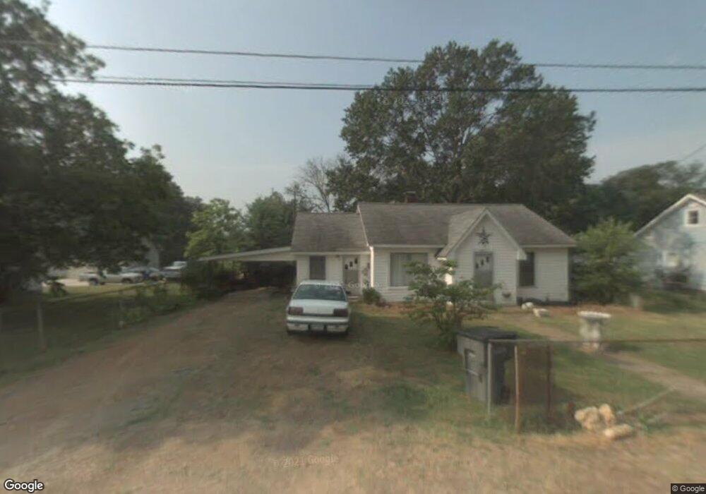
601 Doby St Kannapolis, NC 28081
Estimated Value: $210,000 - $322,000
2
Beds
1
Bath
1,332
Sq Ft
$181/Sq Ft
Est. Value
About This Home
This home is located at 601 Doby St, Kannapolis, NC 28081 and is currently estimated at $240,561, approximately $180 per square foot. 601 Doby St is a home located in Cabarrus County with nearby schools including Winecoff Elementary School, Northwest Cabarrus Middle School, and Northwest Cabarrus High.
Ownership History
Date
Name
Owned For
Owner Type
Purchase Details
Closed on
Jun 24, 2014
Sold by
Upright Merle F and Upright Calvin J
Bought by
King Pamela Marie
Current Estimated Value
Purchase Details
Closed on
Jun 1, 2005
Sold by
Tucker Helen R and Tucker Harvey D
Bought by
Upright Merle F
Create a Home Valuation Report for This Property
The Home Valuation Report is an in-depth analysis detailing your home's value as well as a comparison with similar homes in the area
Home Values in the Area
Average Home Value in this Area
Purchase History
| Date | Buyer | Sale Price | Title Company |
|---|---|---|---|
| King Pamela Marie | -- | None Avaliable | |
| Upright Merle F | $50,000 | -- |
Source: Public Records
Tax History
| Year | Tax Paid | Tax Assessment Tax Assessment Total Assessment is a certain percentage of the fair market value that is determined by local assessors to be the total taxable value of land and additions on the property. | Land | Improvement |
|---|---|---|---|---|
| 2025 | $1,116 | $196,650 | $58,000 | $138,650 |
| 2024 | $2,133 | $196,650 | $58,000 | $138,650 |
| 2023 | $1,452 | $106,010 | $28,000 | $78,010 |
| 2022 | $1,452 | $106,010 | $28,000 | $78,010 |
| 2021 | $1,452 | $106,010 | $28,000 | $78,010 |
| 2020 | $1,452 | $106,010 | $28,000 | $78,010 |
| 2019 | $1,176 | $85,850 | $21,000 | $64,850 |
| 2018 | $1,139 | $84,360 | $21,000 | $63,360 |
| 2017 | $1,122 | $84,360 | $21,000 | $63,360 |
| 2016 | $1,122 | $86,390 | $23,000 | $63,390 |
| 2015 | -- | $86,390 | $23,000 | $63,390 |
| 2014 | -- | $86,390 | $23,000 | $63,390 |
Source: Public Records
Map
Nearby Homes
- 503 Rogers Lake Rd
- 1407 Sherwood Dr
- 304 Lowrance Ave
- 1410 Oakwood Ave
- 112 Elwood St
- 125 Lowrance Ave
- 1436 Trotters Ridge Rd
- 1404 Nottingham Rd
- 301 Briarcliff Dr
- 251 Briarcliff Dr
- 1004 Oakwood Ave
- 366 Courtland Ct
- 1416 Browdis Ave
- 1620 Longbow Dr
- 119 Carriage House Dr
- 103 Carriage House Dr
- 2116 S Main St
- 829 Richard Ave
- 1229 Brecken Ct
- 2203 Oakhurst Ct
- 603 Doby St
- 1500 Cooper Ave
- 1502 Cooper Ave
- 602 Doby St
- 1412 Cooper Ave
- 1502 Dennis Ave
- 1500 Dennis Ave
- 1410 Cooper Ave
- 604 Doby St
- 603 Cobb St
- 1508 Cooper Ave
- 1510 Cooper Ave
- 597 Black Maple Dr
- 597 Black Maple Dr Unit 25
- 581 Black Maple Dr
- 1512 Cooper Ave
- 565 Black Maple Dr
- 1505 Wildwood Dr
- 613 Black Maple Dr
- 1501 Wildwood Dr
Your Personal Tour Guide
Ask me questions while you tour the home.