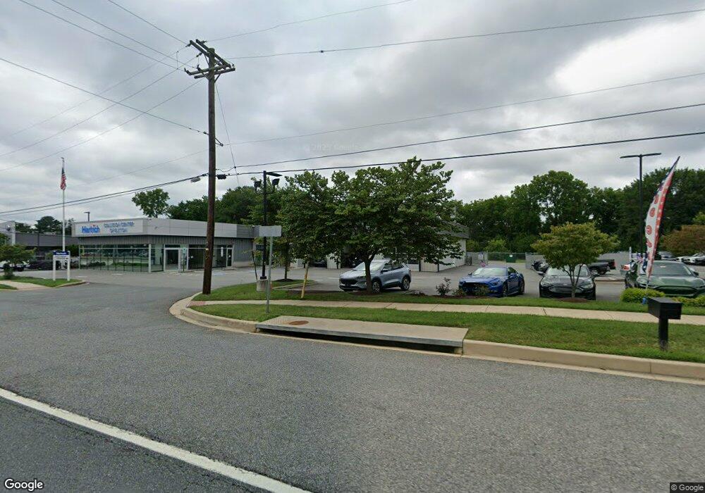
601 E Pulaski Hwy Elkton, MD 21921
--
Bed
--
Bath
7,528
Sq Ft
2.47
Acres
About This Home
This home is located at 601 E Pulaski Hwy, Elkton, MD 21921. 601 E Pulaski Hwy is a home located in Cecil County with nearby schools including Thomson Estates Elementary School, Elkton Middle School, and Elkton High School.
Ownership History
Date
Name
Owned For
Owner Type
Purchase Details
Closed on
Dec 4, 2019
Sold by
503 E Pulaski Llc
Bought by
Hertrich Properties Xxiv Llc
Home Financials for this Owner
Home Financials are based on the most recent Mortgage that was taken out on this home.
Original Mortgage
$6,280,000
Outstanding Balance
$5,552,909
Interest Rate
3.75%
Mortgage Type
Purchase Money Mortgage
Purchase Details
Closed on
Sep 27, 2019
Sold by
Valley Forge Associates
Bought by
503 E Pulaski Llc
Purchase Details
Closed on
Jun 14, 2010
Sold by
Valley Forge Associates
Bought by
503 East Pulaski Llc
Purchase Details
Closed on
Oct 14, 1993
Sold by
Beal
Bought by
Valley Forge Assoc
Create a Home Valuation Report for This Property
The Home Valuation Report is an in-depth analysis detailing your home's value as well as a comparison with similar homes in the area
Home Values in the Area
Average Home Value in this Area
Purchase History
| Date | Buyer | Sale Price | Title Company |
|---|---|---|---|
| Hertrich Properties Xxiv Llc | $6,000,000 | None Available | |
| 503 E Pulaski Llc | -- | None Available | |
| 503 East Pulaski Llc | $1,920,000 | -- | |
| Valley Forge Assoc | $185,000 | -- |
Source: Public Records
Mortgage History
| Date | Status | Borrower | Loan Amount |
|---|---|---|---|
| Open | Hertrich Properties Xxiv Llc | $6,280,000 |
Source: Public Records
Tax History Compared to Growth
Tax History
| Year | Tax Paid | Tax Assessment Tax Assessment Total Assessment is a certain percentage of the fair market value that is determined by local assessors to be the total taxable value of land and additions on the property. | Land | Improvement |
|---|---|---|---|---|
| 2025 | $34,600 | $2,000,000 | $0 | $0 |
| 2024 | $34,173 | $1,975,300 | $1,289,500 | $685,800 |
| 2023 | $33,687 | $1,936,033 | $0 | $0 |
| 2022 | $30,598 | $1,736,667 | $0 | $0 |
| 2021 | $29,981 | $1,699,600 | $1,289,500 | $410,100 |
| 2020 | $27,712 | $1,549,000 | $0 | $0 |
| 2019 | $25,017 | $1,398,400 | $0 | $0 |
| 2018 | $22,323 | $1,247,800 | $898,200 | $349,600 |
| 2017 | $17,540 | $1,143,133 | $0 | $0 |
| 2016 | $14,342 | $1,038,467 | $0 | $0 |
| 2015 | $14,342 | $849,500 | $0 | $0 |
| 2014 | $14,346 | $849,500 | $0 | $0 |
Source: Public Records
Map
Nearby Homes
- 106 Normira Ave
- 0 E Pulaski Hwy
- 4 Saint Pats Cir
- 0 Delaware Ave Unit MDCC2018992
- 114 Creswell Ave
- 114 Saint Louis Dr
- 206 Whitehall Rd
- 103 State St
- 112 Courtney Dr
- 155 E Village Rd
- 110 Delaware Ave
- 17 Kent Rd
- 182 E Village Rd
- 606 Gray Mount Cir
- 124 Michaels Way
- 113 Michaels Way
- Juniper Plan at Gray Mount Commons
- 112 Ben Blvd
- 413 Gray Mount Cir
- 520 Saint Charles St
- 116 Lincoln Ave
- 503 E Pulaski Hwy
- 600 E Pulaski Hwy
- 607 E Pulaski Hwy
- 117 Washington Ave
- 115 Washington Ave
- 104 Roosevelt Blvd
- 609 E Pulaski Hwy
- 113 Washington Ave
- 560 E Pulaski Hwy
- 611 E Pulaski Hwy
- 111 Washington Ave
- 108 Lincoln Ave
- 107 Lincoln Ave
- 122 Washington Ave
- 405 E Pulaski Hwy
- 118 Washington Ave
- 103 Roosevelt Blvd
- 116 Washington Ave
- 106 Lincoln Ave