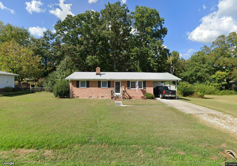
601 Ford Cir Louisburg, NC 27549
Estimated Value: $173,000 - $198,000
3
Beds
1
Bath
1,025
Sq Ft
$179/Sq Ft
Est. Value
About This Home
This home is located at 601 Ford Cir, Louisburg, NC 27549 and is currently estimated at $183,694, approximately $179 per square foot. 601 Ford Cir is a home located in Franklin County with nearby schools including Louisburg Elementary School, Terrell Lane Middle School, and Louisburg High School.
Ownership History
Date
Name
Owned For
Owner Type
Purchase Details
Closed on
Oct 23, 2015
Sold by
Garrett John C and Garrett Louise B
Bought by
Coggins William J
Current Estimated Value
Home Financials for this Owner
Home Financials are based on the most recent Mortgage that was taken out on this home.
Original Mortgage
$63,750
Outstanding Balance
$50,123
Interest Rate
3.94%
Mortgage Type
New Conventional
Estimated Equity
$133,571
Create a Home Valuation Report for This Property
The Home Valuation Report is an in-depth analysis detailing your home's value as well as a comparison with similar homes in the area
Home Values in the Area
Average Home Value in this Area
Purchase History
| Date | Buyer | Sale Price | Title Company |
|---|---|---|---|
| Coggins William J | $85,000 | None Available |
Source: Public Records
Mortgage History
| Date | Status | Borrower | Loan Amount |
|---|---|---|---|
| Open | Coggins William J | $63,750 |
Source: Public Records
Tax History Compared to Growth
Tax History
| Year | Tax Paid | Tax Assessment Tax Assessment Total Assessment is a certain percentage of the fair market value that is determined by local assessors to be the total taxable value of land and additions on the property. | Land | Improvement |
|---|---|---|---|---|
| 2025 | $1,635 | $151,768 | $30,128 | $121,640 |
| 2024 | $1,635 | $151,768 | $30,128 | $121,640 |
| 2023 | $1,267 | $90,020 | $19,920 | $70,100 |
| 2022 | $1,212 | $90,020 | $19,920 | $70,100 |
| 2021 | $1,221 | $90,020 | $19,920 | $70,100 |
| 2020 | $1,224 | $90,020 | $19,920 | $70,100 |
| 2019 | $1,214 | $90,020 | $19,920 | $70,100 |
| 2018 | $1,209 | $90,020 | $19,920 | $70,100 |
| 2017 | $1,033 | $68,900 | $18,000 | $50,900 |
| 2016 | $1,053 | $67,580 | $18,000 | $49,580 |
| 2015 | $913 | $57,050 | $18,000 | $39,050 |
| 2014 | $858 | $57,050 | $18,000 | $39,050 |
Source: Public Records
Map
Nearby Homes
- 0-0 Halifax Rd
- 126 Person St
- 612 N Main St
- 125 Davis St
- 604 N Main St
- 7.69 Acres N Carolina 561
- 23.20 Acre N Carolina 561
- 10.26 Acre N Carolina 561
- 401 N Main St
- 101 Briarwood Ct
- 321 W Noble St
- 191 Nc 56 Hwy E
- 305 N Elm St
- 313 W Noble St
- 205 Williamson St
- 301 W College St
- 109 Drew St
- 414 W Noble St
- 121 Tanglewood Dr
- 101 S Elm St
- 601 Ford Cir
- 513 Ford Cir
- 511 Ford Cir
- 903 N Bickett Blvd
- 510 Ford Cir
- 509 Ford Cir
- 128 Person Cir
- 122 Person Cir
- 909 N Bickett Blvd
- 507 Ford Cir
- 508 Ford Cir
- Lot 1 N Bickett Blvd
- 0 N Bickett Blvd Unit 757640
- 0 N Bickett Blvd Unit 710062
- 0 N Bickett Blvd Unit TR724576
- 0 N Bickett Blvd Unit TR1768416
- 0 N Bickett Blvd Unit TR1870619
- 0 N Bickett Blvd Unit TR1886820
- 0 N Bickett Blvd Unit TR2116775
- 0 N Bickett Blvd Unit 1800167