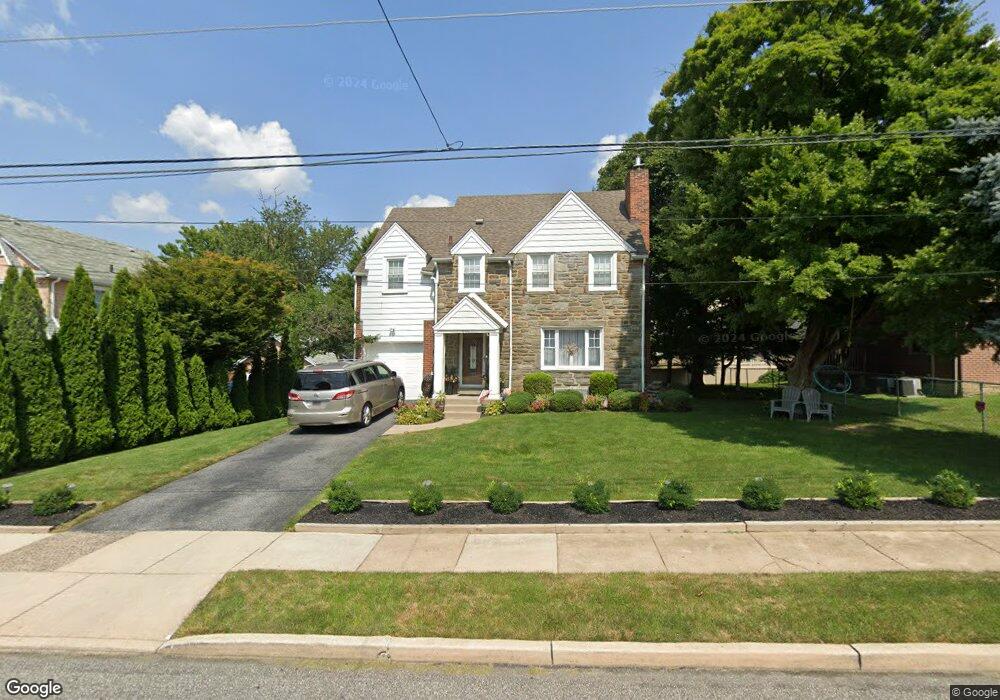
601 Foss Ave Drexel Hill, PA 19026
Estimated Value: $369,000 - $502,000
4
Beds
2
Baths
1,988
Sq Ft
$212/Sq Ft
Est. Value
About This Home
This home is located at 601 Foss Ave, Drexel Hill, PA 19026 and is currently estimated at $420,847, approximately $211 per square foot. 601 Foss Ave is a home located in Delaware County with nearby schools including Hillcrest El School, Drexel Hill Middle School, and Upper Darby High School.
Ownership History
Date
Name
Owned For
Owner Type
Purchase Details
Closed on
Jul 29, 2005
Sold by
Siah Forouzan and Siah Javad
Bought by
Bregenzer Megan and Anglin Donovan
Current Estimated Value
Home Financials for this Owner
Home Financials are based on the most recent Mortgage that was taken out on this home.
Original Mortgage
$240,000
Outstanding Balance
$125,101
Interest Rate
5.54%
Mortgage Type
Fannie Mae Freddie Mac
Estimated Equity
$295,746
Purchase Details
Closed on
Apr 29, 2005
Sold by
Daly Rose E
Bought by
Siah Javad and Siah Forouzan
Create a Home Valuation Report for This Property
The Home Valuation Report is an in-depth analysis detailing your home's value as well as a comparison with similar homes in the area
Home Values in the Area
Average Home Value in this Area
Purchase History
| Date | Buyer | Sale Price | Title Company |
|---|---|---|---|
| Bregenzer Megan | $300,000 | Trident Land Transfer Co | |
| Siah Javad | $195,000 | Long & Foster Settlement Ser |
Source: Public Records
Mortgage History
| Date | Status | Borrower | Loan Amount |
|---|---|---|---|
| Open | Bregenzer Megan | $240,000 |
Source: Public Records
Tax History Compared to Growth
Tax History
| Year | Tax Paid | Tax Assessment Tax Assessment Total Assessment is a certain percentage of the fair market value that is determined by local assessors to be the total taxable value of land and additions on the property. | Land | Improvement |
|---|---|---|---|---|
| 2025 | $8,990 | $205,390 | $44,530 | $160,860 |
| 2024 | $8,686 | $205,390 | $44,530 | $160,860 |
| 2023 | $8,604 | $205,390 | $44,530 | $160,860 |
| 2022 | $8,373 | $205,390 | $44,530 | $160,860 |
| 2021 | $11,290 | $205,390 | $44,530 | $160,860 |
| 2020 | $7,791 | $120,440 | $35,850 | $84,590 |
| 2019 | $7,654 | $120,440 | $35,850 | $84,590 |
| 2018 | $7,566 | $120,440 | $0 | $0 |
| 2017 | $7,369 | $120,440 | $0 | $0 |
| 2016 | $661 | $120,440 | $0 | $0 |
| 2015 | $674 | $120,440 | $0 | $0 |
| 2014 | $661 | $120,440 | $0 | $0 |
Source: Public Records
Map
Nearby Homes
- 3700 School Ln
- 542 Shadeland Ave
- 3765 Highland Ave
- 3634 Rosemont Ave
- 506 Burmont Rd
- 3810 Huey Ave
- 474 Kenwood Rd
- 801 Penn Ave
- 3804 Rosemont Ave
- 3811 Berry Ave
- 3708 Garrett Rd
- 3706 Garrett Rd
- 831 Concord Ave
- 3419 Valley Green Dr
- 455 Irvington Rd
- 4014 Rosemont Ave
- 4123 School Ln
- 382 Upland Way
- 930 Ormond Ave
- 4130 Rosemont Ave