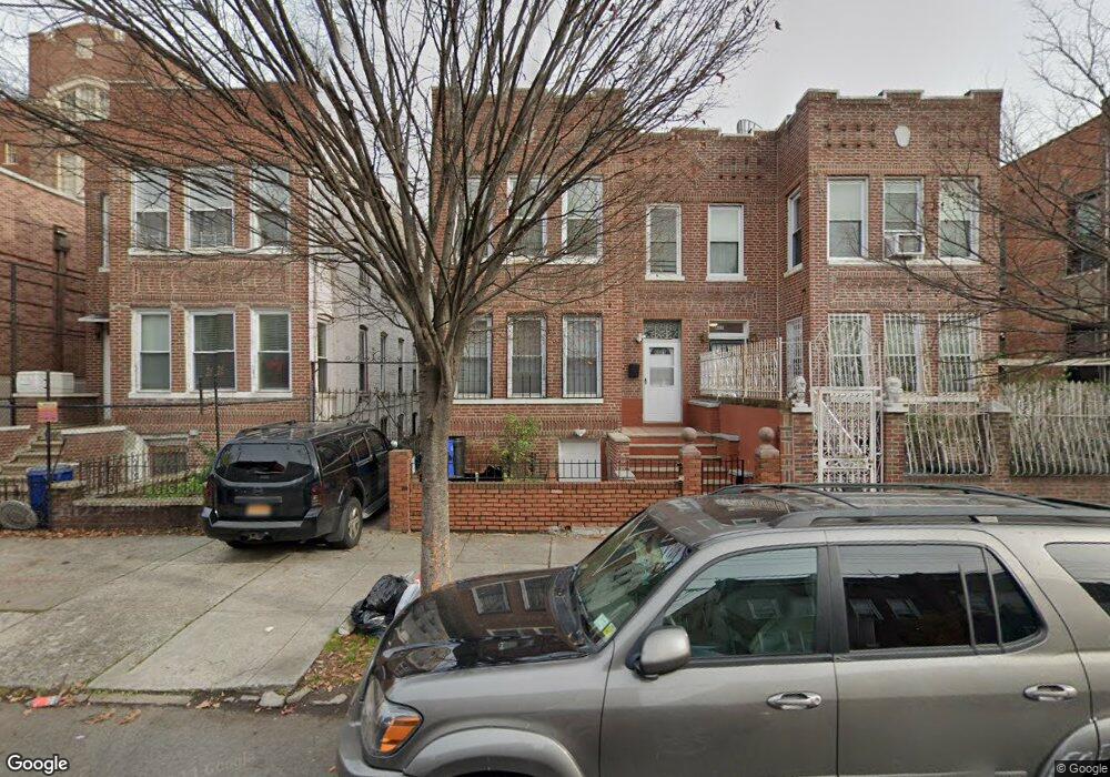
601 Georgia Ave Brooklyn, NY 11207
Brownsville NeighborhoodEstimated Value: $758,245 - $967,000
--
Bed
--
Bath
3,156
Sq Ft
$272/Sq Ft
Est. Value
About This Home
This home is located at 601 Georgia Ave, Brooklyn, NY 11207 and is currently estimated at $858,561, approximately $272 per square foot. 601 Georgia Ave is a home located in Kings County with nearby schools including P.S. 190 - Sheffield, Achievement First - East New York School, and CAMPA Charter School.
Ownership History
Date
Name
Owned For
Owner Type
Purchase Details
Closed on
Mar 17, 2005
Sold by
Fraser Wilmoth H
Bought by
Murrell Ronald
Current Estimated Value
Home Financials for this Owner
Home Financials are based on the most recent Mortgage that was taken out on this home.
Original Mortgage
$342,000
Outstanding Balance
$177,276
Interest Rate
5.95%
Mortgage Type
Purchase Money Mortgage
Estimated Equity
$681,285
Create a Home Valuation Report for This Property
The Home Valuation Report is an in-depth analysis detailing your home's value as well as a comparison with similar homes in the area
Home Values in the Area
Average Home Value in this Area
Purchase History
| Date | Buyer | Sale Price | Title Company |
|---|---|---|---|
| Murrell Ronald | $360,000 | -- |
Source: Public Records
Mortgage History
| Date | Status | Borrower | Loan Amount |
|---|---|---|---|
| Open | Murrell Ronald | $342,000 |
Source: Public Records
Tax History Compared to Growth
Tax History
| Year | Tax Paid | Tax Assessment Tax Assessment Total Assessment is a certain percentage of the fair market value that is determined by local assessors to be the total taxable value of land and additions on the property. | Land | Improvement |
|---|---|---|---|---|
| 2025 | $3,547 | $61,020 | $23,640 | $37,380 |
| 2024 | $3,547 | $55,500 | $23,640 | $31,860 |
| 2023 | $3,390 | $61,860 | $23,640 | $38,220 |
| 2022 | $3,147 | $59,340 | $23,640 | $35,700 |
| 2021 | $3,137 | $46,320 | $23,640 | $22,680 |
| 2020 | $1,559 | $42,660 | $23,640 | $19,020 |
| 2019 | $3,079 | $38,100 | $23,640 | $14,460 |
| 2018 | $2,836 | $13,912 | $8,218 | $5,694 |
| 2017 | $2,678 | $13,136 | $9,584 | $3,552 |
| 2016 | $2,483 | $12,420 | $9,557 | $2,863 |
| 2015 | $1,495 | $12,415 | $8,080 | $4,335 |
| 2014 | $1,495 | $12,265 | $6,784 | $5,481 |
Source: Public Records
Map
Nearby Homes
- 606 Alabama Ave
- 610 Alabama Ave
- 661 Sheffield Ave
- 667 Sheffield Ave
- 582 Williams Ave
- 679 Georgia Ave
- 578 Williams Ave
- 576 Williams Ave
- 541 Hinsdale St
- 421 New Lots Ave
- 694 Pennsylvania Ave
- 589 Hinsdale St
- 427 New Lots Ave
- 650 Williams Ave
- 521 Hegeman Ave
- 584 Hinsdale St
- 660 Williams Ave Unit 142
- 442 Newport St
- 762 New Jersey Ave
- 533 Snediker Ave
- 599 Georgia Ave
- 607 Georgia Ave
- 611 Georgia Ave
- 614 Sheffield Ave
- 616 Sheffield Ave
- 620 Sheffield Ave
- 337 New Lots Ave
- 335 New Lots Ave
- 329 New Lots Ave
- 327 New Lots Ave
- 333 New Lots Ave
- 333 New Lots Ave Unit 2Fl
- 333 New Lots Ave Unit 1
- 339 New Lots Ave
- 325 New Lots Ave
- 323 New Lots Ave
- 341 New Lots Ave
- 604 Georgia Ave
- 602 Georgia Ave
- 598 Georgia Ave